Toggle navigation
LMEC Home
Exhibitions
Georeferencing
Tools for Teachers
Collections
My Favorites
Sign Up / Log In
Search
Search the map portal
Map Collection
Map Collection
Map Sets
Search
Search
Search for
Search In
All Fields
Creator
Title
Subject
Place
Search All Digital Collections
Advanced Search
8944 Results
My Search
Start Over
More Like
commonwealth:9s1619901
Remove constraint More Like: commonwealth:9s1619901
Filter your Search
Place
North and Central America
6,175
United States
5,091
Massachusetts
2,168
Europe
1,396
Suffolk (county)
1,282
Boston
1,255
Canada
449
Asia
438
more
Place
»
Topic
Boston (Mass.)--Maps
752
United States--Maps
282
City planning--Massachusetts--Boston--Maps
221
Real property--Massachusetts--Boston--Maps
207
Massachusetts--Maps
166
Landowners--Massachusetts--Boston--Maps
146
Urban renewal--Massachusetts--Boston--Maps
138
New England--Maps
104
more
Topic
»
Date
Date range begin
–
Date range end
Current results range from
1482
to
2023
View distribution
Creator
United States. Hydrographic Office
595
Boston Redevelopment Authority
224
O.H. Bailey & Co
148
Des Barres, Joseph F. W. (Joseph Frederick Wallet), 1722-1824
124
United States. Post Office Dept
120
Ptolemy, 2nd cent
100
Walling, Henry Francis, 1825-1888
94
Geological Survey (U.S.)
87
more
Creator
»
Format
Maps/Atlases
8,883
Manuscripts
215
Prints
56
Books
36
Objects/Artifacts
10
Drawings/Illustrations
9
Posters
5
Georeferenced
Yes
885
No
8,059
Collection
Norman B. Leventhal Map & Education Center Collection
8,727
Boston and New England Maps
2,427
Urban Maps
2,209
Maritime Charts and Atlases
1,083
American Revolutionary War-Era Maps
642
Boston Redevelopment Authority Collection
257
Massachusetts Real Estate Atlases
22
Mapping Boston Collection
21
more
Collection
»
Available to use
No known restrictions
8,733
Creative Commons license
71
Search Constraints
Sort by relevance
relevance
title
date (asc)
date (desc)
Number of results to display per page
20 per page
10
per page
20
per page
50
per page
100
per page
View results as:
grid view
map view
Search Results
6721.
A plan of the city and harbour of the Havana situated on the island of Cuba
6722.
Plan of the city and harbour of Toulon
6723.
Plan of the city and suburbs of Carthagena ; Plan of the bay & town of Sta. Martha, on the coast of Tierra Firma
6724.
Plan of the city intended for the permanent seat of the government of t[he] United States : projected agreeable to the...
6725.
Plan of the city intended for the permanent seat of the government of the United States : projected agreeable to the direction...
6726.
Plan of the city of Albany about the year 1770 : from the original survey
6727.
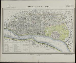
Plan of the city of Calcutta
6728.
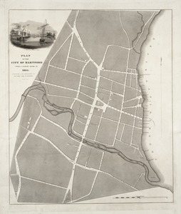
Plan of the city of Hartford from a survey made in 1824
6729.
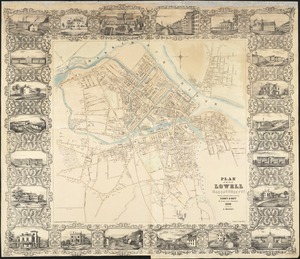
Plan of the city of Lowell, Massachusetts
6730.
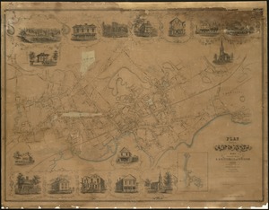
Plan of the city of Lynn Mass. from actual surveys
6731.
Plan of the city of Meriden, New Haven Co., Conn. from actual surveys
6732.
Plan of the city of New Haven, New Haven, Conn.
6733.
Plan of the city of New York
6734.
Plan of the city of New York : showing the made and swamp land
6735.
Plan of the city of New York, 1791
6736.
A plan of the city of New York from an actual survey
6737.
A plan of the city of New York from an actual survey
6738.
A plan of the city of New York from an actual survey
6739.
A plan of the city of New-York
6740.
A plan of the city of New-York & its environs to Greenwich, on the North or Hudsons River, and to Crown Point, on the East or...
‹ Prev
Next ›
1
2
…
333
334
335
336
337
338
339
340
341
…
447
448


![Plan of the city intended for the permanent seat of the government of t[he] United States](https://bpldcassets.blob.core.windows.net/derivatives/images/commonwealth:4m90f381c/image_thumbnail_300.jpg)


![A plan of the city of New-York & its environs to Greenwich, on the North or Hudsons River, and to Crown Point, on the East or Sound River, shewing the several streets, publick buildings, docks, fort & battery, with the true form & course of the commanding grounds, with and without the town : survey'd in the winter, 1775 [i.e. 1766]](https://bpldcassets.blob.core.windows.net/derivatives/images/commonwealth:6t053q479/image_thumbnail_300.jpg)