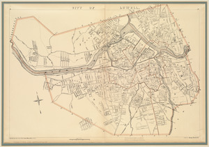
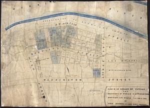
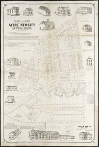
Plan of the city of Lowell, Massachusetts
Item Information
- Title:
- Plan of the city of Lowell, Massachusetts
- Description:
-
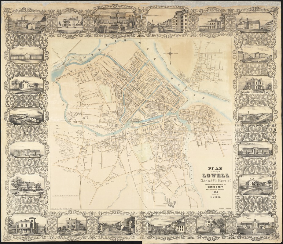
The communities that dotted the northeastern landscape reflected an economy that was heavily industrial and urban. The Industrial Revolution, which greatly accelerated urban growth, was introduced into southern New England at the beginning of the 19th century, with factories utilizing abundant local waterpower resources. Lowell, Massachusetts, was the epitome of a factory town. In 25 years the city grew exponentially, and by 1850 had a population of 30,000, making it the nation’s largest industrial community. Thirteen textile mills, depicted in the marginal illustrations, provided the focus of this industrial activity. Paradoxically, the raw material supplying Lowell’s factories, creating its wealth, was cotton from the American South. The factories first employed local single women, but eventually they were replaced by Irish immigrants in the 1830s and 1840s.
- Creator:
- Sidney & Neff
- Name on Item:
-
from actual surveys by Sidney & Neff.
- Date:
-
1850
- Format:
-
Maps/Atlases
- Location:
-
Boston Public Library
Norman B. Leventhal Map & Education Center - Collection (local):
-
Norman B. Leventhal Map & Education Center Collection
- Subjects:
-
Lowell (Mass.)--Maps
- Places:
-
MassachusettsMiddlesex (county)Lowell
- Extent:
- 1 map : col. ; 85 x 91 cm.
- Terms of Use:
-
No known copyright restrictions.
No known restrictions on use.
- Publisher:
-
Philadelphia :
S. Moody
- Scale:
-
Scale [ca. 1:2400].
- Language:
-
English
- Notes:
-
Includes 22 views of buildings in border.
"Printed by F. Kuhl, Philada."
"N. Friend's Lith."
- Notes (exhibitions):
-
Exhibited: "Torn in Two: The 150th Anniversary of the Civil War" organized by the Norman B. Leventhal Map Center at the Boston Public Library, 2011.
- Identifier:
-
06_01_003612
- Call #:
-
G3764.L7 1850 .S53
- Barcode:
-
39999059001634