Toggle navigation
LMEC Home
Exhibitions
Georeferencing
Tools for Teachers
Collections
My Favorites
Sign Up / Log In
Search
Search the map portal
Map Collection
Map Collection
Map Sets
Search
Search
Search for
Search In
All Fields
Creator
Title
Subject
Place
Search All Digital Collections
Advanced Search
8944 Results
My Search
Start Over
More Like
commonwealth:9s1619901
Remove constraint More Like: commonwealth:9s1619901
Filter your Search
Place
North and Central America
6,175
United States
5,091
Massachusetts
2,168
Europe
1,396
Suffolk (county)
1,282
Boston
1,255
Canada
449
Asia
438
more
Place
»
Topic
Boston (Mass.)--Maps
752
United States--Maps
282
City planning--Massachusetts--Boston--Maps
221
Real property--Massachusetts--Boston--Maps
207
Massachusetts--Maps
166
Landowners--Massachusetts--Boston--Maps
146
Urban renewal--Massachusetts--Boston--Maps
138
New England--Maps
104
more
Topic
»
Date
Date range begin
–
Date range end
Current results range from
1482
to
2023
View distribution
Creator
United States. Hydrographic Office
595
Boston Redevelopment Authority
224
O.H. Bailey & Co
148
Des Barres, Joseph F. W. (Joseph Frederick Wallet), 1722-1824
124
United States. Post Office Dept
120
Ptolemy, 2nd cent
100
Walling, Henry Francis, 1825-1888
94
Geological Survey (U.S.)
87
more
Creator
»
Format
Maps/Atlases
8,883
Manuscripts
215
Prints
56
Books
36
Objects/Artifacts
10
Drawings/Illustrations
9
Posters
5
Georeferenced
Yes
885
No
8,059
Collection
Norman B. Leventhal Map & Education Center Collection
8,727
Boston and New England Maps
2,427
Urban Maps
2,209
Maritime Charts and Atlases
1,083
American Revolutionary War-Era Maps
642
Boston Redevelopment Authority Collection
257
Massachusetts Real Estate Atlases
22
Mapping Boston Collection
21
more
Collection
»
Available to use
No known restrictions
8,733
Creative Commons license
71
Search Constraints
Sort by relevance
relevance
title
date (asc)
date (desc)
Number of results to display per page
20 per page
10
per page
20
per page
50
per page
100
per page
View results as:
grid view
map view
Search Results
6501.
Plan of 82 building lots, in the town of Brighton, comprising 48 acres of the Parkman Farm next the estate of Saml. Bigelow...
6502.
Plan of a part of Beverly in the Colony of the Massachusetts Bay
6503.
Plan of a part of New Brighton, Staten Island, showing the 500 blocks comprised in a proposed sale of lots
6504.
A plan of a survey of Noddles Island
6505.
A plan of Agawam
6506.
Plan of Amelia Island in East Florida : A chart of the entrance into St. Mary's River taken by Captn. W. Fuller in November,...
6507.
Plan of an estate in Boston belonging to Jos. Head Esqr
6508.
Plan of an estate in High St. to be sold at auction Sat. May 1st 1847 at 12 o'clock on the premises by Whitwell, Seaver & Co....
6509.
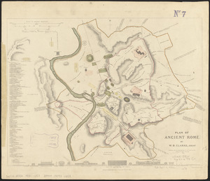
Plan of ancient Rome
6510.
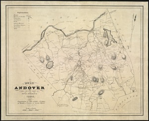
A plan of Andover taken for the town
6511.
Plan of Back Bay showing improvements on streets and estates
6512.
Plan of Bahía Honda ; Plan of Puerto de Cavañas
6513.
Plan of Bahia Xagua on the south side of Cuba ; Plan of the Colorado Rocks, near the west end of Cuba
6514.
A plan of Becket protracted by a scale of 120 rods to an inch
6515.
Plan of Bishop Parker's estate Bedford Street
6516.
Plan of Boston
6517.
Plan of Boston
6518.
A plan of Boston, from actual survey
6519.
A plan of Boston, from actual survey
6520.
Plan of Boston in 1630 and 1900
‹ Prev
Next ›
1
2
…
322
323
324
325
326
327
328
329
330
…
447
448