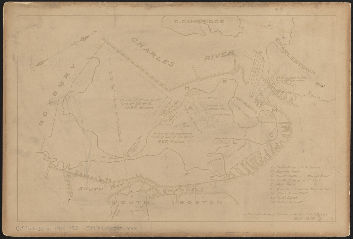
Plan of Boston in 1630 and 1900
Item Information
- Title:
- Plan of Boston in 1630 and 1900
- Date:
-
[1900?]
- Format:
-
Maps/Atlases
- Location:
-
Boston Public Library
Norman B. Leventhal Map & Education Center - Collection (local):
-
Norman B. Leventhal Map & Education Center Collection
- Subjects:
-
Boston (Mass.)--History--Colonial period, ca. 1600-1775--Maps
- Places:
-
MassachusettsSuffolk (county)Boston
- Extent:
- 1 map ; 24 x 37 cm
- Terms of Use:
-
No known copyright restrictions.
No known restrictions on use.
- Publisher:
-
[Massachusetts] :
[publisher not identified]
- Scale:
-
Scale not given
- Language:
-
English
- Notes:
-
Shows Boston in 1630 and 1900 with acreages.
Relief shown by hachures.
Oriented with north to the upper right.
- Identifier:
-
06_01_014959
- Call #:
-
G3764.B6S1 1900 .P53
- Barcode:
-
39999065708487


