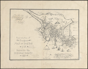
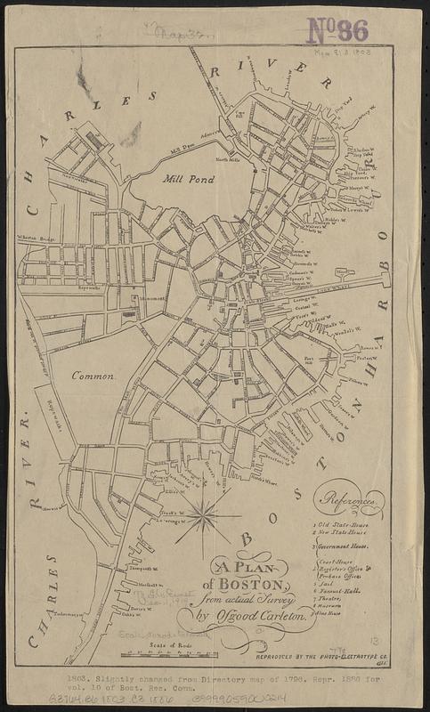
A plan of Boston, from actual survey
Item Information
- Title:
- A plan of Boston, from actual survey
- Cartographer:
- Carleton, Osgood, 1742-1816
- Publisher:
- Photo-Electrotype Co. (Boston, Mass.)
- Name on Item:
-
by Osgood Carleton
- Date:
-
1886
- Format:
-
Maps/Atlases
- Location:
-
Boston Public Library
Norman B. Leventhal Map & Education Center - Collection (local):
-
Norman B. Leventhal Map & Education Center Collection
- Subjects:
-
Boston (Mass.)--Maps--Early works to 1800--Facsimiles
- Places:
-
MassachusettsSuffolk (county)Boston
- Extent:
- 1 map ; 33 x 20 cm
- Terms of Use:
-
No known copyright restrictions.
No known restrictions on use.
- Publisher:
-
Boston, Mass. :
Photo Electrotype Co.
- Scale:
-
Scale [ca. 1:9,320]
- Language:
-
English
- Notes:
-
Facsimile.
Includes references to points of interest.
In lower margin: "1803. Slightly changed from Directory map of 1796. Repr. 1886 for vol. 10 of Bost. Rec. Comm."
- Identifier:
-
06_01_018773
- Call #:
-
G3764.B6 1803 .C3 1886
- Barcode:
-
39999059000214