Toggle navigation
LMEC Home
Exhibitions
Georeferencing
Tools for Teachers
Collections
My Favorites
Sign Up / Log In
Search
Search the map portal
Map Collection
Map Collection
Map Sets
Search
Search
Search for
Search In
All Fields
Creator
Title
Subject
Place
Search All Digital Collections
Advanced Search
425 Results
My Search
Start Over
More Like
commonwealth:8336pn34t
Remove constraint More Like: commonwealth:8336pn34t
Filter your Search
Place
North and Central America
369
United States
231
Canada
93
North America
80
New York
24
Pennsylvania
19
Asia
17
Great Lakes Region
16
more
Place
»
Topic
Canada--Maps--Early works to 1800
79
North America--Maps--Early works to 1800
71
United States--Maps--Early works to 1800
55
Great Lakes Region (North America)--Maps--Early works to 1800
17
Pennsylvania--Maps--Early works to 1800
12
New England--Maps--Early works to 1800
11
Northeastern States--Maps--Early works to 1800
11
New York (State)--Maps--Early works to 1800
9
more
Topic
»
Date
Date range begin
–
Date range end
Current results range from
1618
to
1999
View distribution
Creator
Bellin, Jacques Nicolas, 1703-1772
25
Jefferys, Thomas, -1771
20
Robert Sayer and John Bennett (Firm)
16
Faden, William, 1749-1836
14
Gibson, J. (John), active 1750-1792
14
Carleton, Osgood, 1742-1816
13
Bowles, Carington, 1724-1793
10
Carey, Mathew, 1760-1839
10
more
Creator
»
Format
Maps/Atlases
423
Manuscripts
5
Paintings
3
Ephemera
1
Objects/Artifacts
1
Prints
1
Georeferenced
Yes
1
No
424
Collection
MacLean Collection Map Library
379
American Revolutionary War-Era Maps
365
Norman B. Leventhal Map & Education Center Collection
26
Library and Archives Canada Collection
8
New York Public Library Collection
3
Richard H. Brown Revolutionary War Map Collection at Mount Vernon
3
Boston Athenaeum, Cartographic Collection
1
Harvard Map Collection
1
more
Collection
»
Available to use
No known restrictions
26
Creative Commons license
10
Search Constraints
Sort by relevance
relevance
title
date (asc)
date (desc)
Number of results to display per page
20 per page
10
per page
20
per page
50
per page
100
per page
View results as:
grid view
map view
Search Results
261.
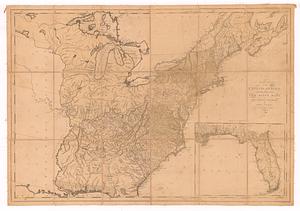
Map of the southern parts of the United States of America
262.
Map of the southern states of America, comprehending Maryland, Virginia, Kentucky, territory sth. of Ohio, North Carolina,...
263.
A map of the state of New York
264.
A map of the state of Pennsylvania
265.
A map of the states of Virginia, North Carolina, South Carolina and Georgia : comprehending the Spanish provinces of east and...
266.
A map of the states of Virginia, North Carolina, South Carolina and Georgia : comprehending the Spanish provinces of east and...
267.
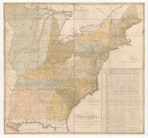
A map of the United States: compiled chiefly from the state maps, and other authentic information
268.
A map of the United States: compiled chiefly from the state maps, and other authentic information
269.
A map of the United States: compiled chiefly from the state maps, and other authentic information
270.
Map of the United States, exhibiting the post-roads, the situations, connections & distances of the post-offices stage roads,...
271.
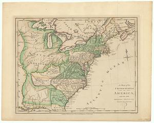
A map of the United States of America, with part of the adjoining provinces from the latest authorities
272.
A map of the United States of N. America
273.
A map of the United States of North America drawn from a number of critical researches
274.
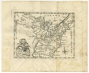
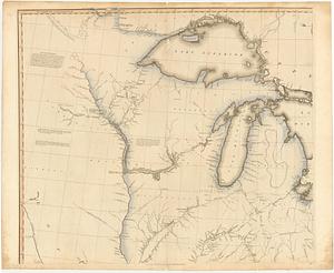
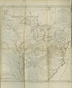
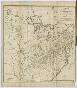
A map of the western part of the territories belonging to the United States of America : drawn from the best authorities
275.
A map of the western part of the territories belonging to the United States of America : drawn from the best authorities
276.
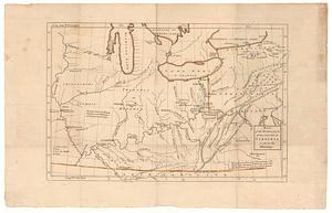
Map of the western parts of the colony of Virginia as far as the Mississipi
277.
A map of Tottin & Crosfields purchase & the waters adjacent in the state of New-York
278.
Map of Washington City
279.
Map of western New York state, marking land plots around Lac Oneida
280.
Mapa del puerto y rio de S.n Francisco explorado por tierra en el mes de Marzo del presen te ano de 1772
‹ Prev
Next ›
1
2
…
10
11
12
13
14
15
16
17
18
…
21
22