Toggle navigation
LMEC Home
Exhibitions
Georeferencing
Tools for Teachers
Collections
My Favorites
Sign Up / Log In
Search
Search the map portal
Map Collection
Map Collection
Map Sets
Search
Search
Search for
Search In
All Fields
Creator
Title
Subject
Place
Search All Digital Collections
Advanced Search
8649 Results
My Search
Start Over
More Like
commonwealth:8336h326z
Remove constraint More Like: commonwealth:8336h326z
Filter your Search
Place
North and Central America
5,888
United States
4,806
Massachusetts
2,068
Europe
1,392
Suffolk (county)
1,041
Boston
1,014
Canada
449
Asia
437
more
Place
»
Topic
Boston (Mass.)--Maps
583
United States--Maps
279
Real property--Massachusetts--Boston--Maps
176
Massachusetts--Maps
162
Landowners--Massachusetts--Boston--Maps
134
North America--Maps--Early works to 1800
103
New England--Maps
101
Europe--Maps
79
more
Topic
»
Date
Date range begin
–
Date range end
Current results range from
1482
to
2023
View distribution
Creator
United States. Hydrographic Office
595
O.H. Bailey & Co
148
Des Barres, Joseph F. W. (Joseph Frederick Wallet), 1722-1824
123
United States. Post Office Dept
120
Ptolemy, 2nd cent
100
Walling, Henry Francis, 1825-1888
94
Geological Survey (U.S.)
87
Jefferys, Thomas, -1771
85
more
Creator
»
Format
Maps/Atlases
8,589
Manuscripts
215
Prints
56
Books
36
Objects/Artifacts
10
Drawings/Illustrations
8
Posters
5
Georeferenced
Yes
869
No
7,780
Collection
Norman B. Leventhal Map & Education Center Collection
8,646
Boston and New England Maps
2,221
Urban Maps
1,992
Maritime Charts and Atlases
1,083
American Revolutionary War-Era Maps
615
Boston Redevelopment Authority Collection
87
Massachusetts Real Estate Atlases
3
Available to use
No known restrictions
8,504
Creative Commons license
47
Search Constraints
Sort by relevance
relevance
title
date (asc)
date (desc)
Number of results to display per page
20 per page
10
per page
20
per page
50
per page
100
per page
View results as:
grid view
map view
Search Results
1.
Hyde Park & Fairmount : in Dorchester & Milton, Norfolk Co
2.
Map of Hyde Park and Milton
3.
Atlas of the town of Milton Norfolk County Mass. : from official plans and private surveys
4.
Atlas of the town of Milton Norfolk County, Massachusetts
5.
A map of the towns of Dorchester and Milton, 1831
6.
Plan of Milton Cemetery
7.
Atlas of the city of Boston : ward 26, Hyde Park : from actual surveys and official plans
8.
Atlas of the city of Medford, Middlesex County, Mass. ; Atlas of the town of Hyde Park, Norfolk County, Mass. ; Atlas of the...
9.
Capital Park : Hyde Park ... Boston
10.
Hyde Park
11.
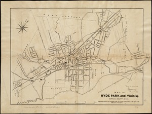
Map of Hyde Park and Vicinity : Norfolk County, Mass
12.
Plan of land and street layout in Boston, Mass., Hyde Park : prepared for the Stoney Brook Land Trust
13.
Rugby : belonging to Wood, Harmon & Co
14.
Atlas of the town of Milton, Norfolk County, Massachusetts
15.
Atlas of Massachusetts
16.
Atlas of the city of Boston : ward 26 Hyde Park
17.
The 100th anniversary map of Abraham Lincoln's visit to Massachusetts, September 11-23, 1848
18.
1630 shoreline
19.
1879. Progress map of the U.S. Geographical Surveys west of the 100th Meridian : prepared under the direction of 1st Lieut....
20.
1903 Map of Salem and surrounding places
‹ Prev
Next ›
1
2
3
4
5
…
432
433