Toggle navigation
LMEC Home
Exhibitions
Georeferencing
Tools for Teachers
Collections
My Favorites
Sign Up / Log In
Search
Search the map portal
Map Collection
Map Collection
Map Sets
Search
Search
Search for
Search In
All Fields
Creator
Title
Subject
Place
Search All Digital Collections
Advanced Search
8699 Results
My Search
Start Over
More Like
commonwealth:7h14b221t
Remove constraint More Like: commonwealth:7h14b221t
Filter your Search
Place
North and Central America
5,930
United States
4,848
Massachusetts
2,079
Europe
1,396
Suffolk (county)
1,046
Boston
1,019
Canada
449
Asia
438
more
Place
»
Topic
Boston (Mass.)--Maps
586
United States--Maps
282
Real property--Massachusetts--Boston--Maps
175
Massachusetts--Maps
162
Landowners--Massachusetts--Boston--Maps
133
North America--Maps--Early works to 1800
103
New England--Maps
102
Europe--Maps
79
more
Topic
»
Date
Date range begin
–
Date range end
Current results range from
1482
to
2023
View distribution
Creator
United States. Hydrographic Office
595
O.H. Bailey & Co
148
Des Barres, Joseph F. W. (Joseph Frederick Wallet), 1722-1824
123
United States. Post Office Dept
120
Ptolemy, 2nd cent
100
Walling, Henry Francis, 1825-1888
94
Geological Survey (U.S.)
86
Jefferys, Thomas, -1771
85
more
Creator
»
Format
Maps/Atlases
8,639
Manuscripts
215
Prints
56
Books
36
Objects/Artifacts
10
Drawings/Illustrations
8
Posters
5
Georeferenced
Yes
869
No
7,830
Collection
Norman B. Leventhal Map & Education Center Collection
8,695
Boston and New England Maps
2,233
Urban Maps
2,023
Maritime Charts and Atlases
1,083
American Revolutionary War-Era Maps
620
Boston Redevelopment Authority Collection
87
William L. Clements Library Collection
4
Applied Geographics, Inc. Records
1
Available to use
No known restrictions
8,553
Creative Commons license
47
Search Constraints
Sort by relevance
relevance
title
date (asc)
date (desc)
Number of results to display per page
20 per page
10
per page
20
per page
50
per page
100
per page
View results as:
grid view
map view
Search Results
1.
Colton's Texas
2.
Gallup's map of Texas
3.
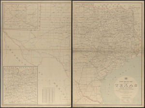
Map of Texas and parts of adjoining territories
4.
Map of Texas and the country adjacent
5.
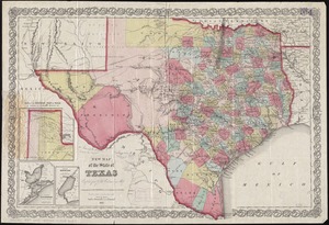
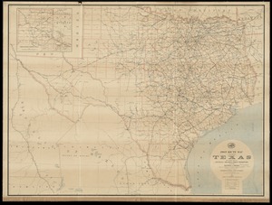
New map of the state of Texas
6.
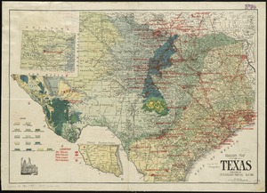
Oil and gas fields of the state of Texas
7.
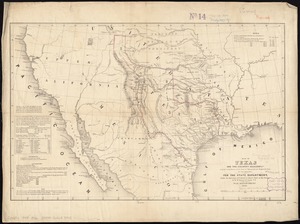
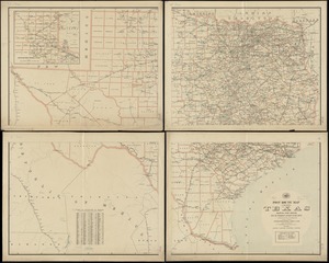
Post route map of the state of Texas showing post offices with the intermediate distances on mail routes in operation on the...
8.
Post route map of the state of Texas showing post offices with the intermediate distances on mail routes in operation on the...
9.
Post route map of the state of Texas with adjacent parts of Louisiana, Arkansas, Indian Territory and of the Republic of Mexico...
10.
Texas and Pacific Rail Way
11.
Texas New Yorker travelers' railroad map of the State of Texas
12.
Texas New Yorker's railroad map of Texas : showing all completed and proposed routes, with principal rivers, county boundaries...
13.
Topographical map of the province of lower Texas on the Gulf of Mexico
14.
American explorations in the West, 1803-1852
15.
Bancroft's map of the Rocky Mountain states, and the Pacific coast
16.
Carta geografica general de la republica Mexicana
17.
The Chevron trail through the scenic west
18.
Great Northern Railway and proprietary lines
19.
Louisiana
20.
Map of Oregon and upper California, from the surveys of John Charles Frémont and other authorities
‹ Prev
Next ›
1
2
3
4
5
…
434
435