Toggle navigation
LMEC Home
Exhibitions
Georeferencing
Tools for Teachers
Collections
My Favorites
Sign Up / Log In
Search
Search the map portal
Map Collection
Map Collection
Map Sets
Search
Search
Search for
Search In
All Fields
Creator
Title
Subject
Place
Search All Digital Collections
Advanced Search
8717 Results
My Search
Start Over
More Like
commonwealth:7h14b1987
Remove constraint More Like: commonwealth:7h14b1987
Filter your Search
Place
North and Central America
5,948
United States
4,866
Massachusetts
2,079
Europe
1,396
Suffolk (county)
1,046
Boston
1,019
Canada
450
Asia
438
more
Place
»
Topic
Boston (Mass.)--Maps
586
United States--Maps
282
Real property--Massachusetts--Boston--Maps
175
Massachusetts--Maps
162
Landowners--Massachusetts--Boston--Maps
133
North America--Maps--Early works to 1800
103
New England--Maps
102
Europe--Maps
79
more
Topic
»
Date
Date range begin
–
Date range end
Current results range from
1482
to
2023
View distribution
Creator
United States. Hydrographic Office
595
O.H. Bailey & Co
148
Des Barres, Joseph F. W. (Joseph Frederick Wallet), 1722-1824
123
United States. Post Office Dept
120
Ptolemy, 2nd cent
100
Walling, Henry Francis, 1825-1888
94
Geological Survey (U.S.)
86
Jefferys, Thomas, -1771
85
more
Creator
»
Format
Maps/Atlases
8,657
Manuscripts
215
Prints
56
Books
36
Objects/Artifacts
10
Drawings/Illustrations
8
Posters
5
Georeferenced
Yes
869
No
7,848
Collection
Norman B. Leventhal Map & Education Center Collection
8,695
Boston and New England Maps
2,233
Urban Maps
2,023
Maritime Charts and Atlases
1,083
American Revolutionary War-Era Maps
638
Boston Redevelopment Authority Collection
87
William L. Clements Library Collection
19
MacLean Collection Map Library
2
more
Collection
»
Available to use
No known restrictions
8,553
Creative Commons license
48
Search Constraints
Sort by relevance
relevance
title
date (asc)
date (desc)
Number of results to display per page
20 per page
10
per page
20
per page
50
per page
100
per page
View results as:
grid view
map view
Search Results
41.
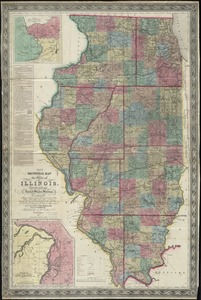
New sectional map of the state of Illinois : compiled from the United States surveys, also exhibiting the internal...
42.
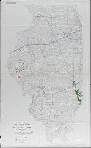
Oil and gas fields of the state of Illinois
43.
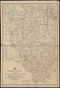
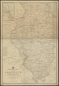
Post route map of the state of Illinois showing post offices with the intermediate distances on mail routes in operation on the...
44.
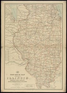
Post route map of the state of Illinois showing post offices with the intermediate distances on mail routes in operation on the...
45.
Post route map of the state of Illinois showing post offices with the intermediate distances on mail routes in operation on the...
46.
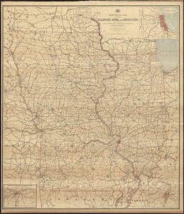
Post route map of the states of Illinois, Iowa, and Missouri with adjacent parts of Indiana, Wisconsin, Minnesota, Nebraska,...
47.
Railroad map of Illinois
48.
State of Illinois
49.
State of Illinois
50.
State of Illinois coal fields and producing districts
51.
Chicago, Burlington & Quincy R.R. and intersecting lines
52.
Map fifth division railway mail service
53.
Map ninth division railway mail service
54.
Map of Atlantic & Pacific Rail Road
55.
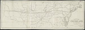
Map of the Clinton Line Railroad and its connections
56.
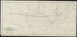
Map of the Fort Wayne, Lacon, & Platte Valley Air Line Railroad, with its eastern connections and proposed extension west in...
57.
Map of the Northern Pacific R.R. its connections and tributary country
58.
Map showing location of the Chicago & Northwestern Railway with its branches & connections through Illinois, Iowa, Nebraska,...
59.
Map showing the Burlington, Cedar Rapids and Minnesota Railway and its connections
60.
Map sixth division railway mail service
‹ Prev
Next ›
1
2
3
4
5
6
7
…
435
436