Toggle navigation
LMEC Home
Exhibitions
Georeferencing
Tools for Teachers
Collections
My Favorites
Sign Up / Log In
Search
Search the map portal
Map Collection
Map Collection
Map Sets
Search
Search
Search for
Search In
All Fields
Creator
Title
Subject
Place
Search All Digital Collections
Advanced Search
8779 Results
My Search
Start Over
More Like
commonwealth:7h14b151b
Remove constraint More Like: commonwealth:7h14b151b
Filter your Search
Place
North and Central America
6,010
United States
4,907
Massachusetts
2,150
Europe
1,396
Suffolk (county)
1,047
Boston
1,020
Canada
450
Asia
438
more
Place
»
Topic
Boston (Mass.)--Maps
590
United States--Maps
282
Massachusetts--Maps
235
Real property--Massachusetts--Boston--Maps
175
Landowners--Massachusetts--Boston--Maps
133
New England--Maps
104
North America--Maps--Early works to 1800
103
Europe--Maps
79
more
Topic
»
Date
Date range begin
–
Date range end
Current results range from
1482
to
2023
View distribution
Creator
United States. Hydrographic Office
595
O.H. Bailey & Co
148
Des Barres, Joseph F. W. (Joseph Frederick Wallet), 1722-1824
123
United States. Post Office Dept
120
Ptolemy, 2nd cent
100
Walling, Henry Francis, 1825-1888
95
Geological Survey (U.S.)
93
Jefferys, Thomas, -1771
85
more
Creator
»
Format
Maps/Atlases
8,718
Manuscripts
217
Prints
56
Books
36
Objects/Artifacts
10
Drawings/Illustrations
8
Posters
5
Ephemera
1
Georeferenced
Yes
880
No
7,899
Collection
Norman B. Leventhal Map & Education Center Collection
8,739
Boston and New England Maps
2,281
Urban Maps
2,024
Maritime Charts and Atlases
1,083
American Revolutionary War-Era Maps
643
Boston Redevelopment Authority Collection
90
Applied Geographics, Inc. Records
20
David Judkins Weaver Papers
20
more
Collection
»
Available to use
No known restrictions
8,597
Creative Commons license
51
Search Constraints
Sort by relevance
relevance
title
date (asc)
date (desc)
Number of results to display per page
20 per page
10
per page
20
per page
50
per page
100
per page
View results as:
grid view
map view
Search Results
201.
A type-ology of population in Massachusetts
202.
Western Massachusetts closed to the public
203.
Western Massachusetts open space abounds
204.
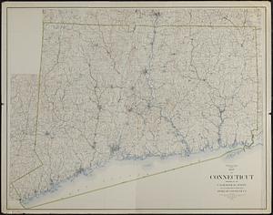
Connecticut from the best authorities
205.
Connecticut from the best authorities
206.
Map of Connecticut
207.
A new and correct map of Connecticut : one of the United States of North America
208.
Open space map of Connecticut, lands dedicated as open space, and selected undeveloped land, lands managed but not dedicated as...
209.
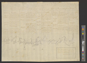
A particular discription of that part of the coast of Connecticut extending from Byram River to Stratford Point : these...
210.
Partie de l'état de Rhode-Island et position des armées Américaine et Britannique au siege de Newport et à l'affaire du 29 Août...
211.
The State of Rhode Island, : from the latest surveys. 1796
212.
An accurate map of the commonwealth of Massachusetts exclusive of the district of Maine compiled pursuant to an act of the...
213.
An accurate map of the commonwealth of Massachusetts exclusive of the district of Maine compiled pursuant to an act of the...
214.
Atlas of Massachusetts
215.
Atlas of Massachusetts
216.
Commonwealth of Massachusetts U.S. congressional districts
217.
DFWELE land showing 1985-1990 acquisitions
218.
Eastern encephalitis risk area
219.
EOEA MassGIS geographic information system transition document : The EOEA geographic information system: MassGIS
220.
EOEA wide area network
‹ Prev
Next ›
1
2
…
7
8
9
10
11
12
13
14
15
…
438
439