Toggle navigation
LMEC Home
Exhibitions
Georeferencing
Tools for Teachers
Collections
My Favorites
Sign Up / Log In
Search
Search the map portal
Map Collection
Map Collection
Map Sets
Search
Search
Search for
Search In
All Fields
Creator
Title
Subject
Place
Search All Digital Collections
Advanced Search
8719 Results
My Search
Start Over
More Like
commonwealth:7h149z475
Remove constraint More Like: commonwealth:7h149z475
Filter your Search
Place
North and Central America
5,950
United States
4,858
Massachusetts
2,080
Europe
1,396
Suffolk (county)
1,046
Boston
1,019
Canada
453
Asia
438
more
Place
»
Topic
Boston (Mass.)--Maps
586
United States--Maps
282
Real property--Massachusetts--Boston--Maps
175
Massachusetts--Maps
163
Landowners--Massachusetts--Boston--Maps
133
New England--Maps
105
North America--Maps--Early works to 1800
103
Europe--Maps
79
more
Topic
»
Date
Date range begin
–
Date range end
Current results range from
1482
to
2023
View distribution
Creator
United States. Hydrographic Office
595
O.H. Bailey & Co
148
Des Barres, Joseph F. W. (Joseph Frederick Wallet), 1722-1824
123
United States. Post Office Dept
120
Ptolemy, 2nd cent
100
Walling, Henry Francis, 1825-1888
94
Geological Survey (U.S.)
90
Jefferys, Thomas, -1771
85
more
Creator
»
Format
Maps/Atlases
8,659
Manuscripts
218
Prints
56
Books
36
Objects/Artifacts
10
Drawings/Illustrations
8
Posters
5
Georeferenced
Yes
869
No
7,850
Collection
Norman B. Leventhal Map & Education Center Collection
8,700
Boston and New England Maps
2,237
Urban Maps
2,023
Maritime Charts and Atlases
1,083
American Revolutionary War-Era Maps
633
Boston Redevelopment Authority Collection
87
American Antiquarian Society Collection
8
William L. Clements Library Collection
6
more
Collection
»
Available to use
No known restrictions
8,558
Creative Commons license
48
Search Constraints
Sort by relevance
relevance
title
date (asc)
date (desc)
Number of results to display per page
20 per page
10
per page
20
per page
50
per page
100
per page
View results as:
grid view
map view
Search Results
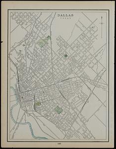
1961.
Dallas, Texas ; Buffalo
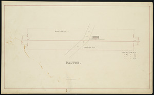
1962.
Dalton
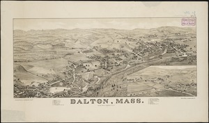
1963.
Dalton, Mass
1964.
Danbury, Conn
1965.
Dane County, Wis.
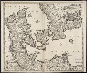
1966.
Dania regnum in quo sunt Ducatus Holsatia et Slesvicum Insulae Danicae et Provinciae Iutia, Scania, Blekingia et Hallandia
1967.
Daniae regni typum potentissimo Invictissimoque D. Christiano, Daniae, Norvegiae, Gotthorum Vandalorum Regi lubens offert
1968.
Danube to India
1969.
Danubius, fluvius Europae maximus, a fontibus ad ostia, cum omnibus fluminibus, ab utroque latere, in illum defluentibus
1970.
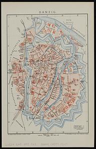
Danzig
1971.
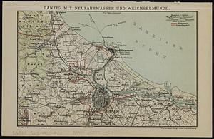
Danzig mit Neufahrwasser und Weichselmünde
1972.
Dawson's map of the Dominion of Canada
1973.
Deans, Krusensterns, and Lazareff Islands
1974.
Deans, Krusensterns, and Lazareff Islands
1975.
Decatur, Ill : 1878
1976.
Decima Asiae tabula
1977.
Decima et ultima Europae tabula
1978.
Decima Europe tabula continent Macedonia et Epirum et Achaiam & Peloponesum
1979.
Dedication of the Army and Navy Monument, Sept. 17, 1877
1980.
Deering, Cumberland County, Maine : 1886
‹ Prev
Next ›
1
2
…
95
96
97
98
99
100
101
102
103
…
435
436