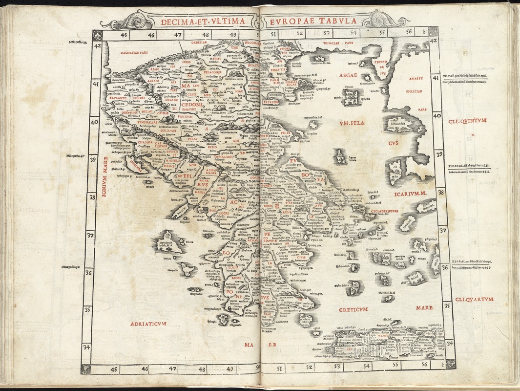
Decima et ultima Europae tabula
Item Information
- Title:
- Decima et ultima Europae tabula
- Creator:
- Ptolemy, 2nd cent
- Date:
-
1511
- Format:
-
Maps/Atlases
- Location:
-
Boston Public Library
Norman B. Leventhal Map & Education Center - Collection (local):
-
Norman B. Leventhal Map & Education Center Collection
- Subjects:
-
Greece--Maps--Early works to 1800
- Places:
-
Greece
- Extent:
- 1 map ; 36 x 41 cm.
- Terms of Use:
-
No known copyright restrictions.
No known restrictions on use.
- Publisher:
-
Venice :
J. Pentius de Leucho
- Scale:
-
Scale [ca. 1:2,600,000]
- Language:
-
Latin
- Notes:
-
Map of mainland Greece and its islands.
Relief shown pictorially.
Includes names of places and natural features.
In margin: Climatic and latitudinal notes.
Appears in the author's Geographia, edited by Bernard Sylvanus. Venetiis : Per Iacobum Pentium de Leucho, anno Domini 1511.
Text in Latin.
Cataloging, conservation, and digitization made possible in part by The National Endowment for the Humanities: Exploring the human endeavor.
Atlas scanned by Internet Archive http://archive.org/details/claudiiptholemae00ptol
- Identifier:
-
06_01_007950
- Call #:
-
G1005 .P7 1511
- Barcode:
-
30000003779804


