Toggle navigation
LMEC Home
Exhibitions
Georeferencing
Tools for Teachers
Collections
My Favorites
Sign Up / Log In
Search
Search the map portal
Map Collection
Map Collection
Map Sets
Search
Search
Search for
Search In
All Fields
Creator
Title
Subject
Place
Search All Digital Collections
Advanced Search
8556 Results
My Search
Start Over
More Like
commonwealth:7h149v43f
Remove constraint More Like: commonwealth:7h149v43f
Filter your Search
Place
North and Central America
5,851
United States
4,770
Massachusetts
2,052
Europe
1,359
Suffolk (county)
1,034
Boston
1,007
Canada
453
Asia
422
more
Place
»
Topic
Boston (Mass.)--Maps
577
United States--Maps
273
Real property--Massachusetts--Boston--Maps
174
Massachusetts--Maps
160
Landowners--Massachusetts--Boston--Maps
132
North America--Maps--Early works to 1800
104
New England--Maps
99
Europe--Maps
78
more
Topic
»
Date
Date range begin
–
Date range end
Current results range from
1482
to
2023
View distribution
Creator
United States. Hydrographic Office
594
O.H. Bailey & Co
148
Des Barres, Joseph F. W. (Joseph Frederick Wallet), 1722-1824
122
United States. Post Office Dept
120
Ptolemy, 2nd cent
100
Walling, Henry Francis, 1825-1888
94
Geological Survey (U.S.)
86
Jefferys, Thomas, -1771
85
more
Creator
»
Format
Maps/Atlases
8,497
Manuscripts
218
Prints
56
Books
36
Objects/Artifacts
10
Drawings/Illustrations
8
Posters
4
Georeferenced
Yes
869
No
7,687
Collection
Norman B. Leventhal Map & Education Center Collection
8,549
Boston and New England Maps
2,204
Urban Maps
1,936
Maritime Charts and Atlases
1,080
American Revolutionary War-Era Maps
622
Boston Redevelopment Authority Collection
87
Richard H. Brown Revolutionary War Map Collection at Mount Vernon
4
Newberry Library Collection
3
Available to use
No known restrictions
8,408
Creative Commons license
50
Search Constraints
Sort by relevance
relevance
title
date (asc)
date (desc)
Number of results to display per page
20 per page
10
per page
20
per page
50
per page
100
per page
View results as:
grid view
map view
Search Results
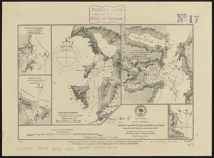
7301.
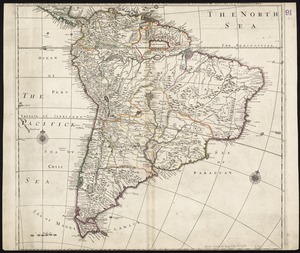
South America divided into its IIII principall parts : I Spanish part: vizt. Firmland, Guiana, Peru, Chili, pt of the country...
7302.
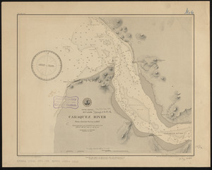
South America, Ecuador, Caraquez River : from a British survey in 1847
7303.
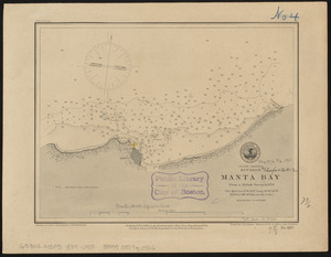
South America, Ecuador, Manta Bay : from a British survey in 1876
7304.
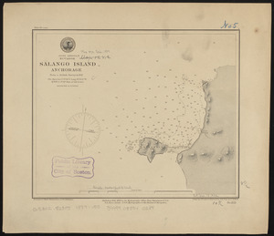
South America, Ecuador, Salango Island anchorage : from a British survey in 1847
7305.
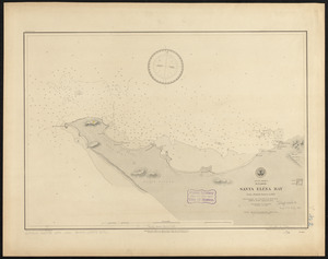
South America, Ecuador, Santa Eléna Bay : from a British survey in 1847
7306.
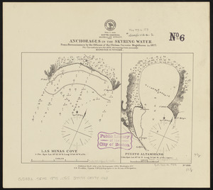
South America, Magellan Strait, anchorages in the Skyring Water : from a reconnaissance by the officers of the Chilean corvette...
7307.
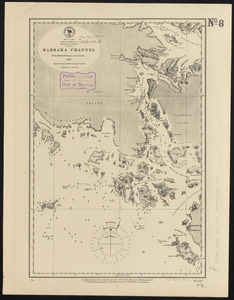
South America, Magellan Strait, Barbara Channel : from British surveys corrected to 1878
7308.
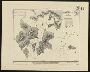
South America-- Magellan Strait, Desolation I., Week Islands : from a British survey in 1830
7309.
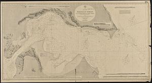
South America, Magellan Strait from the eastern entrance to the First Narrows : compiled from the most recent surveys to 1883
7310.
South America, Magellan Strait from the First Narrows to Broad Reach : compiled from the most recent surveys to 1883
7311.
South America, north coast of Colombia and Venezuela, Gulf of Darien to Puerto Cabello : compiled from the latest information 1886
7312.
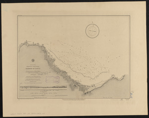
South America, north-west coast of Peru, harbor of Payta
7313.
South America, ports in Desolation and Sta. Ines Is. : from British surveys corrected to 1877
7314.
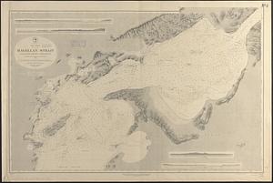
South America, ports in the Strait of Magellan : from British surveys corrected to 1877
7315.
South America, ports on the south side of Tierra del Fuego : from British surveys corrected to 1877
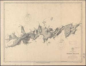
7316.
South America, Staten Island : from a British survey
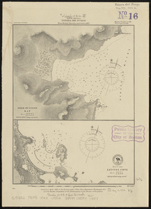
7317.
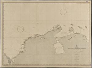
South America, Tierra del Fuego : from British surveys corrected to 1877
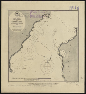
7318.
South America, Tierra del Fuego, Goree Road : from a British survey corrected to 1877
7319.
South America, Tierra del Fuego, Packsaddle Bay : from a British survey corrected to 1877
7320.
South America, United States of Colombia, Bahia Honda : from an old Spanish plan 1886
‹ Prev
Next ›
1
2
…
362
363
364
365
366
367
368
369
370
…
427
428