Toggle navigation
LMEC Home
Exhibitions
Georeferencing
Tools for Teachers
Collections
My Favorites
Sign Up / Log In
Search
Search the map portal
Map Collection
Map Collection
Map Sets
Search
Search
Search for
Search In
All Fields
Creator
Title
Subject
Place
Search All Digital Collections
Advanced Search
8834 Results
My Search
Start Over
More Like
commonwealth:6t053n91f
Remove constraint More Like: commonwealth:6t053n91f
Filter your Search
Place
North and Central America
6,010
United States
4,859
Massachusetts
2,079
Europe
1,396
Suffolk (county)
1,046
Boston
1,019
Canada
454
Asia
441
more
Place
»
Topic
Boston (Mass.)--Maps
586
United States--Maps
282
North America--Maps--Early works to 1800
240
Real property--Massachusetts--Boston--Maps
175
Massachusetts--Maps
162
Landowners--Massachusetts--Boston--Maps
133
New England--Maps
102
Europe--Maps
79
more
Topic
»
Date
Date range begin
–
Date range end
Current results range from
1482
to
2023
View distribution
Creator
United States. Hydrographic Office
595
O.H. Bailey & Co
148
Des Barres, Joseph F. W. (Joseph Frederick Wallet), 1722-1824
123
United States. Post Office Dept
120
Ptolemy, 2nd cent
100
Walling, Henry Francis, 1825-1888
94
Jefferys, Thomas, -1771
92
Sayer, Robert, 1725-1794
87
more
Creator
»
Format
Maps/Atlases
8,774
Manuscripts
217
Prints
56
Books
36
Objects/Artifacts
10
Drawings/Illustrations
8
Posters
5
Georeferenced
Yes
872
No
7,962
Collection
Norman B. Leventhal Map & Education Center Collection
8,704
Boston and New England Maps
2,234
Urban Maps
2,023
Maritime Charts and Atlases
1,083
American Revolutionary War-Era Maps
740
Boston Redevelopment Authority Collection
87
MacLean Collection Map Library
59
New York Public Library Collection
34
more
Collection
»
Available to use
No known restrictions
8,556
Creative Commons license
113
Search Constraints
Sort by relevance
relevance
title
date (asc)
date (desc)
Number of results to display per page
20 per page
10
per page
20
per page
50
per page
100
per page
View results as:
grid view
map view
Search Results
221.
A new map of the north parts of America claimed by France under ye names of Louisiana, Mississipi, Canada, and New France with...
222.
North America
223.
North America
224.
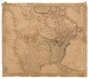
North America
225.
North America, agreeable to the most approved maps and charts
226.
North America, as divided amongst the European powers
227.
North America drawn from the latest and best authorities
228.
North America with the new discoveries
229.
The north part of America : conteyning Newfoundland, new England, Virginia, Florida, new Spaine, and Noua Francia wth ye rich...
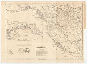
230.
The north-west-coast of North America and adjacent territories
231.
Norumbega et Virginia
232.
Noua Anglia, Nouum Belgium, et Virginia
233.
Nova mappa geographica America Septentrionalis in suas praecipuas partes divisa = Amerique Septentrionale suivent [sic] la...
234.
Nova tabula geographica complectens borealiorem Americae partem : in qua exacte delineatae sunt Canada sive Nova Francia, Nova...
235.
Nova tabula geographica complectens borealiorem Americæ partem : in qua exacte delineatæ sunt Canada sive Nova Francia, Nova...
236.
La Nuoua Francia
237.
Nuove scoperte de' russi al nord del mare del sud si nell' Asia, che nell America
238.
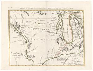
Il paese de' selvagi Outagamiani, Mascoutensi Illinesi e parte delle VI. Nazioni
239.
Rade et port de Plaisance -- Le Port d'Anapolis dans l'Acadie -- Port de Boston dans la Nouvlle. Angleterre
240.
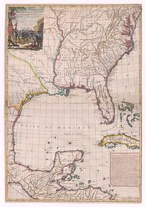
Suite du theatre de la guerre dans l'Amerique Septentrionale y compris le Golfe du Mexique
‹ Prev
Next ›
1
2
…
8
9
10
11
12
13
14
15
16
…
441
442