Toggle navigation
LMEC Home
Exhibitions
Georeferencing
Tools for Teachers
Collections
My Favorites
Sign Up / Log In
Search
Search the map portal
Map Collection
Map Collection
Map Sets
Search
Search
Search for
Search In
All Fields
Creator
Title
Subject
Place
Search All Digital Collections
Advanced Search
8774 Results
My Search
Start Over
More Like
commonwealth:6h446z58f
Remove constraint More Like: commonwealth:6h446z58f
Filter your Search
Place
North and Central America
6,005
United States
4,923
Massachusetts
2,089
Europe
1,396
Suffolk (county)
1,125
Boston
1,098
Canada
449
Asia
438
more
Place
»
Topic
Boston (Mass.)--Maps
606
United States--Maps
282
Real property--Massachusetts--Boston--Maps
254
Landowners--Massachusetts--Boston--Maps
170
Massachusetts--Maps
162
City planning--Massachusetts--Boston--Maps
108
North America--Maps--Early works to 1800
103
New England--Maps
102
more
Topic
»
Date
Date range begin
–
Date range end
Current results range from
1482
to
2023
View distribution
Creator
United States. Hydrographic Office
595
O.H. Bailey & Co
148
Des Barres, Joseph F. W. (Joseph Frederick Wallet), 1722-1824
123
United States. Post Office Dept
120
Boston Redevelopment Authority
111
Ptolemy, 2nd cent
100
Walling, Henry Francis, 1825-1888
94
Geological Survey (U.S.)
86
more
Creator
»
Format
Maps/Atlases
8,714
Manuscripts
215
Prints
56
Books
36
Objects/Artifacts
10
Drawings/Illustrations
8
Posters
5
Georeferenced
Yes
869
No
7,905
Collection
Norman B. Leventhal Map & Education Center Collection
8,696
Boston and New England Maps
2,277
Urban Maps
2,067
Maritime Charts and Atlases
1,083
American Revolutionary War-Era Maps
616
Boston Redevelopment Authority Collection
130
Massachusetts Real Estate Atlases
35
Applied Geographics, Inc. Records
1
Available to use
No known restrictions
8,597
Creative Commons license
47
Search Constraints
Sort by relevance
relevance
title
date (asc)
date (desc)
Number of results to display per page
20 per page
10
per page
20
per page
50
per page
100
per page
View results as:
grid view
map view
Search Results
2521.
France divided into circles and departments
2522.
France divided into circles and departments
2523.
La France divisée en provinces et en généralités : dont le plan est celui de l'ancienne Gaule
2524.
La France divisée par généralités
2525.
France et états limitrophes
2526.
France, from the best authorities
2527.
France kilométrique : carte indiquant les distances kilométriques sur tous les réseaux de chemins de fer
2528.
France, Mediterranean coast : from the Pilote Français 1845 ; republication of Brit. Admty. chart no. 2609, with additions and...
2529.
France, Mediterranean coast : from the Pilote Français 1842 ; republication of Brit. Admty. chart no. 2608, with additions &...
2530.
France, Mediterranean coast : from the Pilote Français 1842 ; republication of Brit. Admty. chart no. 2607, with additions &...
2531.
France, Mediterranean coast : from the Pilote Français 1842 ; republication of Brit. Admty. chart no. 2604, with additions &...
2532.
France, Mediterranean coast : from the Pilote Français 1843 ; republication of Brit. Admty. chart no. 2606, with additions and...
2533.
France, Mediterranean coast : from the Pilote Français 1842 ; republication of Brit. Admty. chart no. 2603, with additions and...
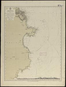
2534.
France, north west coast : from the Pilote Français 1823 ; republication of Brit. Admty. chart no. 2644, corrected to 1876
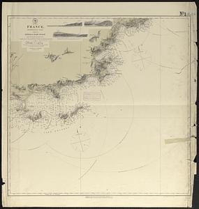
2535.
France, north west coast, Rade de la Hougue : from a French survey in 1833 ; republication of Brit. Admty. chart no. 2743, with...
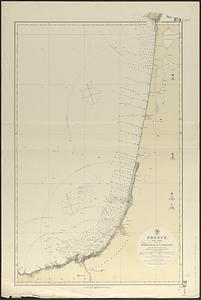
2536.
France, west coast
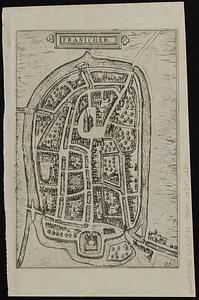
2537.
Franicher
2538.
Frank Leslie's war maps and companion to the newspaper
2539.
Franklin and Franklin Falls, N.H : Merrimack County, 1884
2540.
Franklin, Massachusetts
‹ Prev
Next ›
1
2
…
123
124
125
126
127
128
129
130
131
…
438
439