Toggle navigation
LMEC Home
Exhibitions
Georeferencing
Tools for Teachers
Collections
My Favorites
Sign Up / Log In
Search
Search the map portal
Map Collection
Map Collection
Map Sets
Search
Search
Search for
Search In
All Fields
Creator
Title
Subject
Place
Search All Digital Collections
Advanced Search
8635 Results
My Search
Start Over
More Like
commonwealth:6h446z34v
Remove constraint More Like: commonwealth:6h446z34v
Filter your Search
Place
North and Central America
5,930
United States
4,854
Massachusetts
2,062
Europe
1,359
Suffolk (county)
1,119
Boston
1,092
Canada
448
Asia
422
more
Place
»
Topic
Boston (Mass.)--Maps
597
United States--Maps
273
Real property--Massachusetts--Boston--Maps
252
Landowners--Massachusetts--Boston--Maps
169
Massachusetts--Maps
160
City planning--Massachusetts--Boston--Maps
113
North America--Maps--Early works to 1800
103
New England--Maps
99
more
Topic
»
Date
Date range begin
–
Date range end
Current results range from
1482
to
2023
View distribution
Creator
United States. Hydrographic Office
594
O.H. Bailey & Co
148
Des Barres, Joseph F. W. (Joseph Frederick Wallet), 1722-1824
123
United States. Post Office Dept
120
Boston Redevelopment Authority
113
Ptolemy, 2nd cent
100
Walling, Henry Francis, 1825-1888
94
Geological Survey (U.S.)
86
more
Creator
»
Format
Maps/Atlases
8,576
Manuscripts
215
Prints
56
Books
36
Objects/Artifacts
10
Drawings/Illustrations
8
Posters
4
Georeferenced
Yes
869
No
7,766
Collection
Norman B. Leventhal Map & Education Center Collection
8,550
Boston and New England Maps
2,254
Urban Maps
1,986
Maritime Charts and Atlases
1,081
American Revolutionary War-Era Maps
616
Boston Redevelopment Authority Collection
137
Massachusetts Real Estate Atlases
35
Available to use
No known restrictions
8,459
Creative Commons license
46
Search Constraints
Sort by relevance
relevance
title
date (asc)
date (desc)
Number of results to display per page
20 per page
10
per page
20
per page
50
per page
100
per page
View results as:
grid view
map view
Search Results
1501.
Cenomanorum galliae regionis typus : vulgo Le Mans
1502.
Centennial map of Concord, 1775-1875
1503.
The Centennial-balloon view of the grounds
1504.
Center of New York, first city of the world
1505.
Central & Eastern Europe (nationalities)
1506.
Central Africa
1507.
Central Africa
1508.
Central Africa
1509.
Central America, British Honduras, Belize Harbor : from a British Survey in 1829 & 30
1510.
Central America, north coast of Panama, Port Chagres : from a British survey in 1829 & 1840, and a survey in 1875 by the...
1511.
Central America, southern shore of the Caribbean Sea, Chiriqui Lagoon
1512.
Central America, west coast of Costa Rica, Ballena Bay (Gulf of Nicoya) : from a survey in 1885 by the officers of the U.S.S....
1513.
Central America, west coast of Costa Rica, El Rincon Harbor (Gulf of Dulce) : from a survey in 1885 by the officers of the...
1514.
Central America, west coast of Costa Rica, Gulf of Dulce
1515.
Central America, west coast of Costa Rica, Gulf of Nicoya
1516.
Central America, west coast of Costa Rica, Juanilla Bay : from a survey in 1885 by the officers of the U.S.S. Ranger, Commander...
1517.
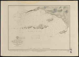
Central America, west coast of Costa Rica, Murcielago Bay : from a survey in 1885 by the officers of the U.S.S. Ranger,...
1518.
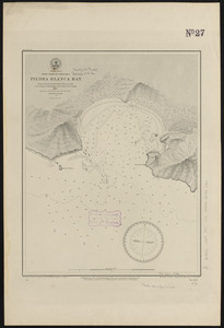
Central America, west coast of Costa Rica, Piedra Blanca Bay : from a survey in 1885 by the officers of the U.S.S. Ranger,...
1519.
Central America, west coast of Costa Rica, Port Culebra
1520.
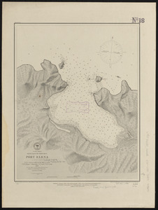
Central America, west coast of Costa Rica, Port Elena (Elena Bay) : from a survey in 1885 by the officers of the U.S.S. Ranger,...
‹ Prev
Next ›
1
2
…
72
73
74
75
76
77
78
79
80
…
431
432