Toggle navigation
LMEC Home
Exhibitions
Georeferencing
Tools for Teachers
Collections
My Favorites
Sign Up / Log In
Search
Search the map portal
Map Collection
Map Collection
Map Sets
Search
Search
Search for
Search In
All Fields
Creator
Title
Subject
Place
Search All Digital Collections
Advanced Search
8658 Results
My Search
Start Over
More Like
commonwealth:6h446v657
Remove constraint More Like: commonwealth:6h446v657
Filter your Search
Place
North and Central America
5,953
United States
4,877
Massachusetts
2,091
Europe
1,359
Suffolk (county)
1,142
Boston
1,115
Canada
448
Asia
422
more
Place
»
Topic
Boston (Mass.)--Maps
598
United States--Maps
273
Real property--Massachusetts--Boston--Maps
252
Landowners--Massachusetts--Boston--Maps
169
Massachusetts--Maps
160
City planning--Massachusetts--Boston--Maps
132
North America--Maps--Early works to 1800
103
New England--Maps
99
more
Topic
»
Date
Date range begin
–
Date range end
Current results range from
1482
to
2023
View distribution
Creator
United States. Hydrographic Office
594
O.H. Bailey & Co
148
Boston Redevelopment Authority
134
Des Barres, Joseph F. W. (Joseph Frederick Wallet), 1722-1824
123
United States. Post Office Dept
120
Ptolemy, 2nd cent
100
Walling, Henry Francis, 1825-1888
94
Geological Survey (U.S.)
86
more
Creator
»
Format
Maps/Atlases
8,598
Manuscripts
215
Prints
56
Books
36
Objects/Artifacts
10
Drawings/Illustrations
9
Posters
4
Georeferenced
Yes
870
No
7,788
Collection
Norman B. Leventhal Map & Education Center Collection
8,552
Boston and New England Maps
2,274
Urban Maps
2,005
Maritime Charts and Atlases
1,081
American Revolutionary War-Era Maps
620
Boston Redevelopment Authority Collection
155
Massachusetts Real Estate Atlases
35
William L. Clements Library Collection
3
more
Collection
»
Available to use
No known restrictions
8,477
Creative Commons license
48
Search Constraints
Sort by relevance
relevance
title
date (asc)
date (desc)
Number of results to display per page
20 per page
10
per page
20
per page
50
per page
100
per page
View results as:
grid view
map view
Search Results
8641.
Yellow Sea, west coast of Korea, A-San Anchorage : from a Japanese government survey in 1879
8642.
Yellowstone National Park : from surveys made under the direction of F.V. Hayden and other authorities
8643.
Yellowstone National Park, Big Horn Mountains and adjacent territory
8644.
Yggdrasill, the mundane tree
8645.
Yosemite Valley
8646.
Yuenan renmin kang mei jiu guo xing shi tu
8647.
Zambales
8648.
Zeilan Insula
8649.
Železnička i brodarska karta Kraljevine Srba Hrvata i Slovenaca = Carte des chemins de fer et de naviation du Royaume des...
8650.
Zentral- und Südafrika
8651.
Zhongguo di zhi tu = General geological map of China : Peking-Tsinan Sheet
8652.
Ziron 1920 political map
8653.
Zone of the armies
8654.
Zoning districts, city of Boston
8655.
Zoning districts, city of Boston
8656.
Zoning districts, city of Boston
8657.
Zoning map of town-planning area of Tokyo - 1925
8658.
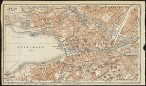
Zürich
‹ Prev
Next ›
1
2
…
429
430
431
432
433