Toggle navigation
LMEC Home
Exhibitions
Georeferencing
Tools for Teachers
Collections
My Favorites
Sign Up / Log In
Search
Search the map portal
Map Collection
Map Collection
Map Sets
Search
Search
Search for
Search In
All Fields
Creator
Title
Subject
Place
Search All Digital Collections
Advanced Search
8777 Results
My Search
Start Over
More Like
commonwealth:6h446v194
Remove constraint More Like: commonwealth:6h446v194
Filter your Search
Place
North and Central America
6,008
United States
4,925
Massachusetts
2,090
Europe
1,396
Suffolk (county)
1,127
Boston
1,100
Canada
449
Asia
438
more
Place
»
Topic
Boston (Mass.)--Maps
607
United States--Maps
282
Real property--Massachusetts--Boston--Maps
254
Landowners--Massachusetts--Boston--Maps
170
Massachusetts--Maps
163
City planning--Massachusetts--Boston--Maps
110
North America--Maps--Early works to 1800
103
New England--Maps
102
more
Topic
»
Date
Date range begin
–
Date range end
Current results range from
1482
to
2023
View distribution
Creator
United States. Hydrographic Office
595
O.H. Bailey & Co
148
Des Barres, Joseph F. W. (Joseph Frederick Wallet), 1722-1824
123
United States. Post Office Dept
120
Boston Redevelopment Authority
111
Ptolemy, 2nd cent
100
Walling, Henry Francis, 1825-1888
94
Geological Survey (U.S.)
87
more
Creator
»
Format
Maps/Atlases
8,717
Manuscripts
215
Prints
56
Books
36
Objects/Artifacts
10
Drawings/Illustrations
8
Posters
5
Georeferenced
Yes
869
No
7,908
Collection
Norman B. Leventhal Map & Education Center Collection
8,696
Boston and New England Maps
2,279
Urban Maps
2,069
Maritime Charts and Atlases
1,083
American Revolutionary War-Era Maps
616
Boston Redevelopment Authority Collection
132
Massachusetts Real Estate Atlases
36
Applied Geographics, Inc. Records
1
Available to use
No known restrictions
8,599
Creative Commons license
47
Search Constraints
Sort by relevance
relevance
title
date (asc)
date (desc)
Number of results to display per page
20 per page
10
per page
20
per page
50
per page
100
per page
View results as:
grid view
map view
Search Results
2381.
Environs of Boston, from Corey's Hill, Brookline, Mass
2382.
Environs of Dartmoor : compiled for the autumn manœuvers (south division), showing the various encampments, and divided into...
2383.
The environs of Dublin
2384.
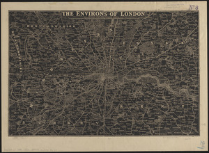
The environs of London : reduced from the Ordnance Survey
2385.
[Environs of Philadelphia]
2386.
E.P. Dutton & Co.'s railroad, steam boat & stage route map of New England, New-York and Canada
2387.
Episcopatus Dunelmensis vulgo The Bishoprike of Durham
2388.
An epitome of Sr. William Petty's large survey of Ireland divided into its 4 provinces & 32 counties ... and bridges
2389.
Erez Israel = Erets Yiśraʼel : adamah ʻIvrit
2390.
Erie Harbor
2391.
Eslam or the countries which have professed the faith of Mahomet
2392.
Essex
2393.
Essex
2394.
Essex actually surveyed with the several Roads from London &c
2395.
Essex County
2396.
Essex County, Massachusetts
2397.
Essex, Mass., Conomo & Falls Village
2398.
Essexiae descriptio = The description of Essex
2399.
The estate of the Brookline Land Company : June 20, 1860
2400.
États Unis
‹ Prev
Next ›
1
2
…
116
117
118
119
120
121
122
123
124
…
438
439

![[Environs of Philadelphia]](https://bpldcassets.blob.core.windows.net/derivatives/images/commonwealth:7h149x76d/image_thumbnail_300.jpg)