Toggle navigation
LMEC Home
Exhibitions
Georeferencing
Tools for Teachers
Collections
My Favorites
Sign Up / Log In
Search
Search the map portal
Map Collection
Map Collection
Map Sets
Search
Search
Search for
Search In
All Fields
Creator
Title
Subject
Place
Search All Digital Collections
Advanced Search
8702 Results
My Search
Start Over
More Like
commonwealth:6h446s68n
Remove constraint More Like: commonwealth:6h446s68n
Filter your Search
Place
North and Central America
5,933
United States
4,851
Massachusetts
2,078
Europe
1,396
Suffolk (county)
1,053
Boston
1,026
Canada
449
Asia
438
more
Place
»
Topic
Boston (Mass.)--Maps
586
United States--Maps
282
Real property--Massachusetts--Boston--Maps
180
Massachusetts--Maps
162
Landowners--Massachusetts--Boston--Maps
138
North America--Maps--Early works to 1800
103
New England--Maps
102
Europe--Maps
79
more
Topic
»
Date
Date range begin
–
Date range end
Current results range from
1482
to
2023
View distribution
Creator
United States. Hydrographic Office
595
O.H. Bailey & Co
148
Des Barres, Joseph F. W. (Joseph Frederick Wallet), 1722-1824
123
United States. Post Office Dept
120
Ptolemy, 2nd cent
100
Walling, Henry Francis, 1825-1888
94
Geological Survey (U.S.)
86
Jefferys, Thomas, -1771
85
more
Creator
»
Format
Maps/Atlases
8,642
Manuscripts
215
Prints
56
Books
36
Objects/Artifacts
10
Drawings/Illustrations
8
Posters
5
Georeferenced
Yes
869
No
7,833
Collection
Norman B. Leventhal Map & Education Center Collection
8,694
Boston and New England Maps
2,235
Urban Maps
2,026
Maritime Charts and Atlases
1,083
American Revolutionary War-Era Maps
615
Boston Redevelopment Authority Collection
90
Massachusetts Real Estate Atlases
5
Available to use
No known restrictions
8,555
Creative Commons license
47
Search Constraints
Sort by relevance
relevance
title
date (asc)
date (desc)
Number of results to display per page
20 per page
10
per page
20
per page
50
per page
100
per page
View results as:
grid view
map view
Search Results
1.
Allston-Brighton open space plan site inventory
2.
Atlas of Dorchester, West Roxbury and Brighton, city of Boston
3.
Atlas of Suffolk, county, vol. 7th, late town of Brighton, now ward 19 of Boston, Massachusetts : from actual survey & official...
4.
Atlas of the city of Boston : Brighton : from actual surveys and official plans
5.
Atlas of the city of Boston : volume 7: Brighton : from actual surveys and official plans
6.
Atlas of the city of Boston : ward 25, Brighton : from actual surveys and official plans
7.
Atlas of the city of Boston : wards 25 & 26, Brighton : from actual surveys and official plans
8.
Atlas of the city of Boston, volume seven, Brighton, Mass. : from actual surveys and official plans
9.
Brighton and Allston urban design strategy
10.
Topographic map of Brighton and Allston
11.
North Harvard project area : location map
12.
Allston Park, Boston, Mass
13.
Atlas of the city of Boston : Charlestown and Brighton, volume six : from actual surveys and official records
14.
Brighton park : Brighton district
15.
Map of Brookline and vicinity
16.
Plan of 82 building lots, in the town of Brighton, comprising 48 acres of the Parkman Farm next the estate of Saml. Bigelow...
17.
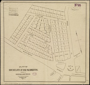
Plan of house lots at Oak Sq. Brighton : belonging to Oak Sq. Land Trust
18.
Plan of house lots in the village of Brighton : upon a part of the well known Winship Estate ... to be sold by public auction...
19.
Plan of the town of Brighton
20.
North Harvard project area : land use of project area
‹ Prev
Next ›
1
2
3
4
5
…
435
436