Toggle navigation
LMEC Home
Exhibitions
Georeferencing
Tools for Teachers
Collections
My Favorites
Sign Up / Log In
Search
Search the map portal
Map Collection
Map Collection
Map Sets
Search
Search
Search for
Search In
All Fields
Creator
Title
Subject
Place
Search All Digital Collections
Advanced Search
8699 Results
My Search
Start Over
More Like
commonwealth:5q47zt322
Remove constraint More Like: commonwealth:5q47zt322
Filter your Search
Place
North and Central America
5,930
United States
4,848
Massachusetts
2,079
Europe
1,396
Suffolk (county)
1,046
Boston
1,019
Canada
449
Asia
438
more
Place
»
Topic
Boston (Mass.)--Maps
586
United States--Maps
282
Real property--Massachusetts--Boston--Maps
175
Massachusetts--Maps
162
Landowners--Massachusetts--Boston--Maps
133
North America--Maps--Early works to 1800
103
New England--Maps
102
Europe--Maps
79
more
Topic
»
Date
Date range begin
–
Date range end
Current results range from
1482
to
2023
View distribution
Creator
United States. Hydrographic Office
595
O.H. Bailey & Co
148
Des Barres, Joseph F. W. (Joseph Frederick Wallet), 1722-1824
123
United States. Post Office Dept
120
Ptolemy, 2nd cent
100
Walling, Henry Francis, 1825-1888
94
Geological Survey (U.S.)
86
Jefferys, Thomas, -1771
85
more
Creator
»
Format
Maps/Atlases
8,639
Manuscripts
216
Prints
56
Books
36
Objects/Artifacts
10
Drawings/Illustrations
8
Posters
5
Georeferenced
Yes
869
No
7,830
Collection
Norman B. Leventhal Map & Education Center Collection
8,694
Boston and New England Maps
2,233
Urban Maps
2,022
Maritime Charts and Atlases
1,084
American Revolutionary War-Era Maps
620
Boston Redevelopment Authority Collection
87
William L. Clements Library Collection
2
Library of Congress Collection
1
more
Collection
»
Available to use
No known restrictions
8,552
Creative Commons license
49
Search Constraints
Sort by relevance
relevance
title
date (asc)
date (desc)
Number of results to display per page
20 per page
10
per page
20
per page
50
per page
100
per page
View results as:
grid view
map view
Search Results
5381.
North America, Newfoundland, Despair Bay, Great Jervis Harbor : from a British survey in 1884-5
5382.
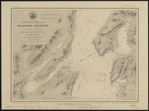
North America, Newfoundland, Fortune Bay, Harbor Breton from a British survey in 1882
5383.
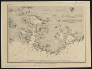
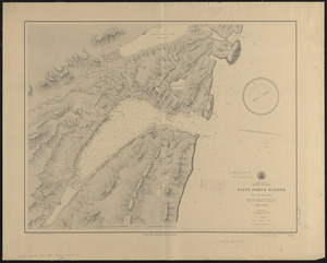
North America, Newfoundland, Hermitage Bay, Gaultois and Picarre Harbors : from a British survey in 1883
5384.
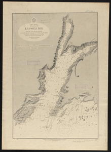
North America, Newfoundland, La Poile Bay : from the latest British surveys
5385.
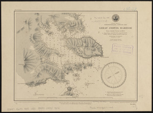
North America, Newfoundland, Saint John's Harbor : from a British survey in 1885
5386.
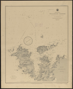
North America, Newfoundland, Twillingate Harbors (Toulinguet Harbors) : from a British survey in 1877
5387.
North America, north east coast of Newfoundland, Cape Onion to Hare Bay
5388.
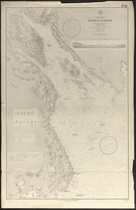
North America, Nova Scotia, Halifax Harbor : from the latest British surveys
5389.
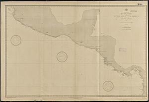
North America, Pacific coast of Mexico and Central America, San Blas to Panama : compiled from the latest British and United...
5390.
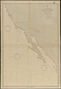
North America, Pacific coast of the United States and Mexico, San Francisco to San Blas : compiled from the latest United...
5391.
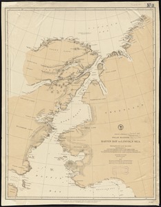
North America polar regions : Baffin Bay to Lincoln Sea, showing the most recent discoveries including those of U.S.S. Polaris...
5392.
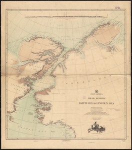
North America, polar regions, Baffin Bay to Lincoln Sea : showing the recent discoveries by civil engineer R.E. Peary, U.S.N.,...
5393.
North America, River St. Lawrence above Quebec
5394.
North America, River St. Lawrence above Quebec
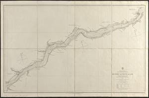
5395.
North America, River St. Lawrence, Montreal Harbour
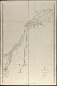
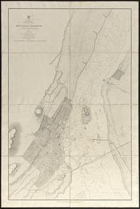
5396.
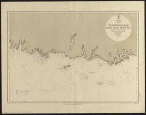
North America, south coast of Newfoundland : Devil Bay to Knife Bay : from a British survey in 1872 & 1873 ; republication of...
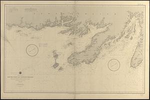
5397.
North America, south coast of Newfoundland from the Burgeo Islands to Cape St. Mary : compiled from the latest information
5398.
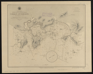
North America, south coast of Newfoundland, Lamalin anchorages : from a British survey in 1884
5399.
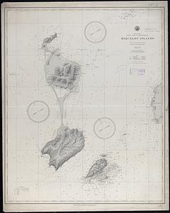
North America, south coast of Newfoundland, Miquelon Islands : from a French survey in 1841
5400.
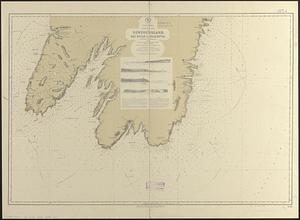
North America, south east coast of Newfoundland, Bay Bulls to Placentia
‹ Prev
Next ›
1
2
…
266
267
268
269
270
271
272
273
274
…
434
435