Toggle navigation
LMEC Home
Exhibitions
Georeferencing
Tools for Teachers
Collections
My Favorites
Sign Up / Log In
Search
Search the map portal
Map Collection
Map Collection
Map Sets
Search
Search
Search for
Search In
All Fields
Creator
Title
Subject
Place
Search All Digital Collections
Advanced Search
254 Results
My Search
Start Over
More Like
commonwealth:4t64hr30t
Remove constraint More Like: commonwealth:4t64hr30t
Filter your Search
Place
North America
227
North and Central America
198
United States
39
Canada
19
South America
8
New England
7
West Indies
6
Asia
5
more
Place
»
Topic
North America--Maps--Early works to 1800
240
Great Britain--Colonies--America--Maps--Early works to 1800
18
United States--Maps--Early works to 1800
13
Canada--Maps--Early works to 1800
12
British--America--Maps--Early works to 1800
9
South America--Maps--Early works to 1800
8
West Indies--Maps--Early works to 1800
8
France--Colonies--America--Maps--Early works to 1800
6
more
Topic
»
Date
Date range begin
–
Date range end
Current results range from
1528
to
1850
View distribution
Creator
Mitchell, John, 1711-1768
17
Sayer, Robert, 1725-1794
15
Gibson, J. (John), active 1750-1792
14
Jefferys, Thomas, -1771
13
Bowen, Emanuel, 1693 or 1694-1767
11
Moll, Herman, d. 1732
11
Anville, Jean Baptiste Bourguignon d', 1697-1782
10
Palairet, Jean, 1697-1774
8
more
Creator
»
Format
Maps/Atlases
254
Manuscripts
4
Georeferenced
Yes
5
No
249
Collection
American Revolutionary War-Era Maps
190
Norman B. Leventhal Map & Education Center Collection
113
MacLean Collection Map Library
59
New York Public Library Collection
32
Richard H. Brown Revolutionary War Map Collection at Mount Vernon
18
Boston Athenaeum, Cartographic Collection
15
Mapping Boston Collection
10
Sidney R. Knafel Map Collection at Phillips Academy
8
more
Collection
»
Available to use
No known restrictions
107
Creative Commons license
73
Search Constraints
Sort by relevance
relevance
title
date (asc)
date (desc)
Number of results to display per page
20 per page
10
per page
20
per page
50
per page
100
per page
View results as:
grid view
map view
Search Results
221.
North America from the French of Mr. D'Anville, improved with the back settlements of Virginia and course of Ohio, illustrated...
222.
North America from the French of Mr. D'Anville, improved with the back settlements of Virginia and course of Ohio, illustrated...
223.
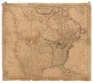
North America with the new discoveries
224.
The north part of America : conteyning Newfoundland, new England, Virginia, Florida, new Spaine, and Noua Francia wth ye rich...
225.
The north part of America : conteyning Newfoundland, new England, Virginia, Florida, new Spaine, and Noua Francia wth ye rich...
226.
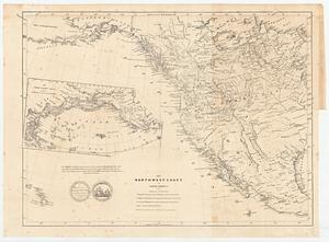
The north-west-coast of North America and adjacent territories
227.
Norumbega et Virginia
228.
Noua Anglia, Nouum Belgium, et Virginia
229.
Noua et accurata totius Americae tabula
230.
Le Nouveau Mexique et la Floride : tirées de diverses cartes, et relations
231.
Nova mappa geographica America Septentrionalis in suas praecipuas partes divisa = Amerique Septentrionale suivent [sic] la...
232.
Nova tabula geographica complectens borealiorem Americae partem : in qua exacte delineatae sunt Canada sive Nova Francia, Nova...
233.
Nova tabula geographica complectens borealiorem Americae partem : in qua exacte delineatae sunt Canada sive Nova Francia, Nova...
234.
Nova tabula geographica complectens borealiorem Americæ partem : in qua exacte delineatæ sunt Canada sive Nova Francia, Nova...
235.
Nova tabula geographica complectens borealiorem Americæ partem : in qua exacte delineatæ sunt Canada sive Nova Francia, Nova...
236.
Novissima et accuratissima totius Americae descriptio
237.
La Nuoua Francia
238.
Nuove scoperte de' russi al nord del mare del sud si nell' Asia, che nell America
239.
Il paese de' selvagi Outagamiani, Mascoutensi Illinesi e parte delle VI. Nazioni
240.
Partie de l'Amerique Septentrionale, qui comprend le Canada, la Louisiane, le Labrador, le Groenland, la Nouvelle Angleterre,...
‹ Prev
Next ›
1
2
…
8
9
10
11
12
13