Toggle navigation
LMEC Home
Exhibitions
Georeferencing
Tools for Teachers
Collections
My Favorites
Sign Up / Log In
Search
Search the map portal
Map Collection
Map Collection
Map Sets
Search
Search
Search for
Search In
All Fields
Creator
Title
Subject
Place
Search All Digital Collections
Advanced Search
254 Results
My Search
Start Over
More Like
commonwealth:4t64hr30t
Remove constraint More Like: commonwealth:4t64hr30t
Filter your Search
Place
North America
227
North and Central America
198
United States
39
Canada
19
South America
8
New England
7
West Indies
6
Asia
5
more
Place
»
Topic
North America--Maps--Early works to 1800
240
Great Britain--Colonies--America--Maps--Early works to 1800
18
United States--Maps--Early works to 1800
13
Canada--Maps--Early works to 1800
12
British--America--Maps--Early works to 1800
9
South America--Maps--Early works to 1800
8
West Indies--Maps--Early works to 1800
8
France--Colonies--America--Maps--Early works to 1800
6
more
Topic
»
Date
Date range begin
–
Date range end
Current results range from
1528
to
1850
View distribution
Creator
Mitchell, John, 1711-1768
17
Sayer, Robert, 1725-1794
15
Gibson, J. (John), active 1750-1792
14
Jefferys, Thomas, -1771
13
Bowen, Emanuel, 1693 or 1694-1767
11
Moll, Herman, d. 1732
11
Anville, Jean Baptiste Bourguignon d', 1697-1782
10
Palairet, Jean, 1697-1774
8
more
Creator
»
Format
Maps/Atlases
254
Manuscripts
4
Georeferenced
Yes
5
No
249
Collection
American Revolutionary War-Era Maps
190
Norman B. Leventhal Map & Education Center Collection
113
MacLean Collection Map Library
59
New York Public Library Collection
32
Richard H. Brown Revolutionary War Map Collection at Mount Vernon
18
Boston Athenaeum, Cartographic Collection
15
Mapping Boston Collection
10
Sidney R. Knafel Map Collection at Phillips Academy
8
more
Collection
»
Available to use
No known restrictions
107
Creative Commons license
73
Search Constraints
Sort by relevance
relevance
title
date (asc)
date (desc)
Number of results to display per page
20 per page
10
per page
20
per page
50
per page
100
per page
View results as:
grid view
map view
Search Results
1.
An accurate map of North America : Describing and distinguishing the British and Spanish dominions of this great continent;...
2.
Amérique septentrionale avec les routes, distances en miles, limites et etablissements françois et anglois
3.
A general map of the middle British colonies in America : Viz. Virginia, Maryland, Delaware, Pensilvania, New-Jersey, New-York,...
4.
A map of the British and French dominions in North America : with the roads, distances, limits, and extent of the settlements,...
5.
A map of the British and French dominions in North America : with the roads, distances, limits, and extent of the settlements,...
6.
A Map of the British and French settlements in North America
7.
A Map of the British and French settlements in North America
8.
A map of the British colonies in North America : with the roads, distances, limits, and extent of the settlements, humbly...
9.
A map of the British colonies in North America : with the roads, distances, limits, and extent of the settlements, humbly...
10.
Carte d'une partie de l'Amérique Septentrionale
11.
Carte de la Nouvelle Angleterre, Nouvelle Yorck, et Pensilvanie : pour servir à l'Histoire générale des voyages
12.
Carte du havre de Chibucto avec le plan de la ville de Halifax sur la coste de l'Accadia ou Nova Scotia latitude 44° 31ʹ
13.
A chart of the Atlantic Ocean : its islands and the adjacent continents: In which the British Dominions in Europe and America,...
14.
A chart of the Banks of Newfoundland
15.
Map for the interior travels through America : delineating the march of the army
16.
Map of part of the continent of North America : whereon is laid down the Missouri, Jeffersons, Lewis's, Clarks, and the...
17.
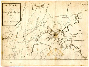
Map of the seat of the late war at Boston in the state of Massachusetts
18.
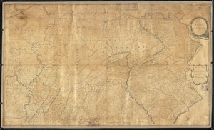
A map of the state of Pennsylvania
19.
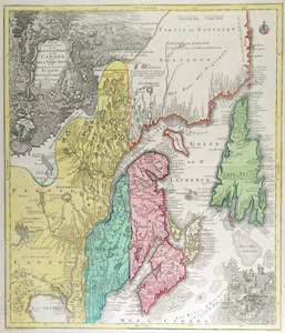
Partie orientale de la Nouvelle France ou du Canada : avec l'isle de Terre-Neuve et de Nouvelle Escosse, Acadie et Nouv....
20.
Plan de Boston : cette ville est composée de quatre mille maisons, et d'environ vingt mille habitans, on compte par an jusqu'a...
‹ Prev
Next ›
1
2
3
4
5
…
12
13