Toggle navigation
LMEC Home
Exhibitions
Georeferencing
Tools for Teachers
Collections
My Favorites
Sign Up / Log In
Search
Search the map portal
Map Collection
Map Collection
Map Sets
Search
Search
Search for
Search In
All Fields
Creator
Title
Subject
Place
Search All Digital Collections
Advanced Search
8712 Results
My Search
Start Over
More Like
commonwealth:4m90fh92c
Remove constraint More Like: commonwealth:4m90fh92c
Filter your Search
Place
North and Central America
6,003
United States
4,851
Massachusetts
2,053
Europe
1,359
Suffolk (county)
1,034
Boston
1,007
Canada
544
Asia
422
more
Place
»
Topic
Boston (Mass.)--Maps
577
United States--Maps
275
Real property--Massachusetts--Boston--Maps
174
Massachusetts--Maps
161
United States--History--French and Indian War, 1754-1763--Maps
161
Landowners--Massachusetts--Boston--Maps
132
North America--Maps--Early works to 1800
103
New England--Maps
101
more
Topic
»
Date
Date range begin
–
Date range end
Current results range from
1482
to
2023
View distribution
Creator
United States. Hydrographic Office
594
O.H. Bailey & Co
148
Des Barres, Joseph F. W. (Joseph Frederick Wallet), 1722-1824
123
United States. Post Office Dept
120
Ptolemy, 2nd cent
100
Jefferys, Thomas, -1771
99
Walling, Henry Francis, 1825-1888
94
Geological Survey (U.S.)
86
more
Creator
»
Format
Maps/Atlases
8,652
Manuscripts
216
Prints
57
Books
36
Objects/Artifacts
10
Drawings/Illustrations
8
Posters
4
Georeferenced
Yes
869
No
7,843
Collection
Norman B. Leventhal Map & Education Center Collection
8,549
Boston and New England Maps
2,204
Urban Maps
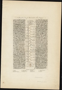
1,936
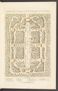
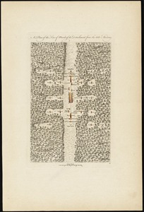
Maritime Charts and Atlases
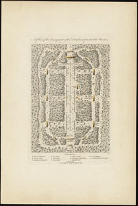
1,081
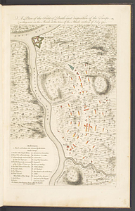
American Revolutionary War-Era Maps
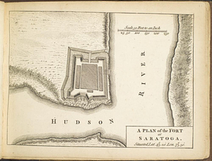
779
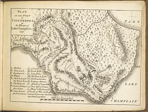
William L. Clements Library Collection
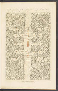
149
Boston Redevelopment Authority Collection
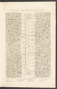
87
American Antiquarian Society Collection
9
more
Collection
»
Available to use
No known restrictions
8,409
Creative Commons license
50
Search Constraints
Sort by relevance
relevance
title
date (asc)
date (desc)
Number of results to display per page
20 per page
10
per page
20
per page
50
per page
100
per page
View results as:
grid view
map view
Search Results
121.
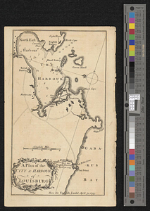
A plan of the city & harbor of Louisburg
122.
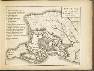
Plan of the city and fortress of Louisbourg, with the attacks
123.
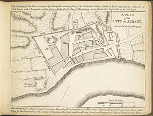
A plan of the city of Albany situated lat. 42, 30" long. 74
124.
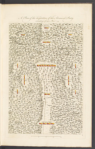
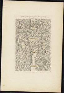
A plan of the disposition of the advanced party, consisting of 400 men
125.
A plan of the disposition of the advanced party consisting of 400 men : to defend the workers in making the road
126.
Plan of the encampment, intrenchment with theier [sic] environs at Lake George
127.
A plan of the encampment of the detachment from the Little Meadows
128.
A plan of the encampment of the detachment from the little Meadows
129.
A plan of the field of battle and disposition of the troops, as they were on the march at the time of the attack on the 9th of...
130.
A plan of the fort at Saratoga : situated lat. 43 20' lon. 73 30'
131.
Plan of the fort at Tienderoga at the head of Lake Champlain, 1758
132.
A plan of the line of march of the detachment from the Little Meadows
133.
A plan of the line of march of the detachment from the little Meadows
134.
A plan of the line of march with the whole baggage
135.
A plan of the line of march with the whole baggage
136.
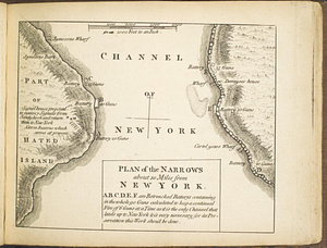
Plan of the narrows about 10 miles from New York
137.
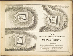
Plan of the new fort & redoubts, at Crown Point
138.
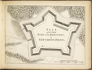
Plan of the new fort and redoubts, at New Crown Point
139.
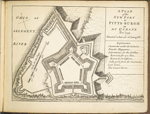
A plan of the new fort at Pitts-Burgh or Du Quesne Novr. 1759 : situated in lat. 40 20' long. 80
140.
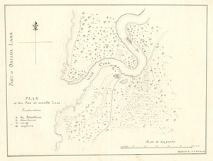
Plan of the post at Oneida Lake
‹ Prev
Next ›
1
2
3
4
5
6
7
8
9
10
11
…
435
436
![Plan of the encampment, intrenchment with theier [sic] environs at Lake George](https://bpldcassets.blob.core.windows.net/derivatives/metadata/commonwealth-oai:v9800134b/image_thumbnail_300.jpg)