Toggle navigation
LMEC Home
Exhibitions
Georeferencing
Tools for Teachers
Collections
My Favorites
Sign Up / Log In
Search
Search the map portal
Map Collection
Map Collection
Map Sets
Search
Search
Search for
Search In
All Fields
Creator
Title
Subject
Place
Search All Digital Collections
Advanced Search
8325 Results
My Search
Start Over
More Like
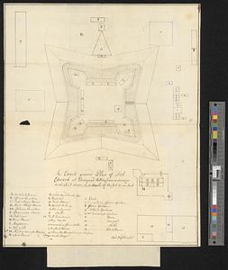
commonwealth:4m90fh92c
Remove constraint More Like: commonwealth:4m90fh92c
Filter your Search
Place
North and Central America
5,070
United States
3,684
Suffolk (county)
1,026
Boston
999
Europe
963
Canada
523
France
269
Massachusetts
250
more
Place
»
Topic
Boston (Mass.)--Maps
574
United States--Maps
272
Real property--Massachusetts--Boston--Maps
174
Massachusetts--Maps
161
United States--History--French and Indian War, 1754-1763--Maps
161
Landowners--Massachusetts--Boston--Maps
132
North America--Maps--Early works to 1800
103
New England--Maps
101
more
Topic
»
Date
Date range begin
–
Date range end
Current results range from
1482
to
2023
View distribution
Creator
United States. Hydrographic Office
357
O.H. Bailey & Co
148
Des Barres, Joseph F. W. (Joseph Frederick Wallet), 1722-1824
123
United States. Post Office Dept
120
Ptolemy, 2nd cent
100
Jefferys, Thomas, -1771
98
Walling, Henry Francis, 1825-1888
94
Geological Survey (U.S.)
82
more
Creator
»
Format
Maps/Atlases
8,265
Manuscripts
216
Prints
52
Books
36
Objects/Artifacts
10
Drawings/Illustrations
8
Posters
4
Georeferenced
Yes
869
No
7,456
Collection
Norman B. Leventhal Map Center Collection
8,162
Boston and New England Maps
2,184
Urban Maps
1,925
American Revolutionary War-Era Maps
779
Maritime Charts and Atlases
750
William L. Clements Library Collection
149
Boston Redevelopment Authority Collection
86
American Antiquarian Society Collection
9
more
Collection
»
Available to use
No known restrictions
8,022
Creative Commons license
50
Search Constraints
Sort by relevance
relevance
title
date (asc)
date (desc)
Number of results to display per page
20 per page
10
per page
20
per page
50
per page
100
per page
View results as:
grid view
map view
Search Results
21.
Continuation of the River Chaudière from where it falls into the St. Lawrence, as laid down in the lower plan, to the village...
22.
Continuation of the River Chaudière joining to A
23.
Continuation of the River Chaudière joining to B
24.
A correct plan of the environs of Quebec, and of the battle fought on the 13th September, 1759 : together with a particular...
25.
A draught of a route from Québec to Fort Halifax on the River Kennebec and back again to Québec by the rivers Chaudière and...
26.
Draught of the River Pittquioyack in the Bay of Fundy 1758
27.
Draught of the river St. Lawrence from Lake Ontario to Montreal
28.
An exact ground plan of Fort Edward at Pesaquid taken from a survey and laid down by a scale of 60 feet to one inch
29.
Fort Bedford
30.
Fort Edward to Ticonderoga
31.
Fort Halifax and the Kennebec River : Québec July 25th, 1761
32.
Fort William Henry
33.
French draught of Lake Champlain & Lake George with remarks of an English prisoner who return'd from Quebec to Fort Edward by...
34.
Gabarus Bay
35.
Ein grund-ris von der Festung Duquesne ...
36.
Hudson's River from New York to Albany
37.
Lake Champlain
38.
Lake Megantic and the Chaudière River : Québec July 25th, 1761
39.
Map from Albany to Crown Point
40.
A Map of that part of America which was the principal seat of war in 1756
‹ Prev
Next ›
1
2
3
4
5
6
…
416
417