Toggle navigation
LMEC Home
Exhibitions
Georeferencing
Tools for Teachers
Collections
My Favorites
Sign Up / Log In
Search
Search the map portal
Map Collection
Map Collection
Map Sets
Search
Search
Search for
Search In
All Fields
Creator
Title
Subject
Place
Search All Digital Collections
Advanced Search
8657 Results
My Search
Start Over
More Like
commonwealth:4m90f4770
Remove constraint More Like: commonwealth:4m90f4770
Filter your Search
Place
North and Central America
5,896
United States
4,815
Massachusetts
2,068
Europe
1,392
Suffolk (county)
1,041
Boston
1,014
Canada
449
Asia
437
more
Place
»
Topic
Boston (Mass.)--Maps
582
United States--Maps
279
Real property--Massachusetts--Boston--Maps
175
Massachusetts--Maps
161
Landowners--Massachusetts--Boston--Maps
133
North America--Maps--Early works to 1800
103
New England--Maps
101
Europe--Maps
79
more
Topic
»
Date
Date range begin
–
Date range end
Current results range from
1482
to
2023
View distribution
Creator
United States. Hydrographic Office
595
O.H. Bailey & Co
148
Des Barres, Joseph F. W. (Joseph Frederick Wallet), 1722-1824
123
United States. Post Office Dept
120
Ptolemy, 2nd cent
100
Walling, Henry Francis, 1825-1888
94
Geological Survey (U.S.)
86
Jefferys, Thomas, -1771
85
more
Creator
»
Format
Maps/Atlases
8,597
Manuscripts
215
Prints
56
Books
36
Objects/Artifacts
10
Drawings/Illustrations
8
Posters
5
Georeferenced
Yes
869
No
7,788
Collection
Norman B. Leventhal Map & Education Center Collection
8,646
Boston and New England Maps
2,221
Urban Maps
1,992
Maritime Charts and Atlases
1,083
American Revolutionary War-Era Maps
625
Boston Redevelopment Authority Collection
87
William L. Clements Library Collection
9
American Antiquarian Society Collection
1
more
Collection
»
Available to use
No known restrictions
8,504
Creative Commons license
47
Search Constraints
Sort by relevance
relevance
title
date (asc)
date (desc)
Number of results to display per page
20 per page
10
per page
20
per page
50
per page
100
per page
View results as:
grid view
map view
Search Results
1.
George Washington's map, accompanying his "journal to the Ohio", 1754
2.
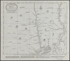
A map of some of the south and east bounds of Pennsylvania in America, being partly inhabited
3.
Carte générale des États-Unis de l'Amérique avec les plans des principales villes
4.
The city of New York as laid out by the Commissioners with the surrounding country
5.
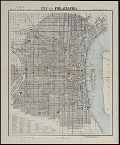
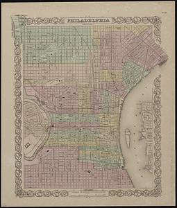
City of Philadelphia
6.
Cyclists' road map of the Philadelphia District
7.
A kite view of Philadelphia and the Sesqui Centennial International Exposition
8.
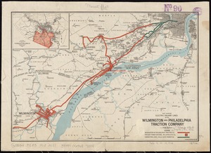
Map showing electric railway lines of the Wilmington and Philadelphia Traction Company
9.
The Matthews-Northrup up-to-date map of Philadelphia, Pennsylvania
10.
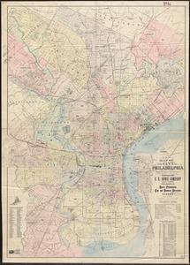
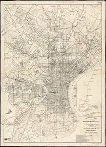
New map of the city of Philadelphia from the latest city surveys
11.
Official map of the Philadelphia Rapid Transit Co
12.
Philadelphia
13.
Philadelphia water front, Schuylkill River, Pennsylvania
14.
Scattergood's map of sixteen miles around Philadelphia
15.
The Seventh Ward of Philadelphia : the distribution of Negro inhabitants throughout the ward, and their social conditions
16.
Street map of Philadelphia : issued by the Philadelphia Hotel Association, Philadelphia, Pa.
17.
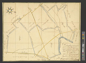
Draught of a tract of land situate in Bucks County, in the Commonwealth of Pennsylvania divided in three parts, called...
18.
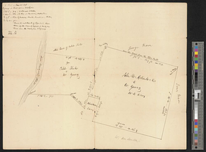
Map of land owned by W. Youngs estate on the Brandywine
19.
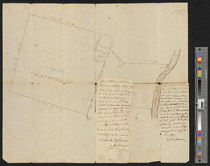
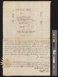
A plot of Wm Young's land including Delaware paper mill
20.
Block between Sixteenth and Seventeenth Streets and Chestnut and Market Streets, Philadelphia, 1771
‹ Prev
Next ›
1
2
3
4
5
…
432
433