Toggle navigation
LMEC Home
Exhibitions
Georeferencing
Tools for Teachers
Collections
My Favorites
Sign Up / Log In
Search
Search the map portal
Map Collection
Map Collection
Map Sets
Search
Search
Search for
Search In
All Fields
Creator
Title
Subject
Place
Search All Digital Collections
Advanced Search
459 Results
My Search
Start Over
More Like
commonwealth:4168f424k
Remove constraint More Like: commonwealth:4168f424k
Filter your Search
Place
North and Central America
386
United States
224
North America
146
Canada
63
New York
23
Pennsylvania
18
Asia
17
South Carolina
14
more
Place
»
Topic
North America--Maps
85
North America--Maps--Early works to 1800
59
United States--Maps--Early works to 1800
43
Canada--Maps--Early works to 1800
38
United States--Maps
20
Great Lakes Region (North America)--Maps--Early works to 1800
12
Pennsylvania--Maps--Early works to 1800
11
Northeastern States--Maps--Early works to 1800
9
more
Topic
»
Date
Date range begin
–
Date range end
Current results range from
1623
to
1999
View distribution
Creator
Jefferys, Thomas, -1771
19
Gibson, J. (John), active 1750-1792
17
Bellin, Jacques Nicolas, 1703-1772
16
Anville, Jean Baptiste Bourguignon d', 1697-1782
15
Faden, William, 1749-1836
15
Robert Sayer and John Bennett (Firm)
15
Carleton, Osgood, 1742-1816
13
Sayer, Robert, 1725-1794
11
more
Creator
»
Format
Maps/Atlases
457
Manuscripts
3
Paintings
3
Ephemera
1
Objects/Artifacts
1
Prints
1
Georeferenced
Yes
13
No
446
Collection
MacLean Collection Map Library
379
American Revolutionary War-Era Maps
368
Norman B. Leventhal Map & Education Center Collection
41
American Antiquarian Society Collection
17
William L. Clements Library Collection
12
New York Public Library Collection
9
Richard H. Brown Revolutionary War Map Collection at Mount Vernon
1
Available to use
No known restrictions
41
Creative Commons license
11
Search Constraints
Sort by relevance
relevance
title
date (asc)
date (desc)
Number of results to display per page
20 per page
10
per page
20
per page
50
per page
100
per page
View results as:
grid view
map view
Search Results
261.
A map of the most inhabited part of New England, containing the provinces of Massachusets Bay and New Hampshire, with the...
262.
A map of the most inhabited part of New England containing the provinces of Massachusets Bay and New Hampshire with the...
263.
A map of the most inhabited part of New England, containing the provinces of Massachusetts Bay and New Hampshire, with the...
264.
A map of the most inhabited part of Virginia containing the whole province of Maryland with part of Pensilvania, New Jersey and...
265.
A map of the most inhabited part of Virginia containing the whole province of Maryland with part of Pensilvania, New Jersey and...
266.
Map of the mouth of the Mississippi
267.
A map of the new northern archipelago discover'd by the Russians in the seas of Kamtschatka & Anadir
268.
A map of the north weft parts of the United States of America
269.
A map of the northern and middle states : comprehending the western territory and the British dominions in North America from...
270.
A map of the northern and middle states : comprehending the western territory and the British dominions in North America ;...
271.
A map of the northern and middle states : comprehending the western territory and the British dominions in North America, from...
272.
A map of the northern and middle states : comprehending the western territory and the British dominions in North America :...
273.
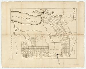
A map of the Oneida Reservation including the lands leased to Peter Smith
274.
A map of the province of New York, with part of Pensilvania, and New England
275.
A map of the province of South Carolina with all the rivers, creeks, bays, inletts, islands, inland navigation, soundings, time...
276.
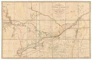
A map of the province of upper Canada, describing all the new settlements, townships, &c. with the countries adjacent, from...
277.
A map of the several dispositions of the English fleet & army on the river S.t Laurence, to the taking of Quebec
278.
Map of the southern parts of the United States of America
279.
Map of the southern states of America, comprehending Maryland, Virginia, Kentucky, territory sth. of Ohio, North Carolina,...
280.
A map of the state of New York
‹ Prev
Next ›
1
2
…
10
11
12
13
14
15
16
17
18
…
22
23