Toggle navigation
LMEC Home
Exhibitions
Georeferencing
Tools for Teachers
Collections
My Favorites
Sign Up / Log In
Search
Search the map portal
Map Collection
Map Collection
Map Sets
Search
Search
Search for
Search In
All Fields
Creator
Title
Subject
Place
Search All Digital Collections
Advanced Search
8550 Results
My Search
Start Over
More Like
commonwealth:3f463b04x
Remove constraint More Like: commonwealth:3f463b04x
Filter your Search
Place
North and Central America
5,846
United States
4,770
Massachusetts
2,052
Europe
1,358
Suffolk (county)
1,035
Boston
1,008
Canada
448
Asia
422
more
Place
»
Topic
Boston (Mass.)--Maps
578
United States--Maps
273
Real property--Massachusetts--Boston--Maps
174
Massachusetts--Maps
160
Landowners--Massachusetts--Boston--Maps
132
North America--Maps--Early works to 1800
103
New England--Maps
99
Europe--Maps
78
more
Topic
»
Date
Date range begin
–
Date range end
Current results range from
1482
to
2023
View distribution
Creator
United States. Hydrographic Office
594
O.H. Bailey & Co
148
Des Barres, Joseph F. W. (Joseph Frederick Wallet), 1722-1824
123
United States. Post Office Dept
120
Ptolemy, 2nd cent
100
Walling, Henry Francis, 1825-1888
94
Geological Survey (U.S.)
86
Jefferys, Thomas, -1771
85
more
Creator
»
Format
Maps/Atlases
8,491
Manuscripts
215
Prints
56
Books
36
Objects/Artifacts
10
Drawings/Illustrations
8
Posters
4
Georeferenced
Yes
869
No
7,681
Collection
Norman B. Leventhal Map & Education Center Collection
8,549
Boston and New England Maps
2,205
Urban Maps
1,937
Maritime Charts and Atlases
1,081
American Revolutionary War-Era Maps
616
Boston Redevelopment Authority Collection
88
Available to use
No known restrictions
8,409
Creative Commons license
46
Search Constraints
Sort by relevance
relevance
title
date (asc)
date (desc)
Number of results to display per page
20 per page
10
per page
20
per page
50
per page
100
per page
View results as:
grid view
map view
Search Results
6361.
A plan of the operations of the King's army under the command of General Sr. William Howe, K.B. in New York and east New Jersey...
6362.
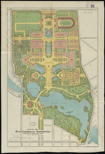
Plan of the Pan-American Exposition to be held at Buffalo, New York, May 1-Nov 1, 1901
6363.
Plan of the parkway between Muddy River gate house and Jamaica Park 1892
6364.
A plan of the Pitts Farm in Chelsea
6365.
Plan of the Pratt estate, corner of Summer & Hawley Streets : to be sold by pulic auction on Thursday April 10th 1855 at 12...
6366.
A plan of the property of the Hampton Normal and Agricultural Institute at Hampton Virginia
6367.
Plan of the proposed docks at South Boston
6368.
Plan of the receiving basin showing certain avenues and lines of release
6369.
A plan of the reduction of Manila and Cavita
6370.
A plan of the river and sound of D'Awfoskee in South Carolina
6371.
A plan of the rivers Scoodic and Magaguadavic with their principal branches including the Bay of Passamaquoddy and the adjacent...
6372.
A plan of the salt marsh and upland in Roxbury, lying the east side of the Mill Creek
6373.
Plan of the Siege of Yorktown, 1781
6374.
Plan of the South Cove
6375.
Plan of the South Open Ground, the Upper Plaisance, the Midway Plaisance, the Lake Open Ground, the Lagoon Plaisance and the...
6376.
Plan of the southern portion of the province of South Australia as divided into counties and hundreds, showing agricultural...
6377.
Plan of the state farm at Bridgewater, Plymouth County, Mass
6378.
[Plan of the State House grounds and the adjacent district]
6379.
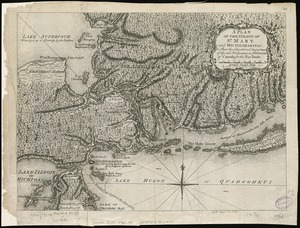
A plan of the Straits of St. Mary, and Michilimakinac, to shew the situation & importance of the two westernmost settlements of...
6380.
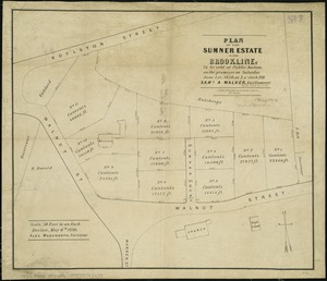
Plan of the Sumner Estate in Brookline : to be sold at public auction, on the premises on Saturday June 1st, 1850, at 3 o'clock...
‹ Prev
Next ›
1
2
…
315
316
317
318
319
320
321
322
323
…
427
428


![[Plan of the State House grounds and the adjacent district]](https://bpldcassets.blob.core.windows.net/derivatives/images/commonwealth:js956k629/image_thumbnail_300.jpg)