Toggle navigation
LMEC Home
Exhibitions
Georeferencing
Tools for Teachers
Collections
My Favorites
Sign Up / Log In
Search
Search the map portal
Map Collection
Map Collection
Map Sets
Search
Search
Search for
Search In
All Fields
Creator
Title
Subject
Place
Search All Digital Collections
Advanced Search
8889 Results
My Search
Start Over
More Like
commonwealth:3f4636930
Remove constraint More Like: commonwealth:3f4636930
Filter your Search
Place
North and Central America
6,120
United States
5,036
Massachusetts
2,135
Europe
1,396
Suffolk (county)
1,235
Boston
1,208
Canada
449
Asia
438
more
Place
»
Topic
Boston (Mass.)--Maps
752
United States--Maps
282
Real property--Massachusetts--Boston--Maps
223
Landowners--Massachusetts--Boston--Maps
169
Massachusetts--Maps
166
City planning--Massachusetts--Boston--Maps
159
New England--Maps
104
North America--Maps--Early works to 1800
103
more
Topic
»
Date
Date range begin
–
Date range end
Current results range from
1482
to
2023
View distribution
Creator
United States. Hydrographic Office
595
Boston Redevelopment Authority
163
O.H. Bailey & Co
148
Des Barres, Joseph F. W. (Joseph Frederick Wallet), 1722-1824
124
United States. Post Office Dept
120
Ptolemy, 2nd cent
100
Walling, Henry Francis, 1825-1888
94
Geological Survey (U.S.)
87
more
Creator
»
Format
Maps/Atlases
8,829
Manuscripts
215
Prints
56
Books
36
Objects/Artifacts
10
Drawings/Illustrations
8
Posters
5
Georeferenced
Yes
885
No
8,004
Collection
Norman B. Leventhal Map & Education Center Collection
8,723
Boston and New England Maps
2,359
Urban Maps
2,143
Maritime Charts and Atlases
1,083
American Revolutionary War-Era Maps
638
Boston Redevelopment Authority Collection
193
Massachusetts Real Estate Atlases
38
Mapping Boston Collection
20
more
Collection
»
Available to use
No known restrictions
8,666
Creative Commons license
70
Search Constraints
Sort by relevance
relevance
title
date (asc)
date (desc)
Number of results to display per page
20 per page
10
per page
20
per page
50
per page
100
per page
View results as:
grid view
map view
Search Results
6761.
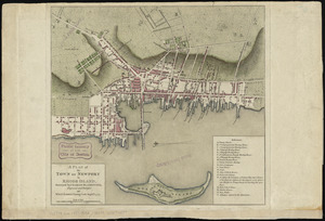
A plan of the town of Newport in Rhode Island
6762.
A plan of the town of Newport in the province of Rhode Island
6763.
A plan of the town of Newport in the province of Rhode Island
6764.
Plan of the town of Quebec, the capital of Canada in North America, with the Bason and a part of the adjacent country shewing...
6765.
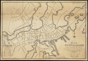
Plan of the town of Salem in the commonwealth of Massachusetts : from actual surveys, made in the years 1796 & 1804; with the...
6766.
A plan of the town of Walpole taken by an actual survey in the month of October 1794 and layed down from a scale of 200 rods to...
6767.
Plan of the town of West Roxbury : compiled from various plans and surveys, by order of the selectmen
6768.
Plan of the town, road, and harbour of Chagre ; Plan of Porto Belo
6769.
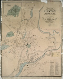
Plan of the towns of Clinton, Worcester Co. Mass : from recent surveys and records
6770.
Plan of the towns of Sturbridge and Southbridge : from actual surveys and records
6771.
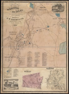
Plan of the towns of Webster and Dudley : from actual surveys and records
6772.
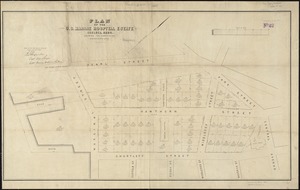
Plan of the U.S. Marine Hospital estate Chelsea, Mass : showing the subdivision into the buildings lots
6773.
A plan of the west parish or Newbury new town : taken Septs. 15, 1729
6774.
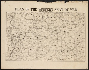
Plan of the western seat of war
6775.
Plan of the yard and buildings of the Manchester Print Works
6776.
[Plan of Tremont Street from Park to Boylston]
6777.
[Plan of Tremont Street, from West to Boylston]
6778.
Plan of Waquoit Bay in the town of Falmouth
6779.
A plan of West Springfield
6780.
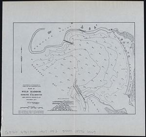
Plan of Wild Harbor at North Falmouth : under chapter 112 resolves of 1907
‹ Prev
Next ›
1
2
…
335
336
337
338
339
340
341
342
343
…
444
445


![[Plan of Tremont Street from Park to Boylston]](https://bpldcassets.blob.core.windows.net/derivatives/images/commonwealth:9s161b59r/image_thumbnail_300.jpg)
![[Plan of Tremont Street, from West to Boylston]](https://bpldcassets.blob.core.windows.net/derivatives/images/commonwealth:sn00b611k/image_thumbnail_300.jpg)