Toggle navigation
LMEC Home
Exhibitions
Georeferencing
Tools for Teachers
Collections
My Favorites
Sign Up / Log In
Search
Search the map portal
Map Collection
Map Collection
Map Sets
Search
Search
Search for
Search In
All Fields
Creator
Title
Subject
Place
Search All Digital Collections
Advanced Search
8705 Results
My Search
Start Over
More Like
commonwealth:3f4635607
Remove constraint More Like: commonwealth:3f4635607
Filter your Search
Place
North and Central America
5,936
United States
4,849
Massachusetts
2,080
Europe
1,396
Suffolk (county)
1,046
Boston
1,019
Canada
451
Asia
438
more
Place
»
Topic
Boston (Mass.)--Maps
586
United States--Maps
282
Real property--Massachusetts--Boston--Maps
175
Massachusetts--Maps
164
Landowners--Massachusetts--Boston--Maps
133
New England--Maps
105
North America--Maps--Early works to 1800
103
Europe--Maps
79
more
Topic
»
Date
Date range begin
–
Date range end
Current results range from
1482
to
2023
View distribution
Creator
United States. Hydrographic Office
595
O.H. Bailey & Co
148
Des Barres, Joseph F. W. (Joseph Frederick Wallet), 1722-1824
123
United States. Post Office Dept
120
Ptolemy, 2nd cent
100
Walling, Henry Francis, 1825-1888
94
Geological Survey (U.S.)
86
Jefferys, Thomas, -1771
85
more
Creator
»
Format
Maps/Atlases
8,645
Manuscripts
215
Prints
56
Books
36
Objects/Artifacts
10
Drawings/Illustrations
8
Posters
5
Georeferenced
Yes
869
No
7,836
Collection
Norman B. Leventhal Map & Education Center Collection
8,695
Boston and New England Maps
2,233
Urban Maps
2,023
Maritime Charts and Atlases
1,083
American Revolutionary War-Era Maps
625
Boston Redevelopment Authority Collection
87
American Antiquarian Society Collection
5
William L. Clements Library Collection
3
more
Collection
»
Available to use
No known restrictions
8,553
Creative Commons license
48
Search Constraints
Sort by relevance
relevance
title
date (asc)
date (desc)
Number of results to display per page
20 per page
10
per page
20
per page
50
per page
100
per page
View results as:
grid view
map view
Search Results
2381.
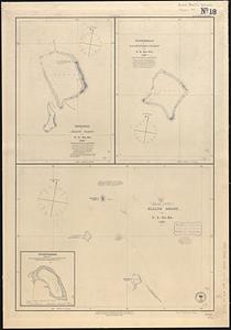
Funafuti or Ellice Island ; Nukufetau or De Peysters Island ; Ellice Group ; Nukulailai (Mitchell I.) from a sketch by Captain...
2382.
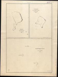
Funafuti or Ellices Island ; Nukufetau or De Peysters Island ; De Peysters Group
2383.
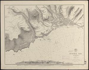
Funchal Bay, Madeira : from a British survey, corrected to 1871
2384.
G. Freytags völker- und sprachenkarte von Österreich-Ungarn
2385.
G. Woolworth Colton's new guide map of the United States & Canada : with railroads, counties etc
2386.
G. Woolworth Colton's railroad, township & distance map of New England : with adjacent portions of New York, Canada & New...
2387.
G. Woolworth Colton's railroad, township & distance map of New England with adjacent portions of New York, Canada & New Brunswick
2388.
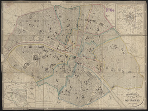
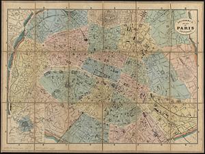
Galignani's plan of Paris and environs
2389.
Galignani's plan of Paris and environs
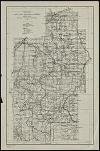
2390.
Gallatin National Forest, Montana
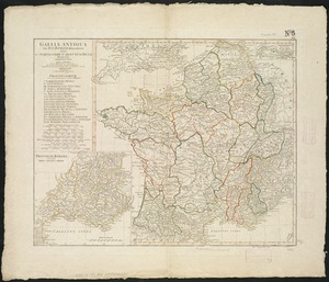
2391.
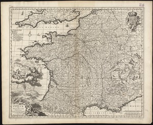
Gallia Antiqua ex Aevi Romani monumentis eruta et serenissimi Carnutum Ducis munificientia publicijuris facta
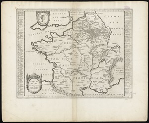
2392.
Gallia vetus : ad Iul Caesaris commentaria ex conatibus geographicis
2393.
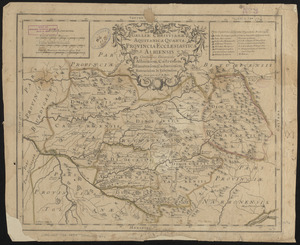
Galliae Christianae Aquitanica quarta : Provincia ecclesiastica albiensis continens dioceses Albiensem, Castrensem, Mimatensem,...
2394.
Galliae seu Franciae tabula, qua omnes provinciae, via angiariae, et aliae res notatu dignae distincte et accurate ostendatur
2395.
Gallup's map of Louisiana
2396.
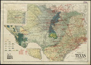
Gallup's map of Texas
2397.
The game of American story and glory : [cards]
2398.
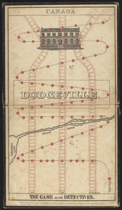
The game of the detectives
2399.
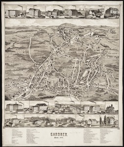
Gardner, Mass., 1880
2400.
Gardner's or Kemins Island, Phœnix Group ; Flint's Island ; McKeans Island, Phœnix Group ; Maro Reef ; Lahaina Roads, Island of...
‹ Prev
Next ›
1
2
…
116
117
118
119
120
121
122
123
124
…
435
436