Toggle navigation
LMEC Home
Exhibitions
Georeferencing
Tools for Teachers
Collections
My Favorites
Sign Up / Log In
Search
Search the map portal
Map Collection
Map Collection
Map Sets
Search
Search
Search for
Search In
All Fields
Creator
Title
Subject
Place
Search All Digital Collections
Advanced Search
8699 Results
My Search
Start Over
More Like
commonwealth:3f4630542
Remove constraint More Like: commonwealth:3f4630542
Filter your Search
Place
North and Central America
5,926
United States
4,844
Massachusetts
2,079
Europe
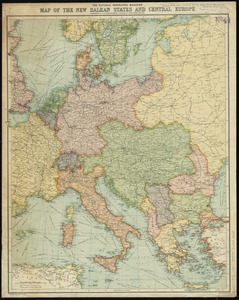
1,395
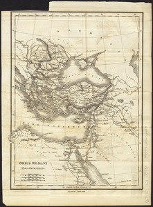
Suffolk (county)
1,046
Boston
1,019
Canada
449
Asia
438
more
Place
»
Topic
Boston (Mass.)--Maps
586
United States--Maps
282
Real property--Massachusetts--Boston--Maps
175
Massachusetts--Maps
162
Landowners--Massachusetts--Boston--Maps
133
North America--Maps--Early works to 1800
103
New England--Maps
102
Europe--Maps
79
more
Topic
»
Date
Date range begin
–
Date range end
Current results range from
1482
to
2023
View distribution
Creator
United States. Hydrographic Office
595
O.H. Bailey & Co
148
Des Barres, Joseph F. W. (Joseph Frederick Wallet), 1722-1824
123
United States. Post Office Dept
120
Ptolemy, 2nd cent
100
Walling, Henry Francis, 1825-1888
94
Geological Survey (U.S.)
86
Jefferys, Thomas, -1771
85
more
Creator
»
Format
Maps/Atlases
8,639
Manuscripts
215
Prints
56
Books
36
Objects/Artifacts
10
Drawings/Illustrations
8
Posters
5
Georeferenced
Yes
874
No
7,825
Collection
Norman B. Leventhal Map & Education Center Collection
8,699
Boston and New England Maps
2,233
Urban Maps
2,023
Maritime Charts and Atlases
1,083
American Revolutionary War-Era Maps
616
Boston Redevelopment Authority Collection
87
Available to use
No known restrictions
8,557
Creative Commons license
47
Search Constraints
Sort by relevance
relevance
title
date (asc)
date (desc)
Number of results to display per page
20 per page
10
per page
20
per page
50
per page
100
per page
View results as:
grid view
map view
Search Results
21.
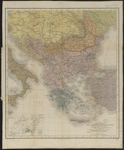
The Balkans
22.
The Balkans
23.
Block diagram showing terrain of the Balkan Peninsula
24.
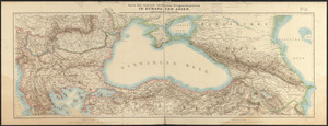
Caucasus, Central Asia and Turkey
25.
The cross and the crescent--Harper's pictorial map of the seat of the war in the east
26.
The Daily Telegraph war map no. 10
27.
The Daily telegraph war map no. 18
28.
The Daily Telegraph war map no. 19
29.
The Daily Telegraph war map no. 20
30.
Eastern Mediterranean
31.
The Egyptian gazette war map no. 3
32.
G. Freytags völker- und sprachenkarte von Österreich-Ungarn
33.
General-strassen & ortskarte des Österreichisch-Ungarischen Reiches nebst ganz süd-west-Deutschland einem grossen theile von...
34.
The Graphic map of Bulgaria, eastern Roumelia, the Turkish Empire in Europe, etc., according to the Treaty of Berlin
35.
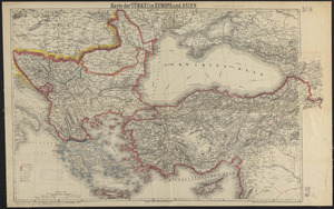
Karte der Türkei in Europa und Asien
36.
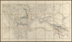
Karte des russisch-türkischen kriegsschauplatzes in Europa und Asien
37.
Kriegsschauplatz uebersichtskarte der Europäischen Türkei mit den vasallenstaaten Montenegro, Serbien, Rumænien u. Griechenland
38.
Mer noire
39.
The National Geographic magazine map of the new Balkan states and Central Europe
40.
Orbis Romani pars orientalis
‹ Prev
Next ›
1
2
3
4
5
6
…
434
435