Toggle navigation
LMEC Home
Exhibitions
Georeferencing
Tools for Teachers
Collections
My Favorites
Sign Up / Log In
Search
Search the map portal
Map Collection
Map Collection
Map Sets
Search
Search
Search for
Search In
All Fields
Creator
Title
Subject
Place
Search All Digital Collections
Advanced Search
8711 Results
My Search
Start Over
More Like
commonwealth:3f462w33h
Remove constraint More Like: commonwealth:3f462w33h
Filter your Search
Place
North and Central America
5,942
United States
4,853
Massachusetts
2,091
Europe
1,396
Suffolk (county)
1,048
Boston
1,021
Canada
449
Asia
438
more
Place
»
Topic
Boston (Mass.)--Maps
587
United States--Maps
282
Real property--Massachusetts--Boston--Maps
175
Massachusetts--Maps
162
Landowners--Massachusetts--Boston--Maps
133
North America--Maps--Early works to 1800
103
New England--Maps
102
Europe--Maps
79
more
Topic
»
Date
Date range begin
–
Date range end
Current results range from
1482
to
2023
View distribution
Creator
United States. Hydrographic Office
595
O.H. Bailey & Co
148
Des Barres, Joseph F. W. (Joseph Frederick Wallet), 1722-1824
122
United States. Post Office Dept
120
Ptolemy, 2nd cent
100
Walling, Henry Francis, 1825-1888
94
Geological Survey (U.S.)
86
Jefferys, Thomas, -1771
85
more
Creator
»
Format
Maps/Atlases
8,651
Manuscripts
217
Prints
56
Books
36
Objects/Artifacts
10
Drawings/Illustrations
8
Posters
5
Georeferenced
Yes
870
No
7,841
Collection
Norman B. Leventhal Map & Education Center Collection
8,697
Boston and New England Maps
2,238
Urban Maps
2,023
Maritime Charts and Atlases
1,082
American Revolutionary War-Era Maps
628
Boston Redevelopment Authority Collection
87
Sidney R. Knafel Map Collection at Phillips Academy
5
British Library Collection
3
more
Collection
»
Available to use
No known restrictions
8,553
Creative Commons license
57
Search Constraints
Sort by relevance
relevance
title
date (asc)
date (desc)
Number of results to display per page
20 per page
10
per page
20
per page
50
per page
100
per page
View results as:
grid view
map view
Search Results
2901.
Island of Moala, Feejee Group ; Island of Totoia, Feejee Group ; Island of Matuku, Feejee Group
2902.
Island of Ovolau, Feejee Group
2903.
Island of Savaii, Samoan Group
2904.
Island of Savaii, Samoan Group
2905.
The island of St. Christophers, alias St. Kitts
2906.
The island of St. Eustatius corruptly St. Eustatia
2907.
[Island of St. Peters]
2908.
Island of Upolu, Samoan Group
2909.
Island of Yendua, Feejee Group ; Nucumurry Harbour, west end of Vanua Levu ; Wailea Bay, north side of Vanua Levu
2910.
Island of Yendua, Feejee Group ; Nucumurry Harbour, west end of Vanua Levu ; Wailea Bay, north side of Vanua Levu
2911.
Islands in the North Pacific Ocean : from surveys by the U.S.S. "Portsmouth," Commander J.S. Skerrett, in 1874 ; (Fanning...
2912.
Islands of Manua, Ofoo & Oloosinga, Samoan Group ; Island of Tutuila, Samoan Group
2913.
Islands of Manua, Ofoo & Oloosinga, Samoan Group ; Island of Tutuila, Samoan Group
2914.
L'Isle de France et lieux circövoysins
2915.
Isle de la Guadeloupe
2916.
L'isle de la Martinique : scituée a 14 degrez 30 minutes de latitude septentrionale
2917.
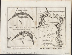
Isle de May ; Veue de l'isle de S. Jago ou St. Jacques, Ville S. Jago ou Ribeyro Grande ; Le havre de Praya dans l'isle de St....
2918.
The isle of California : New Mexico : Louisiane : The river Misisipi, and the lakes of Canada
2919.
Isle of Sable
2920.
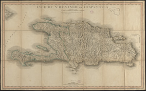
Isle of St. Domingo or Hispaniola
‹ Prev
Next ›
1
2
…
142
143
144
145
146
147
148
149
150
…
435
436


![[Island of St. Peters]](https://bpldcassets.blob.core.windows.net/derivatives/images/commonwealth:cj82m507n/image_thumbnail_300.jpg)