Toggle navigation
LMEC Home
Exhibitions
Georeferencing
Tools for Teachers
Collections
My Favorites
Sign Up / Log In
Search
Search the map portal
Map Collection
Map Collection
Map Sets
Search
Search
Search for
Search In
All Fields
Creator
Title
Subject
Place
Search All Digital Collections
Advanced Search
8773 Results
My Search
Start Over
More Like
commonwealth:1544f6102
Remove constraint More Like: commonwealth:1544f6102
Filter your Search
Place
North and Central America
6,004
United States
4,906
Massachusetts
2,154
Europe
1,396
Suffolk (county)
1,047
Boston
1,020
Canada
450
Asia
438
more
Place
»
Topic
Boston (Mass.)--Maps
590
United States--Maps
282
Massachusetts--Maps
235
Real property--Massachusetts--Boston--Maps
175
Landowners--Massachusetts--Boston--Maps
133
New England--Maps
104
North America--Maps--Early works to 1800
103
Europe--Maps
79
more
Topic
»
Date
Date range begin
–
Date range end
Current results range from
1482
to
2023
View distribution
Creator
United States. Hydrographic Office
595
O.H. Bailey & Co
148
Des Barres, Joseph F. W. (Joseph Frederick Wallet), 1722-1824
123
United States. Post Office Dept
120
Ptolemy, 2nd cent
100
Walling, Henry Francis, 1825-1888
95
Geological Survey (U.S.)
92
Jefferys, Thomas, -1771
85
more
Creator
»
Format
Maps/Atlases
8,712
Manuscripts
217
Prints
56
Books
36
Objects/Artifacts
10
Drawings/Illustrations
8
Posters
5
Ephemera
1
Georeferenced
Yes
879
No
7,894
Collection
Norman B. Leventhal Map & Education Center Collection
8,742
Boston and New England Maps
2,284
Urban Maps
2,024
Maritime Charts and Atlases
1,083
American Revolutionary War-Era Maps
635
Boston Redevelopment Authority Collection
90
Applied Geographics, Inc. Records
23
David Judkins Weaver Papers
20
more
Collection
»
Available to use
No known restrictions
8,600
Creative Commons license
51
Search Constraints
Sort by relevance
relevance
title
date (asc)
date (desc)
Number of results to display per page
20 per page
10
per page
20
per page
50
per page
100
per page
View results as:
grid view
map view
Search Results
1.
Map of Cape Cod and vicinity
2.
Map of Cape Cod and vicinity
3.
A picture chart of Cape Cod, Martha's Vineyard and Nantucket
4.
The Pilgrim® map Cape Cod, Martha's Vineyard and Nantucket
5.
From Muskeget Channel to Buzzard's Bay and entrance to Vineyard Sound, Mass
6.
From Muskeget Channel to Buzzard's Bay and entrance to Vineyard Sound, Mass
7.
Atlas of Massachusetts
8.
Sectional map of the Old Colony Railroad South Shore, Nantasket Beach and Plymouth lines
9.
The South Shore and Norfolk County, Mass
10.
Chart of the harbours of Salem, Marblehead, Beverly and Manchester : from a survey taken in the years 1804, 5 & 6
11.
Chart of the harbours of Salem, Marblehead, Beverly, and Manchester : from a survey taken in the years 1804, 5 & 6
12.
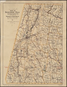
Map of the Berkshire Hills Massachusetts
13.
Map of the Beverly and Manchester shore Massachusetts
14.
The North Shore and part of Middlesex County, Mass
15.
Railway and highway map of the famous Berkshire Hills region, showing also villages and points of interest : from official...
16.
Railway and highway map of the famous Berkshire Hills region, showing also villages and points of interest : from official...
17.
Winter sports map of the Berkshire Hills
18.
1630 shoreline
19.
Boston old and new
20.
The colour of an old city : a map of Boston, decorative and historical
‹ Prev
Next ›
1
2
3
4
5
…
438
439