Toggle navigation
LMEC Home
Exhibitions
Georeferencing
Tools for Teachers
Collections
My Favorites
Sign Up / Log In
Search
Search the map portal
Map Collection
Map Collection
Map Sets
Search
Search
Search for
Search In
All Fields
Creator
Title
Subject
Place
Search All Digital Collections
Advanced Search
8794 Results
My Search
Start Over
More Like
commonwealth:1257bp07f
Remove constraint More Like: commonwealth:1257bp07f
Filter your Search
Place
North and Central America
6,089
United States
5,011
Massachusetts
2,108
Europe
1,359
Suffolk (county)
1,274
Boston
1,247
Canada
448
Asia
422
more
Place
»
Topic
Boston (Mass.)--Maps
741
United States--Maps
273
Real property--Massachusetts--Boston--Maps
252
City planning--Massachusetts--Boston--Maps
208
Landowners--Massachusetts--Boston--Maps
169
Massachusetts--Maps
163
Urban renewal--Massachusetts--Boston--Maps
111
North America--Maps--Early works to 1800
103
more
Topic
»
Date
Date range begin
–
Date range end
Current results range from
1482
to
2023
View distribution
Creator
United States. Hydrographic Office
594
Boston Redevelopment Authority
208
O.H. Bailey & Co
148
Des Barres, Joseph F. W. (Joseph Frederick Wallet), 1722-1824
124
United States. Post Office Dept
120
Ptolemy, 2nd cent
100
Walling, Henry Francis, 1825-1888
94
Geological Survey (U.S.)
87
more
Creator
»
Format
Maps/Atlases
8,735
Manuscripts
215
Prints
56
Books
36
Objects/Artifacts
10
Drawings/Illustrations
8
Posters
4
Georeferenced
Yes
885
No
7,909
Collection
Norman B. Leventhal Map & Education Center Collection
8,576
Boston and New England Maps
2,380
Urban Maps
2,109
Maritime Charts and Atlases
1,081
American Revolutionary War-Era Maps
638
Boston Redevelopment Authority Collection
245
Massachusetts Real Estate Atlases
38
Mapping Boston Collection
20
more
Collection
»
Available to use
No known restrictions
8,572
Creative Commons license
69
Search Constraints
Sort by relevance
relevance
title
date (asc)
date (desc)
Number of results to display per page
20 per page
10
per page
20
per page
50
per page
100
per page
View results as:
grid view
map view
Search Results
3621.
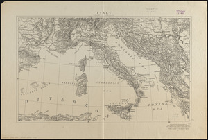
Italy
3622.
Italy
3623.
Italy
3624.
Italy, and Sardinia, from the best authorities
3625.
Italy with Vatican City
3626.
Iuliacensis et Montensis Ducatus = De Hertoghdomen Gulick en Berghe
3627.
Iutiae tabula in quae sunt dioeceses Alburgensis, Wiburgensis, Ripensis et Arhusiensis quae et sunt divisae in omnia dominia
3628.
J. Schedler's relief map of the White Mountains, N.H
3629.
Jackson County, Wis.
3630.
Jamaica
3631.
Jamaica, from the latest surveys
3632.
Jamaica Park and Bussey Farm Parkway : West Roxbury district
3633.
Jamaica Plain, Massachusetts : Ward 23, City of Boston, 1891
3634.
Jamaica Plain view of the world
3635.
Jamaica Pond master plan
3636.
James Hayes Park
3637.
Japan - n.w. coast of Nipon, Nanao Harbors : south harbor, surveyed by Commander C.J. Bullock and the officers of H.M.S....
3638.
Japan, anchorages in the Seto-Uchi or Inland Sea
3639.
Japan, anchorages on the coasts of Yezo Id
3640.
Japan and its relation to the territory bordering on the Pacific Ocean
‹ Prev
Next ›
1
2
…
178
179
180
181
182
183
184
185
186
…
439
440