Toggle navigation
LMEC Home
Exhibitions
Georeferencing
Tools for Teachers
Collections
My Favorites
Sign Up / Log In
Search
Search the map portal
Map Collection
Map Collection
Map Sets
Search
Search
Search for
Search In
All Fields
Creator
Title
Subject
Place
Search All Digital Collections
Advanced Search
8722 Results
My Search
Start Over
More Like
commonwealth:1257bb152
Remove constraint More Like: commonwealth:1257bb152
Filter your Search
Place
North and Central America
5,953
United States
4,871
Massachusetts
2,101
Europe
1,396
Suffolk (county)
1,060
Boston
1,033
Canada
449
Asia
438
more
Place
»
Topic
Boston (Mass.)--Maps
597
United States--Maps
282
Real property--Massachusetts--Boston--Maps
175
Massachusetts--Maps
162
Landowners--Massachusetts--Boston--Maps
133
North America--Maps--Early works to 1800
103
New England--Maps
102
Europe--Maps
79
more
Topic
»
Date
Date range begin
–
Date range end
Current results range from
1482
to
2023
View distribution
Creator
United States. Hydrographic Office
595
O.H. Bailey & Co
148
Des Barres, Joseph F. W. (Joseph Frederick Wallet), 1722-1824
124
United States. Post Office Dept
120
Ptolemy, 2nd cent
100
Walling, Henry Francis, 1825-1888
94
Geological Survey (U.S.)
86
Jefferys, Thomas, -1771
85
more
Creator
»
Format
Maps/Atlases
8,662
Manuscripts
215
Prints
56
Books
36
Objects/Artifacts
10
Drawings/Illustrations
8
Posters
6
Georeferenced
Yes
873
No
7,849
Collection
Norman B. Leventhal Map & Education Center Collection
8,707
Boston and New England Maps
2,248
Urban Maps
2,029
Maritime Charts and Atlases
1,088
American Revolutionary War-Era Maps
628
Boston Redevelopment Authority Collection
90
Mapping Boston Collection
12
William L. Clements Library Collection
10
more
Collection
»
Available to use
No known restrictions
8,556
Creative Commons license
60
Search Constraints
Sort by relevance
relevance
title
date (asc)
date (desc)
Number of results to display per page
20 per page
10
per page
20
per page
50
per page
100
per page
View results as:
grid view
map view
Search Results
61.
A draught of the towns of Boston & Charles Town & the circumjacent country, shewing the works thrown up by the kings troops, &...
62.
The Harbor Park system
63.
Map of parts of Boston Harbor and its tributaries
64.
A map of the environs of Boston
65.
Map to accompany report of State Board on Docks and Terminal Facilities : showing existing conditions and proposed changes at...
66.
A new and accurate chart of the harbour of Boston, in New England, in North America
67.
A new survey of the harbour of Boston in New England : done by order of the principall officers and comissioners of Her Maties....
68.
Plan of Boston
69.
Plan of Boston
70.
A plan of Boston in New England with its environs, including Milton, Dorchester, Roxbury, Brooklin, Cambridge, Medford,...
71.
Plan of the Inner Harbor of Boston
72.
A plan of the town and chart of the harbour of Boston exhibiting a view of the islands castle forts and entrances into the said...
73.
A plan of the town and harbour of Boston and the country adjacent with the road from Boston to Concord shewing the place of the...
74.
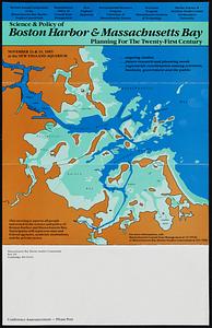
Science & policy of Boston Harbor symposium poster
75.
Thirty-miles round Boston
76.
The town & harbour of Boston &c.
77.
The 100th anniversary map of Abraham Lincoln's visit to Massachusetts, September 11-23, 1848
78.
1630 shoreline
79.
1879. Progress map of the U.S. Geographical Surveys west of the 100th Meridian : prepared under the direction of 1st Lieut....
80.
1903 Map of Salem and surrounding places
‹ Prev
Next ›
1
2
3
4
5
6
7
8
…
436
437