Toggle navigation
LMEC Home
Exhibitions
Georeferencing
Tools for Teachers
Collections
My Favorites
Sign Up / Log In
Search
Search the map portal
Map Collection
Map Collection
Map Sets
Search
Search
Search for
Search In
All Fields
Creator
Title
Subject
Place
Search All Digital Collections
Advanced Search
8693 Results
My Search
Start Over
More Like
commonwealth:0r96fq189
Remove constraint More Like: commonwealth:0r96fq189
Filter your Search
Place
North and Central America
5,925
United States
4,843
Massachusetts
2,078
Europe
1,395
Suffolk (county)
1,045
Boston
1,018
Canada
449
Asia
437
more
Place
»
Topic
Boston (Mass.)--Maps
586
United States--Maps
282
Real property--Massachusetts--Boston--Maps
175
Massachusetts--Maps
162
Landowners--Massachusetts--Boston--Maps
133
North America--Maps--Early works to 1800
103
New England--Maps
102
Europe--Maps
79
more
Topic
»
Date
Date range begin
–
Date range end
Current results range from
1482
to
2023
View distribution
Creator
United States. Hydrographic Office
595
O.H. Bailey & Co
148
Des Barres, Joseph F. W. (Joseph Frederick Wallet), 1722-1824
123
United States. Post Office Dept
120
Ptolemy, 2nd cent
100
Walling, Henry Francis, 1825-1888
94
Geological Survey (U.S.)
86
Jefferys, Thomas, -1771
85
more
Creator
»
Format
Maps/Atlases
8,633
Manuscripts
215
Prints
56
Books
36
Objects/Artifacts
10
Drawings/Illustrations
8
Posters
5
Georeferenced
Yes
869
No
7,824
Collection
Norman B. Leventhal Map & Education Center Collection
8,693
Boston and New England Maps
2,232
Urban Maps
2,023
Maritime Charts and Atlases
1,083
American Revolutionary War-Era Maps
615
Boston Redevelopment Authority Collection
87
Available to use
No known restrictions
8,551
Creative Commons license
47
Search Constraints
Sort by relevance
relevance
title
date (asc)
date (desc)
Number of results to display per page
20 per page
10
per page
20
per page
50
per page
100
per page
View results as:
grid view
map view
Search Results
1.
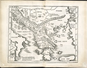
Greece with part of Anatolia = La Graecia con parte della Natolia
2.
Decima et ultima Europae tabula
3.
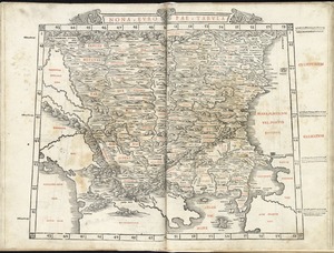
Decima Europe tabula continent Macedonia et Epirum et Achaiam & Peloponesum
4.
Graeciae antiquae
5.
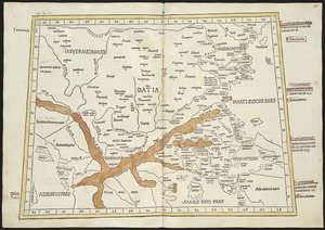
Nona Europa tabula continet Iaziges Metanastas
6.
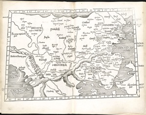
Nona Europae tabula
7.
Ta. moder. Bossinae, Serviae, Graeciae, et Sclavoniae
8.
Tabula IX Europae
9.
Tabula X Europae
10.
Accuratissima et maxima totius Turcici Imperii tabula cum omnibus suis regionibus novissima delineatio
11.
Asiæ quæ vulgo minor dicitur et Syriæ tabula geographica : quantum per subsidia licuit elaborata, opere, si quod aliud in...
12.
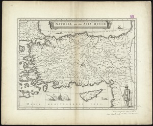
Natolia, quae olim Asia Minor
13.
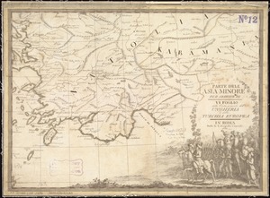
Parte dell'Asia Minore per servire di VI foglio della carta generale dell'Ungheria e della Turchia Europea
14.
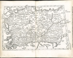
Prima Asie Tabula : continet pontum & Bithiniã et regionem q̃, pprie Asya dicitur ac lyciam & Gallaciam ac Pamphiliam &...
15.
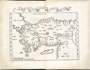
Tabu. Asiae minoris
16.
Tabula I Asiae
17.
Turcicum imperium
18.
Turcicum imperium
19.
The Turkish Empire in Europe, Asia and Africa, dividid into all its governments, together with the other territories that are...
20.
Turquie d'Europe
‹ Prev
Next ›
1
2
3
4
5
…
434
435