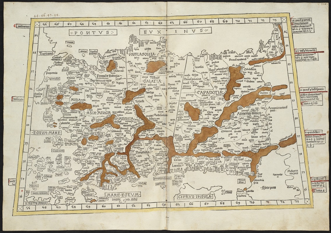
Prima Asie Tabula : continet pontum & Bithiniã et regionem q̃, pprie Asya dicitur ac lyciam & Gallaciam ac Pamphiliam & Cappadociam Armeniam minorem & Syliciam
Item Information
- Title:
- Prima Asie Tabula : continet pontum & Bithiniã et regionem q̃, pprie Asya dicitur ac lyciam & Gallaciam ac Pamphiliam & Cappadociam Armeniam minorem & Syliciam
- Title (alt.):
-
Asie maioris tabule decem quarum prima
- Creator:
- Ptolemy, 2nd cent
- Printer:
- Hol, Lienhart
- Date:
-
[1482]
- Format:
-
Maps/Atlases
- Location:
-
Boston Public Library
Norman B. Leventhal Map & Education Center - Collection (local):
-
Norman B. Leventhal Map & Education Center Collection
- Subjects:
-
Turkey--Maps--Early works to 1800
- Places:
-
Turkey
- Extent:
- 1 map : col ; 33 x 48 cm.
- Terms of Use:
-
No known copyright restrictions.
No known restrictions on use.
- Publisher:
-
Ulm :
Lienhart Hol
- Scale:
-
Scale [ca. 1:3,400,000]
- Language:
-
Latin
- Notes:
-
Title from verso.
Map of Turkey.
Relief shown by brown coloring.
Engraved on wood with place names in moveable type.
Includes names of places and natural features.
In margin: notes on latitude.
Appears in the author's Geographia. Ulm : Lienhart Hol, 16 July 1482.
Text in Latin.
Cataloging, conservation, and digitization made possible in part by The National Endowment for the Humanities: Exploring the human endeavor.
Atlas scanned by Internet Archive http://www.archive.org/details/cosmographia00ptol
- Notes (date):
-
This date is inferred.
- Identifier:
-
06_01_000853
- Call #:
-
G1005.P7 1482
- Barcode:
-
30000003825240


