Toggle navigation
LMEC Home
Exhibitions
Georeferencing
Tools for Teachers
Collections
My Favorites
Sign Up / Log In
Search
Search the map portal
Map Collection
Map Collection
Map Sets
Search
Search
Search for
Search In
All Fields
Creator
Title
Subject
Place
Search All Digital Collections
Advanced Search
8871 Results
My Search
Start Over
More Like
commonwealth:0c4863041
Remove constraint More Like: commonwealth:0c4863041
Filter your Search
Place
North and Central America
6,102
United States
5,020
Massachusetts
2,126
Europe
1,396
Suffolk (county)
1,222
Boston
1,195
Canada
449
Asia
438
more
Place
»
Topic
Boston (Mass.)--Maps
613
United States--Maps
282
Real property--Massachusetts--Boston--Maps
228
City planning--Massachusetts--Boston--Maps
200
Landowners--Massachusetts--Boston--Maps
168
Massachusetts--Maps
162
Buildings--Massachusetts--Boston--Maps
125
Urban renewal--Massachusetts--Boston--Maps
112
more
Topic
»
Date
Date range begin
–
Date range end
Current results range from
1482
to
2023
View distribution
Creator
United States. Hydrographic Office
595
Boston Redevelopment Authority
200
O.H. Bailey & Co
148
Des Barres, Joseph F. W. (Joseph Frederick Wallet), 1722-1824
123
United States. Post Office Dept
120
Ptolemy, 2nd cent
100
Walling, Henry Francis, 1825-1888
94
Geological Survey (U.S.)
86
more
Creator
»
Format
Maps/Atlases
8,811
Manuscripts
215
Prints
56
Books
36
Objects/Artifacts
10
Drawings/Illustrations
8
Posters
5
Georeferenced
Yes
871
No
8,000
Collection
Norman B. Leventhal Map & Education Center Collection
8,697
Boston and New England Maps
2,375
Urban Maps
2,164
Maritime Charts and Atlases
1,083
American Revolutionary War-Era Maps
616
Boston Redevelopment Authority Collection
226
Massachusetts Real Estate Atlases
34
Applied Geographics, Inc. Records
2
more
Collection
»
Available to use
No known restrictions
8,694
Creative Commons license
48
Search Constraints
Sort by relevance
relevance
title
date (asc)
date (desc)
Number of results to display per page
20 per page
10
per page
20
per page
50
per page
100
per page
View results as:
grid view
map view
Search Results
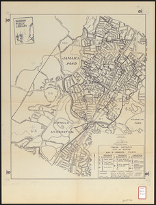
241.
Jamaica Plain urban renewal area r-49 : existing land use
242.
Jamaica Plain urban renewal area r-49 : proposed circulation
243.
Jamaica Plain urban renewal area r-49 : existing circulation
244.
Jamaica Plain urban renewal area r-49 : proposed treatment and title I projects
245.
Zoning districts city of Boston map 9 Jamaica Plain
246.
Blue Hill Avenue commercial strip
247.
Boston with Charlestown and Roxbury
248.
Campus High School urban renewal area, Mass. r- : land disposition map
249.
Campus High School urban renewal area Mass. r- : existing land use
250.
Campus High School urban renewal area Mass. r-129 : proposed land-use
251.
Campus High School urban renewal area Mass. r-129 : property map
252.
Campus High School urban renewal area Mass. r-129 : disposition parcels
253.
Campus High School urban renewal area Mass. r-129 : existing land-use
254.
Campus High School urban renewal area Mass. r-129 : existing and proposed zoning
255.
Campus High School urban renewal area Massachusetts R-129 : illustrative site plan
256.
Location of manufacturers in Boston sheet 4 or 6
257.
Roxbury
258.
Roxbury - N. Dorchester G.N.R.P. : preliminary land use plan
259.
Roxbury - N. Dorchester G.N.R.P. : preliminary circulation plan
260.
Roxbury-N. Dorchester G.N.R.P. r-50 : existing & proposed community facilities
‹ Prev
Next ›
1
2
…
9
10
11
12
13
14
15
16
17
…
443
444