Toggle navigation
LMEC Home
Exhibitions
Georeferencing
Tools for Teachers
Collections
My Favorites
Sign Up / Log In
Search
Search the map portal
Map Collection
Map Collection
Map Sets
Search
Search
Search for
Search In
All Fields
Creator
Title
Subject
Place
Search All Digital Collections
Advanced Search
46 Results
My Search
Start Over
More Like
commonwealth-oai:m039q4378
Remove constraint More Like: commonwealth-oai:m039q4378
Topic
Saint Lawrence River--Maps
Remove constraint Topic: Saint Lawrence River--Maps
Filter your Search
Place
North and Central America
46
Saint Lawrence River
46
Canada
43
Quebec
40
Longue-Pointe-de-Mingan
12
Mingan Îles de
12
Saguenay
12
Sept Iles
12
more
Place
»
Topic
Saint Lawrence River--Maps
[remove]
46
United States--History--French and Indian War, 1754-1763--Maps
24
Longue-Pointe (Québec)--Maps
12
Mingan Islands (Québec)--Maps
12
Saguenay River (Québec)--Maps
12
Sept-Iles (Québec)--Maps
12
Richelieu River (N.Y. and Vt-Québec)--Maps
7
Québec (Québec)--Maps
6
more
Topic
»
Date
Date range begin
–
Date range end
Current results range from
1753
to
1780
1753 : 1781
1753
1781
View distribution
Creator
Cook, James, 1728-1779
12
Desjardins, pilot of Québec
12
Jefferys, Thomas, -1771
12
Robert Sayer and John Bennett (Firm)
12
Saunders, Charles, Sir, 1713?-1775
12
Holland, Samuel, 1728-1801
4
Mackellar, Patrick, 1717-1778
3
Montrésor, John, 1736-1799
3
more
Creator
»
Format
Maps/Atlases
46
Georeferenced
No
46
Collection
American Revolutionary War-Era Maps
46
William L. Clements Library Collection
43
Library and Archives Canada Collection
3
Search Constraints
Sort by relevance
relevance
title
date (asc)
date (desc)
Number of results to display per page
20 per page
10
per page
20
per page
50
per page
100
per page
View results as:
grid view
map view
Search Results
1.
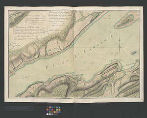
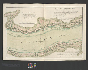
The St. Lawrence River from the Rapids of Richelieu to Cape Torment
2.
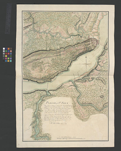
Parish of St. Foix
3.
A plan of the river St. Laurence, from Sillery to the fall of Montmerenci, with the operations of the siege of Quebec; under...
4.
Continuation of the Grande Riviere with the village of Fariole lying near Cape Torment on the north shore
5.
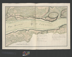
Draught of the river St. Lawrence from Lake Ontario to Montreal
6.
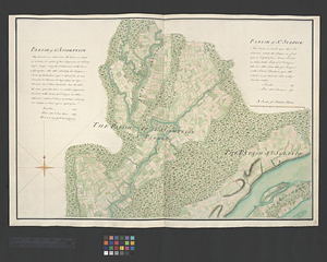
Parish of Batiscant. Parish of St. Pierre Becquet. Parish of Champlain. Parish of Gentilly
7.
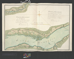
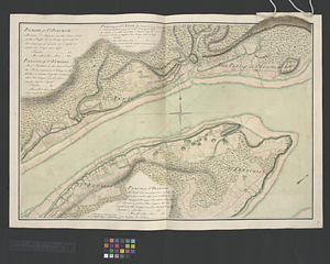
Parish of Dechaillon or St. Jean. Parish of Grondines
8.
Parish of Dechambeaux. Parish of Cape Sante. Parish of Lotbinière. Parish of St. Croix
9.
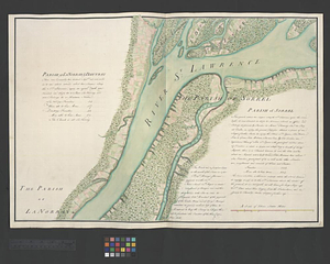
Parish of La Norray & Dautray. Parish of Sorrel
10.
Parish of L'Assomption. Parish of St. Sulpice
11.
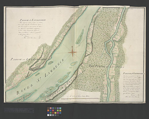
Parish of Lavalterie. Parish of Contrecoeur
12.
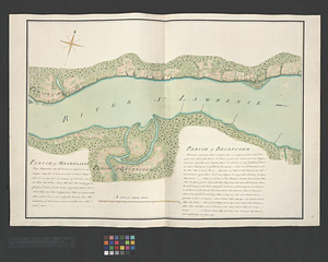
Parish of Magdelaine. Parish of Becancour
13.
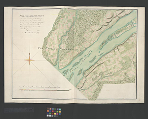
Parish of Repentigny
14.
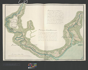
Parish of St. Ann's. Parish of the River Batiscant
15.
Parish of St. Joachim. Parish of St. Famille. Parish of St. Anne. Parish of St. François
16.
Parish of St. Lawrence. Parish of Beaumont. Parish of St. Peter
17.
Parish of St. Michelle. Parish of St. John Baptist. Parish of St. Vertier
18.
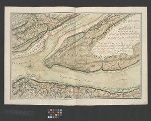
Parish of St. Nicholas. The Parish of St. Augustin
19.
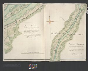
Parish of the Ecureuils. Parish of Point aux Trembles. Parish of St. Antoine. Parish of St. Croix
20.
Parish of Vercheres. Parish of St. Antoine
‹ Prev
Next ›
1
2
3