Toggle navigation
LMEC Home
Exhibitions
Georeferencing
Tools for Teachers
Collections
My Favorites
Sign Up / Log In
Search
Search the map portal
Map Collection
Map Collection
Map Sets
Search
Search
Search for
Search In
All Fields
Creator
Title
Subject
Place
Search All Digital Collections
Advanced Search
27 Results
My Search
Start Over
More Like
commonwealth-oai:cn69r351f
Remove constraint More Like: commonwealth-oai:cn69r351f
Topic
Newport (R.I.)--Maps
Remove constraint Topic: Newport (R.I.)--Maps
Filter your Search
Place
Newport
27
Newport (county)
27
North and Central America
27
Rhode Island
27
United States
27
Bristol (county)
9
Narragansett Bay
8
Bristol
1
more
Place
»
Topic
Newport (R.I.)--Maps
[remove]
27
United States--History--Revolution, 1775-1783--Maps
24
Narragansett Bay (R.I.)--Maps
8
Rhode Island, Battle of, R.I., 1778--Maps
7
Newport County (R.I.)--Maps
6
Bristol (R.I. : Town)--Maps
1
Northumberland, Hugh Percy, Duke of, 1742-1817
1
Providence (R.I.)--Maps
1
more
Topic
»
Date
Date range begin
–
Date range end
Current results range from
1770
to
1783
1770 : 1784
1770
1784
View distribution
Creator
Fage, Edward
6
Aubant, Abraham d'
5
Blaskowitz, Charles
3
Des Barres, Joseph F. W. (Joseph Frederick Wallet), 1729-1824
3
Faden, William, 1749-1836
2
Colbert, Edouard Charles Victurnien, Comte de Maulevrier, 1758-1820
1
Petit
1
Straton, James
1
Format
Maps/Atlases
27
Georeferenced
No
27
Collection
American Revolutionary War-Era Maps
27
William L. Clements Library Collection
27
Search Constraints
Sort by relevance
relevance
title
date (asc)
date (desc)
Number of results to display per page
20 per page
10
per page
20
per page
50
per page
100
per page
View results as:
grid view
map view
Search Results
1.
A chart of the harbour of Rhode Island and Narraganset Bay surveyed in pursuance of directions from the Lords of Trade to His...
2.
A chart of the harbour of Rhode Island and Narraganset Bay surveyed in pursuance of directions from the Lords of Trade to his...
3.
A chart of the harbour of Rhode Island and Narraganset Bay surveyed in pursuance of directions from the Lords of Trade to his...
4.
A draught of Rhode Island, 1777
5.
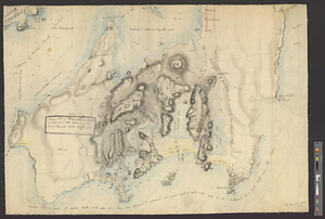
Narragansett Bay and Rhode Island
6.
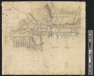
New Port
7.
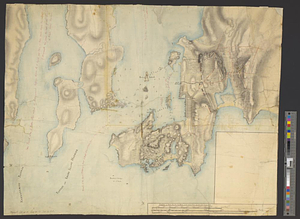
Newport and its environs, ca. 1778
8.
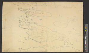
Newport County, ca. 1779
9.
Original plan of Brentons Neck; and all the ground to the southward of the town of New-port Rhode Island, 1779
10.
Partie de l'état de Rhode-Island et position des armées Américaine et Britannique au siege de Newport et à l'affaire du 29 Août...
11.
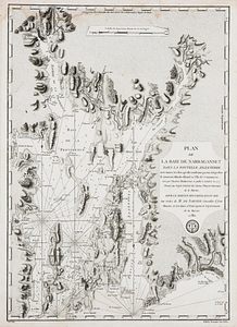
Plan de la baie de Narragansett dans la Nouvelle Angleterre avec toutes les îles qu'elle renferme parmi lesquelles se trouvent...
12.
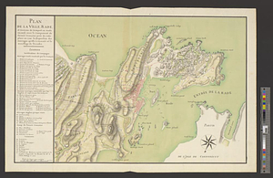
Plan de la ville, rade, et environs de Newport en Rode Island, avec le campement de l'armée Françoise prés de cette place en...
13.
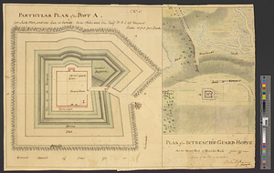
Plan of an intrench'd guard house at the north end of Howlands Neck, June 1777
14.
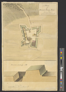
A plan of Bristol Ferry fort
15.
Plan of Fort Brown, for 4 guns en barbette; with a small redout, and a line for 60 men, and a barrack
16.
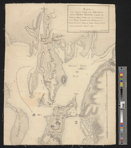
Plan of the adjacent coast to the northern part of Rhode Island, to express the route of a body of troops under the command of...
17.
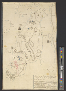
Plan of the position of his majesty's troops at Rhode Island, after the defeat of the rebels the 29th of August 1778
18.
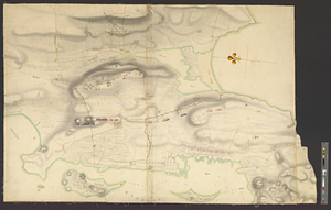
Plan of the town and environs of Newport, Rhode Island : exhibiting its defenses formed before the 8th of August 1778 when the...
19.
Plan of the town and environs of Newport, Rhode Island : exhibiting its defenses formed before the 8th of August 1778 when the...
20.
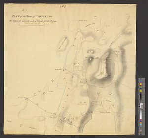
Plan of the town of Newport, and the adjacent country; with a project for its defence : (no. 7)
+
-
Redo search here
Search when I move the map
Leaflet
| ©
OpenStreetMap
contributors, ©
CartoDB
‹ Prev
Next ›
1
2