Toggle navigation
LMEC Home
Exhibitions
Georeferencing
Tools for Teachers
Collections
My Favorites
Sign Up / Log In
Search
Search the map portal
Map Collection
Map Collection
Map Sets
Search
Search
Search for
Search In
All Fields
Creator
Title
Subject
Place
Search All Digital Collections
Advanced Search
15 Results
My Search
Start Over
More Like
commonwealth-oai:1r66p079m
Remove constraint More Like: commonwealth-oai:1r66p079m
Available to use
No known restrictions
Remove constraint Available to use: No known restrictions
Filter your Search
Place
North and Central America
14
United States
12
Massachusetts
5
Boston
4
Suffolk (county)
4
North America
3
York (county)
3
Yorktown
3
more
Place
»
Topic
United States--History--Revolution, 1775-1783--Maps
10
Atlantic Coast (North America)--Maps
5
Boston (Mass.)--History--Revolution, 1775-1783--Maps
3
North America--Maps
2
Virginia--History--Revolution, 1775-1783--Maps--Early works to 1800
2
Virginia--Maps--Early works to 1800
2
Yorktown (Va.)--History--Siege, 1781--Maps--Early works to 1800
2
Yorktown (Va.)--Maps--Early works to 1800
2
more
Topic
»
Date
Date range begin
–
Date range end
Current results range from
1777
to
1994
1777 : 1995
1777
1995
View distribution
Creator
Bauman, Sebastian
1
Blaisdell, H. W.
1
Crissy, James
1
Faden, William, 1749-1836
1
Knox, Henry, 1750-1806
1
Marshall, John, 1755-1835
1
Ravenstein, Ernst Georg, 1834-1913
1
Ribero, Diego, d. 1533
1
more
Creator
»
Format
Maps/Atlases
15
Manuscripts
1
Georeferenced
No
15
Collection
Norman B. Leventhal Map & Education Center Collection
13
American Revolutionary War-Era Maps
5
Boston and New England Maps
5
Urban Maps
3
New-York Historical Society Collection
2
Maritime Charts and Atlases
1
Available to use
No known restrictions
[remove]
15
Search Constraints
Sort by relevance
relevance
title
date (asc)
date (desc)
Number of results to display per page
20 per page
10
per page
20
per page
50
per page
100
per page
View results as:
grid view
map view
Search Results
1.
Carta universal en que se contiene todo lo que del mundo se ha descubierto fasta agora
2.
Fishing grounds on the Atlantic coast of North America
3.
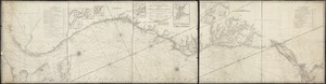
A new and accurate chart (from Captain Holland's surveys) of the North American coast, for the navigation between Cape Cod in...
4.
North Atlantic Ocean, southeast coast of North America, including the Bahamas and Greater Antilles
5.
Staaten am Atlantischen Ocean
6.
Atlas to Marshall's life of Washington
7.
Boston with its environs
8.
Centennial map of Concord, 1775-1875
9.
Gen. Washington's Revolutionary campaign war map : after a survey ordered by him showing the position of his army in defence of...
10.
Map of American camp in New Jersey and surrounding countryside
11.
Map of the vicinity of Yorktown, Virginia, 1881
12.
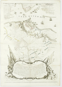
A plan of the entrance of Chesapeak Bay, with James and York Rivers : wherein are shown the respective positions (in the...
13.
Plan of the town of Boston with the attack on Bunkers-Hill in the peninsula of Charlestown the 17th of June 1775
14.
Sketch of Bunker Hill Battle
15.
To His Excellency Genl. Washington, Commander in Chief of the armies of the United States of America : this plan of the...