Toggle navigation
LMEC Home
Exhibitions
Georeferencing
Tools for Teachers
Collections
My Favorites
Sign Up / Log In
Search
Search the map portal
Map Collection
Map Collection
Map Sets
Search
Search
Search for
Search In
All Fields
Creator
Title
Subject
Place
Search All Digital Collections
Advanced Search
36 Results
My Search
Start Over
More Like
commonwealth:dn403j96s
Remove constraint More Like: commonwealth:dn403j96s
Available to use
Creative Commons license
Remove constraint Available to use: Creative Commons license
Filter your Search
Place
United States
26
North and Central America
15
Canada
9
North America
5
Great Lakes
2
Middle Atlantic
2
New England
2
Eastern United States
1
more
Place
»
Topic
United States--Maps--Early works to 1800
28
Canada--Maps--Early works to 1800
7
North America--Maps--Early works to 1800
5
United States--History--Revolution, 1775-1783--Maps--Early works to 1800
4
Great Lakes Region (North America)--Maps--Early works to 1800
3
Great Britain--Colonies--America--Maps--Early works to 1800
2
Middle Atlantic States--Maps--Early works to 1800
2
New England--Maps--Early works to 1800
2
more
Topic
»
Date
Date range begin
–
Date range end
Current results range from
1632
to
1830
1632 : 1831
1632
1831
View distribution
Creator
Basset (Firm)
3
Denis, Louis, 1725-1794
3
Robert Sayer and John Bennett (Firm)
3
Bew, J., -1793
2
Lodge, John, -1796
2
Pownall, Thomas, 1722-1805
2
Russell, John, active 1733-1795
2
André.
1
more
Creator
»
Format
Maps/Atlases
36
Manuscripts
1
Georeferenced
Yes
4
No
32
Collection
American Revolutionary War-Era Maps
33
New York Public Library Collection
17
Richard H. Brown Revolutionary War Map Collection at Mount Vernon
11
Mapping Boston Collection
3
Norman B. Leventhal Map & Education Center Collection
3
Harvard Map Collection
2
Boston Athenaeum, Cartographic Collection
1
British Library Collection
1
more
Collection
»
Available to use
Creative Commons license
[remove]
36
Search Constraints
Sort by relevance
relevance
title
date (asc)
date (desc)
Number of results to display per page
20 per page
10
per page
20
per page
50
per page
100
per page
View results as:
grid view
map view
Search Results
1.
Carte du Canada et des Etats-Unis de l'Amérique Septentrionale
2.
A New map of North America with the West India Islands : divided according to the preliminary articles of peace, signed at...
3.
Carte de la Nouuelle France, augmentée depuis la derniere, seruant a la navigation faicte en son vray Meridien
4.
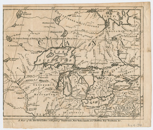
A Map of the five Great Lakes with part of Pensilvania, New York, Canada, and Hudsons Bay Territories &c
5.
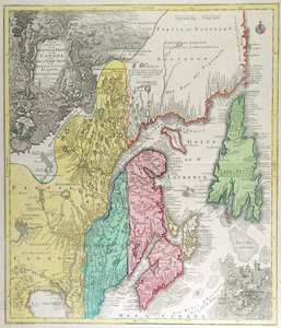
La Pensilvania, la Nuova York, il Jersey Settentrio[na]le : con la parte occidentale del Connecticut, Massachusset-s-bay e...
6.
An accurate map of Canada, with the adjacent countries : exhibiting the late seat of war between the English & French in those...
7.
Carte d'une partie du Nord Amerique dans la quelle se trouvent les isles et les provinces suivantes : l'Isle de la Terre-Neuve...
8.
A new map of Nova Scotia and Cape Breton Island : with the adjacent parts of New England and Canada composed from a great...
9.
Partie orientale de la Nouvelle France ou du Canada : avec l'isle de Terre-Neuve et de Nouvelle Escosse, Acadie et Nouv....
10.
Théatre de la guerre en Amerique, avec les Isles Antilles : projetté et assujettie aux observations
11.
An accurate map of the United States of America : according to the Treaty of Peace of 1783
12.
L'Amerique Septentrionale, ou se remarquent les Etats Unis
13.
BOWLES'S NEW POCKET MAP OF THE UNITED STATES OF AMERICA : WITH THE BRITISH POSSESSIONS OF CANADA, NOVA SCOTIA, AND OF...
14.
Carta della Nuova Inghilterra, Nuova Iork, e Pensilvania
15.
Carte de la Louisiane et du cours du Mississipi avec les colonies anglaises
16.
Carte du theatre de la guerre presente en Amerique
17.
Carte du theatre de la guerre presente en Amerique
18.
Carte generale des colonies angloises dans l'Amerique Septentrionale pour l'intelligence de la guerre presente : d'apres des...
19.
Carte générale des Etats Unis de l'Amérique Septentrionale : renfermant aussi quelques provinces Angloises adjacentes
20.
Carte génerale des Etats-Unis de l'Amérique Septentrionale : divisée en ses 17 provinces
+
-
Redo search here
Search when I move the map
Leaflet
| ©
OpenStreetMap
contributors, ©
CartoDB
‹ Prev
Next ›
1
2


![La Pensilvania, la Nuova York, il Jersey Settentrio[na]le](https://bpldcassets.blob.core.windows.net/derivatives/images/commonwealth:z603vq53g/image_thumbnail_300.jpg)