Toggle navigation
LMEC Home
Exhibitions
Georeferencing
Tools for Teachers
Collections
My Favorites
Sign Up / Log In
Search
Search the map portal
Map Collection
Map Collection
Map Sets
Search
Search
Search for
Search In
All Fields
Creator
Title
Subject
Place
Search All Digital Collections
Advanced Search
17 Results
My Search
Start Over
More Like
commonwealth:q524nk114
Remove constraint More Like: commonwealth:q524nk114
Collection
Urban Maps
Remove constraint Collection: Urban Maps
Filter your Search
Place
North and Central America
15
United States
14
Washington
3
Allegheny (county)
2
Carrollsburg (historical)
2
Chatham (county)
2
Pittsburgh
2
Savannah
2
more
Place
»
Topic
Manuscript maps--Early works to 1800
8
Real property--Washington (D.C.)--Maps--Early works to 1800
3
Washington (D.C.)--Maps, Manuscript--Early works to 1800
3
Carrollsburg (Washington, D.C.)--Maps, Manuscript--Early works to 1800
2
Carrollsburg (Washington, D.C.)--Surveys--Maps--Early works to 1800
2
Pittsburgh (Pa.)--Maps--Early works to 1800
2
Real property--Georgia--Savannah--Maps--Early works to 1800
2
Savannah (Ga.)--Maps, Manuscript--Early works to 1800
2
more
Topic
»
Date
Date range begin
–
Date range end
Current results range from
1723
to
1899
1723 : 1900
1723
1900
View distribution
Creator
L'Enfant, Pierre Charles, 1754-1825
2
Marian S. Carson Collection (Library of Congress)
2
Day, E. A.
1
Deakins, Francis
1
Dermott, James R. (James Reed)
1
Getchel, Stephen
1
Hills, John, (Surveyor)
1
King, N. (Nicholas), 1771-1812
1
more
Creator
»
Format
Manuscripts
17
Maps/Atlases
17
Georeferenced
Yes
1
No
16
Collection
Urban Maps
[remove]
17
American Revolutionary War-Era Maps
16
Library of Congress Collection
15
Boston and New England Maps
1
Newberry Library Collection
1
Norman B. Leventhal Map & Education Center Collection
1
Available to use
Creative Commons license
15
No known restrictions
1
Search Constraints
Sort by relevance
relevance
title
date (asc)
date (desc)
Number of results to display per page
20 per page
10
per page
20
per page
50
per page
100
per page
View results as:
grid view
map view
Search Results
1.
Dotted line map of Washington, D.C., 1791, before Aug. 19th
2.
Map of part of the city of Washington shewing the situation of the mansion house, grave yard & buildings belonging to Mr....
3.
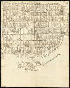
Plan of the city intended for the permanent seat of the government of t[he] United States : projected agreeable to the...
4.
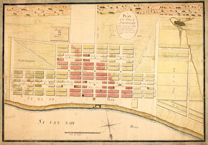
Plan of the Town of Turner, formerly Silvester Plantation : out side lines and part of the lotts ran out
5.
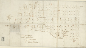
Plat of Carrollsburg
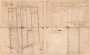
6.
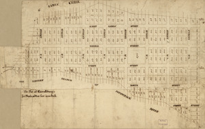
The plot of Carroll'sburgh : [part of Washington D.C.]
7.
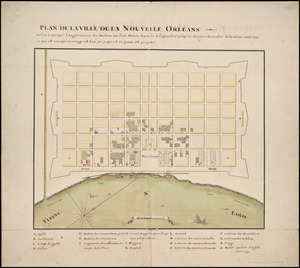
Plan de la ville de la Nouvelle Orleans : ou l'on à marqué l'augmentation des maisons qui sont baties depuis le 3. septembre...
8.
A plan of Becket protracted by a scale of 120 rods to an inch
9.
Map of Alexandria, Virginia
10.
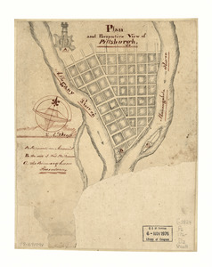
Plan and perspective view of Pittsburgh
11.
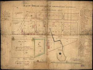
Plan du terrain sur le cap appartenant à la paroise de cette uille 1756
12.
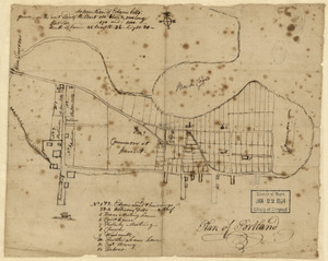
Plan of Portland
13.
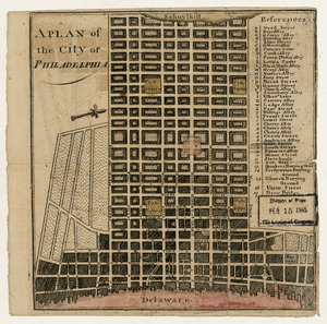
A plan of the city of Philadelphia
14.
A plan of the city of Savannah : with a drawing of the part of the city burnt in the dreadful fires of the 26 November & 6...
15.
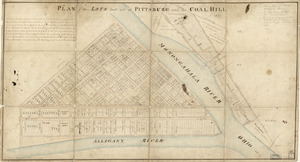
Plan of the lots laid out at Pittsburg and the Coal Hill
16.
A Plan of the town of Pensacola, 1767
17.
A plann of the town of Savannah in the state of Georgia


![Plan of the city intended for the permanent seat of the government of t[he] United States](https://bpldcassets.blob.core.windows.net/derivatives/images/commonwealth:q524nf917/image_thumbnail_300.jpg)