Toggle navigation
LMEC Home
Exhibitions
Georeferencing
Tools for Teachers
Collections
My Favorites
Sign Up / Log In
Search
Search the map portal
Map Collection
Map Collection
Map Sets
Search
Search
Search for
Search In
All Fields
Creator
Title
Subject
Place
Search All Digital Collections
Advanced Search
4 Results
My Search
Start Over
More Like
commonwealth:q524mv18j
Remove constraint More Like: commonwealth:q524mv18j
Collection
New-York Historical Society Collection
Remove constraint Collection: New-York Historical Society Collection
Filter your Search
Place
United States
4
Canada
2
North America
2
North and Central America
2
Mexico
1
Northeastern United States
1
Topic
United States--Maps--Early works to 1800
4
North America--Maps--Early works to 1800
2
Canada, Eastern--Maps--Early works to 1800
1
Canada--Maps--Early works to 1800
1
England--Colonies--North America--Maps--Early works to 1800
1
France--Colonies--North America--Maps--Early works to 1800
1
Indians of North America--Maps--Early works to 1800
1
Mexico--Maps--Early works to 1800
1
more
Topic
»
Date
Date range begin
–
Date range end
Current results range from
1755
to
1783
1755 : 1784
1755
1784
View distribution
Creator
Bowen, Emanuel, 1693 or 1694-1767
1
Evans, Lewis, 1700?-1756
1
Kitchin, Thomas, 1719-1784
1
Millar, Andrew, 1705-1768
1
Mitchell, John, 1711-1768
1
Pownall, Thomas, 1722-1805
1
Robert Sayer and John Bennett (Firm)
1
Turner, James, -1759
1
more
Creator
»
Format
Maps/Atlases
4
Georeferenced
No
4
Collection
American Revolutionary War-Era Maps
4
New-York Historical Society Collection
[remove]
4
Available to use
No known restrictions
4
Search Constraints
Sort by relevance
relevance
title
date (asc)
date (desc)
Number of results to display per page
20 per page
10
per page
20
per page
50
per page
100
per page
View results as:
grid view
map view
Search Results
1.
A general map of the middle British colonies, in America : viz Virginia, Màriland, Dèlaware, Pensilvania, New-Jersey, New-York,...
2.
A map of the British and French dominions in North America : with the roads, distances, limits, and extent of the settlements,...
3.
A new and correct map of North America, with the West India islands, divided according to the preliminary articles of peace,...
4.
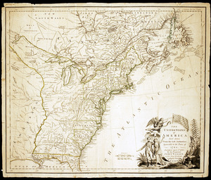
The United States of America laid down from the best authorities, agreeable to the Peace of 1783