Toggle navigation
LMEC Home
Exhibitions
Georeferencing
Tools for Teachers
Collections
My Favorites
Sign Up / Log In
Search
Search the map portal
Map Collection
Map Collection
Map Sets
Search
Search
Search for
Search In
All Fields
Creator
Title
Subject
Place
Search All Digital Collections
Advanced Search
14164 Results
Filter your Search
Place
North and Central America
10,811
United States
8,818
Massachusetts
2,820
Suffolk (county)
1,688
Boston
1,644
Europe
1,428
Canada
1,010
New York
683
more
Place
»
Topic
Boston (Mass.)--Maps
753
City planning--Massachusetts--Boston--Maps
419
United States--History--Revolution, 1775-1783--Maps
331
United States--Maps
331
Real property--Massachusetts--Boston--Maps
254
Urban renewal--Massachusetts--Boston--Maps
254
North America--Maps--Early works to 1800
241
Massachusetts--Maps
236
more
Topic
»
Date
Date range begin
–
Date range end
Current results range from
1482
to
2023
View distribution
Creator
United States. Hydrographic Office
597
Boston Redevelopment Authority
404
Des Barres, Joseph F. W. (Joseph Frederick Wallet), 1722-1824
247
Jefferys, Thomas, -1771
172
United States. National Ocean Service
170
Royal United Services Institute for Defence and Security Studies
160
George, III, King of Great Britain, 1738-1820
152
George, IV, King of Great Britain, 1762-1830
151
more
Creator
»
Format
Maps/Atlases
13,978
Manuscripts
985
Prints
102
Books
53
Drawings/Illustrations
44
Photographs
15
Objects/Artifacts
13
Documents
7
more
Format
»
Georeferenced
Yes
979
No
13,185
Collection
Norman B. Leventhal Map & Education Center Collection
9,162
American Revolutionary War-Era Maps
3,629
Boston and New England Maps
2,936
Urban Maps
2,511
Maritime Charts and Atlases
1,169
William L. Clements Library Collection
910
Library of Congress Collection
618
Boston Redevelopment Authority Collection
475
more
Collection
»
Available to use
No known restrictions
10,408
Creative Commons license
1,678
Search Constraints
Sort by relevance
relevance
title
date (asc)
date (desc)
Number of results to display per page
20 per page
10
per page
20
per page
50
per page
100
per page
View results as:
grid view
map view
Search Results
12641.
St. Pablo, Paumotu Group ; Nukutipipi or Margaret Island, Paumotu Group ; Heretua or Archangel of Quiros, Paumotu Group ; Teku...
12642.
St. Paul's Bay; Isle de Coudres; Great Cove; Pt. de Mille Vaches
12643.
[St. Peter's Bay, on the south shore of Cape Breton Island]
12644.
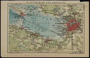
St. Petersburg und umgebung
12645.
St. Stephen, New Brunswick and Calais, Maine : 1889
12646.
St. Thomas, Province, Ontario Canada, 1875
12647.
St. Vincent, from an actual survey made in the year 1773 : after the treaty with the Caribs
12648.
Staaten am Atlantischen Ocean
12649.
Stamford, Conn
12650.
Standard railway map of South Africa = Standaard spoorwegkaart van Suidafrika
12651.
Standard Russo-Japanese war map July 1904
12652.
Standard storehouse [insurance map]
12653.
The Standard Textile Products Co., Inc., Rock Island, Ill. [insurance map]
12654.
Stanford's enlarged map of the seat of war
12655.
Stanford's library map of the world on Mercator's projection
12656.
Stanford's military map of the seat of war
12657.
Stanford's shilling map of the seat of war
12658.
Stannard & Son's, panoramic birds-eye view, of Berlin & its defences, the principal Prussian ports on the Baltic, with Denmark...
12659.
Stannard & Son's, panoramic birds-eye view of France & Prussia and the surrounding countries likely to be involved in the War,...
12660.
Stannard & Son's, panoramic birds-eye view of the French & Prussian provinces, on the banks of the Rhine, shewing all the...
‹ Prev
Next ›
1
2
…
629
630
631
632
633
634
635
636
637
…
708
709


![[St. Peter's Bay, on the south shore of Cape Breton Island]](https://bpldcassets.blob.core.windows.net/derivatives/images/commonwealth:ws859h094/image_thumbnail_300.jpg)


![Standard storehouse [insurance map]](https://bpldcassets.blob.core.windows.net/derivatives/images/commonwealth:gh93hk49d/image_thumbnail_300.jpg)
![The Standard Textile Products Co., Inc., Rock Island, Ill. [insurance map]](https://bpldcassets.blob.core.windows.net/derivatives/images/commonwealth:2r36vc76n/image_thumbnail_300.jpg)


