Toggle navigation
LMEC Home
Exhibitions
Georeferencing
Tools for Teachers
Collections
My Favorites
Sign Up / Log In
Search
Search the map portal
Map Collection
Map Collection
Map Sets
Search
Search
Search for
Search In
All Fields
Creator
Title
Subject
Place
Search All Digital Collections
Advanced Search
13680 Results
Filter your Search
Place
North and Central America
10,344
United States
8,475
Massachusetts
2,789
Suffolk (county)
1,677
Boston
1,633
Europe
1,415
Canada
950
New York
649
more
Place
»
Topic
Boston (Mass.)--Maps
747
City planning--Massachusetts--Boston--Maps
418
United States--History--Revolution, 1775-1783--Maps
329
United States--Maps
322
Real property--Massachusetts--Boston--Maps
254
Urban renewal--Massachusetts--Boston--Maps
254
Massachusetts--Maps
231
Insurance surveys
197
more
Topic
»
Date
Date range begin
–
Date range end
Current results range from
1482
to
2023
View distribution
Creator
United States. Hydrographic Office
597
Boston Redevelopment Authority
404
Des Barres, Joseph F. W. (Joseph Frederick Wallet), 1722-1824
247
Royal United Services Institute for Defence and Security Studies
160
Jefferys, Thomas, -1771
154
George, III, King of Great Britain, 1738-1820
152
George, IV, King of Great Britain, 1762-1830
151
O.H. Bailey & Co
148
more
Creator
»
Format
Maps/Atlases
13,499
Manuscripts
985
Prints
102
Books
49
Drawings/Illustrations
44
Photographs
15
Objects/Artifacts
13
Documents
7
more
Format
»
Georeferenced
Yes
979
No
12,701
Collection
Norman B. Leventhal Map & Education Center Collection
9,096
American Revolutionary War-Era Maps
3,305
Boston and New England Maps
2,915
Urban Maps
2,471
Maritime Charts and Atlases
1,169
William L. Clements Library Collection
910
Library of Congress Collection
618
Boston Redevelopment Authority Collection
475
more
Collection
»
Available to use
No known restrictions
10,246
Creative Commons license
1,678
Search Constraints
Sort by relevance
relevance
title
date (asc)
date (desc)
Number of results to display per page
20 per page
10
per page
20
per page
50
per page
100
per page
View results as:
grid view
map view
Search Results
4821.
[Manuscript map of New England and eastern Canada, showing the routes of Champlain's voyage]
4822.
Manuscript map of the United States
4823.
Manuscript maps of U.S. states
4824.
Manuscript maps of U.S. states, possibly drawn by a schoolchild
4825.
Manuscript plan of the Bulfinch Triangle, Boston, MA : [text]
4826.
Manuscript plan of the Bulfinch Triangle, Boston, MA : [sheet 2]
4827.
Manuscript plan of the Bulfinch Triangle, Boston, MA : [sheet 1]
4828.
Manuscript survey of a property in Kittery, Maine
4829.
A map & chart of the bays harbours post roads and settlements in Passamaquoddy & Machias with the large island of Grand Manan
4830.
Map & profiles of the Vt. Central and Vt. and Canada Railroads
4831.
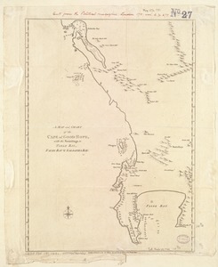
A Map and chart of the Cape of Good Hope, with the soundings in Table Bay, False Bay and Saldanha Bay
4832.
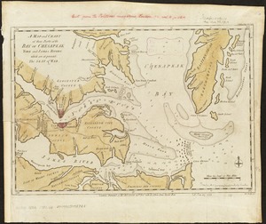
A map and chart of those parts of the Bay of Chesapeak, York and James Rivers which are at present the seat of war
4833.
Map and profile of the Champlain Canal as made from Lake Champlain to the Hudson River and surveyed thence to the tide at...
4834.
Map and profile of the proposed Birmingham Canal : from Warrior River to Five Mile Creek, Alabama
4835.
[Map and profiles of proposed (?) fortifications on Jekyll Island (?)]
4836.
Map, boundary, Michigan and Ohio
4837.
Map City of Baltimore
4838.
A map containing part of the Provinces of New York and New Jersey
4839.
A map containing the towns, villages, gentlemens houses, roads, rivers & other remarks for 20 miles round London
4840.
[Map depicting early land division and ownership in Barnard, Vermont]
‹ Prev
Next ›
1
2
…
238
239
240
241
242
243
244
245
246
…
683
684
![[Manuscript map of New England and eastern Canada, showing the routes of Champlain's voyage]](https://bpldcassets.blob.core.windows.net/derivatives/images/commonwealth:qb98n8061/image_thumbnail_300.jpg)


![[Map and profiles of proposed (?) fortifications on Jekyll Island (?)]](https://bpldcassets.blob.core.windows.net/derivatives/images/commonwealth:hx11z458p/image_thumbnail_300.jpg)


![[Map depicting early land division and ownership in Barnard, Vermont]](https://bpldcassets.blob.core.windows.net/derivatives/images/commonwealth:kk91ft09h/image_thumbnail_300.jpg)