Toggle navigation
LMEC Home
Exhibitions
Georeferencing
Tools for Teachers
Collections
My Favorites
Sign Up / Log In
Search
Search the map portal
Map Collection
Map Collection
Map Sets
Search
Search
Search for
Search In
All Fields
Creator
Title
Subject
Place
Search All Digital Collections
Advanced Search
13680 Results
Filter your Search
Place
North and Central America
10,344
United States
8,475
Massachusetts
2,789
Suffolk (county)
1,677
Boston
1,633
Europe
1,415
Canada
950
New York
649
more
Place
»
Topic
Boston (Mass.)--Maps
747
City planning--Massachusetts--Boston--Maps
418
United States--History--Revolution, 1775-1783--Maps
329
United States--Maps
322
Real property--Massachusetts--Boston--Maps
254
Urban renewal--Massachusetts--Boston--Maps
254
Massachusetts--Maps
231
Insurance surveys
197
more
Topic
»
Date
Date range begin
–
Date range end
Current results range from
1482
to
2023
View distribution
Creator
United States. Hydrographic Office
597
Boston Redevelopment Authority
404
Des Barres, Joseph F. W. (Joseph Frederick Wallet), 1722-1824
247
Royal United Services Institute for Defence and Security Studies
160
Jefferys, Thomas, -1771
154
George, III, King of Great Britain, 1738-1820
152
George, IV, King of Great Britain, 1762-1830
151
O.H. Bailey & Co
148
more
Creator
»
Format
Maps/Atlases
13,499
Manuscripts
985
Prints
102
Books
49
Drawings/Illustrations
44
Photographs
15
Objects/Artifacts
13
Documents
7
more
Format
»
Georeferenced
Yes
979
No
12,701
Collection
Norman B. Leventhal Map & Education Center Collection
9,096
American Revolutionary War-Era Maps
3,305
Boston and New England Maps
2,915
Urban Maps
2,471
Maritime Charts and Atlases
1,169
William L. Clements Library Collection
910
Library of Congress Collection
618
Boston Redevelopment Authority Collection
475
more
Collection
»
Available to use
No known restrictions
10,246
Creative Commons license
1,678
Search Constraints
Sort by relevance
relevance
title
date (asc)
date (desc)
Number of results to display per page
20 per page
10
per page
20
per page
50
per page
100
per page
View results as:
grid view
map view
Search Results
12821.
Township map of Stephenson Winnebago, Ogle & Lee Counties
12822.
Township map of Union, Johnson, Pope, Alexander, Pulaski, and Massac Counties
12823.
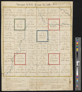
Township no. VII range no. XIV
12824.
The townships of Dedham, Westwood, Needham, Dover, Sherborn, Norwood, Medfield, Millis, Walpole, Norfolk, Massachusetts
12825.
Tracciamento della strada di ferro da Milano a Como
12826.
Tracciamento della strada di ferro da Milano a Venezia
12827.
A tracing relating to Fort Washington or Knyphausen
12828.
Track chart U.S. dry dock Dewey : Solomons to Olongapo, December 28, 1905-July 10, 1906
12829.
Track of the U.S. surveying brig Dolphin : from September 1851 to July 1852 : [Atlantic Ocean]
12830.
Tracks operated by the Boston Elevated Railway Company January 1916
12831.
A tract of land granted to George Murray and Jacobas Bruyn lying & being in the county of Ulster on the west side of the Wall...
12832.
Tractus regni Angliae septentrion[alis] in quo ducatus Eboracensis, episcopatus Dunelmensis, comitatus Northumbriae, Cumbriae,...
12833.
Trade wind chart of the Atlantic Ocean
12834.
A trader's map of the Ohio country before 1753
12835.
Traffic circulation plan parcel 7 : Government Center project
12836.
Traffic for Birkenhead
12837.
Traffic map of down-town Boston : parking spaces and one-way streets
12838.
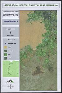
Trans Sahara Railway project
12839.
Trans-continental map : showing the main lines and proposed extensions of the various trans-continental railroad systems of the...
12840.
Transisalania provincia : vulgo Over-Yssel
‹ Prev
Next ›
1
2
…
638
639
640
641
642
643
644
645
646
…
683
684


![Tractus regni Angliae septentrion[alis] in quo ducatus Eboracensis, episcopatus Dunelmensis, comitatus Northumbriae, Cumbriae, Westmoriae et Lancastriae cum Mona insula](https://bpldcassets.blob.core.windows.net/derivatives/images/commonwealth:cj82kr11k/image_thumbnail_300.jpg)