Tracciamento della strada di ferro da Milano a Como
Item Information
- Title:
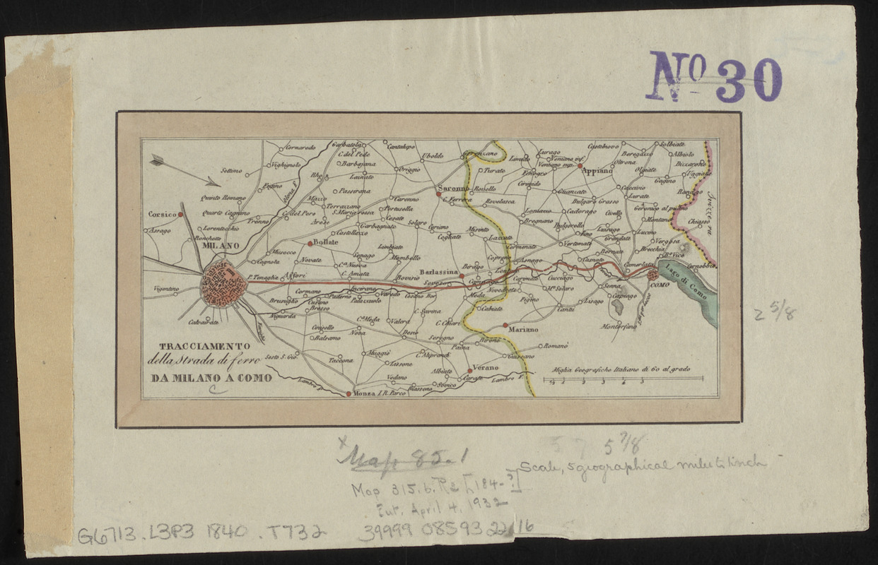
- Tracciamento della strada di ferro da Milano a Como
- Date:
-
[ca. 1836]
- Format:
-
Maps/Atlases
- Location:
-
Boston Public Library
Norman B. Leventhal Map & Education Center - Collection (local):
-
Norman B. Leventhal Map & Education Center Collection
- Subjects:
-
Railroads--Italy--Lombardy--Maps
Lombardy (Italy)--Maps
- Places:
-
ItalyLombardy (region)
- Extent:
- 1 map : color ; 7 x 15 cm
- Terms of Use:
-
No known copyright restrictions.
No known restrictions on use.
- Publisher:
-
[Place of publication not identified] :
[publisher not identified]
- Scale:
-
Scale approximately 1:1,750,000
- Language:
-
Italian
- Notes:
-
Shows a proposed railroad between Milan and Como. A more sinuous railway connecting major cities was built.
Relief shown by hachures.
Oriented with north to the lower right.
- Identifier:
-
06_01_015143
- Call #:
-
G6713.L3P3 1836 .T732
- Barcode:
-
39999085932216


