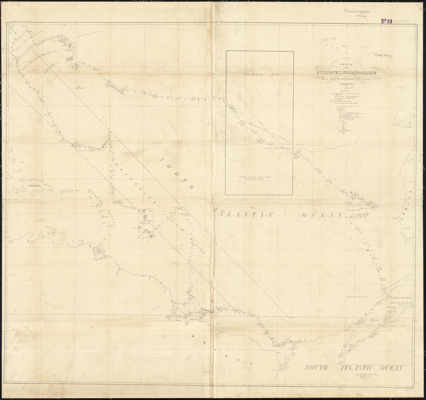
Track of the U.S. surveying brig Dolphin : from September 1851 to July 1852 : [Atlantic Ocean]
Item Information
- Title:
- Track of the U.S. surveying brig Dolphin : from September 1851 to July 1852 : [Atlantic Ocean]
- Title (alt.):
-
Lee's report
- Creator:
- Elliott, H. C. (Henry C.)
- Contributor:
- Lee, Samuel Phillips, 1812-1897
- Contributor:
- Dolphin (Brig)
- Contributor:
- United States. Navy Department
- Name on Item:
-
Samuel Phillips Lee, commanding ; captain's clerk & draughtsman, Henry C. Elliott
- Date:
-
[1854]
- Format:
-
Maps/Atlases
- Location:
-
Boston Public Library
Norman B. Leventhal Map & Education Center - Collection (local):
-
Norman B. Leventhal Map & Education Center Collection
- Subjects:
-
Nautical charts--Atlantic Ocean--Maps
Atlantic Ocean--Maps
- Places:
-
Atlantic Ocean
- Extent:
- 1 map ; 119 x 126 cm, folded to 22 x 15 cm
- Terms of Use:
-
No known copyright restrictions.
No known restrictions on use.
- Publisher:
-
[Washington] :
[Tucker, Printer to the Senate]
- Scale:
-
Scale approximately 1:5,500,000
- Language:
-
English
- Notes:
-
Embossed on cover: Senate document. Map. Lee's report.
Map is mounted and bound in 24 x 15 cm book cover as a separate volume to accompany: Report and charts of the cruise of the U.S. brig Dolphin / by U.S. Navy Lieut. Samuel Phillips Lee.
- Notes (date):
-
This date is inferred.
- Identifier:
-
06_01_012298
- Call #:
-
G9110 1854 .E45
- Barcode:
-
39999065701516


