Toggle navigation
LMEC Home
Exhibitions
Georeferencing
Tools for Teachers
Collections
My Favorites
Sign Up / Log In
Search
Search the map portal
Map Collection
Map Collection
Map Sets
Search
Search
Search for
Search In
All Fields
Creator
Title
Subject
Place
Search All Digital Collections
Advanced Search
13385 Results
Filter your Search
Place
North and Central America
10,111
United States
8,249
Massachusetts
2,691
Suffolk (county)
1,664
Boston
1,621
Europe
1,386
Canada
949
New York
640
more
Place
»
Topic
Boston (Mass.)--Maps
741
City planning--Massachusetts--Boston--Maps
418
United States--History--Revolution, 1775-1783--Maps
329
United States--Maps
315
Urban renewal--Massachusetts--Boston--Maps
254
Real property--Massachusetts--Boston--Maps
252
Massachusetts--Maps
219
Insurance surveys
197
more
Topic
»
Date
Date range begin
–
Date range end
Current results range from
1482
to
2023
View distribution
Creator
United States. Hydrographic Office
595
Boston Redevelopment Authority
403
Des Barres, Joseph F. W. (Joseph Frederick Wallet), 1722-1824
247
Royal United Services Institute for Defence and Security Studies
160
Jefferys, Thomas, -1771
154
George, III, King of Great Britain, 1738-1820
152
George, IV, King of Great Britain, 1762-1830
151
O.H. Bailey & Co
148
more
Creator
»
Format
Maps/Atlases
13,205
Manuscripts
985
Prints
102
Books
49
Drawings/Illustrations
44
Photographs
15
Objects/Artifacts
13
Documents
7
more
Format
»
Georeferenced
Yes
979
No
12,406
Collection
Norman B. Leventhal Map & Education Center Collection
8,891
American Revolutionary War-Era Maps
3,305
Boston and New England Maps
2,804
Urban Maps
2,397
Maritime Charts and Atlases
1,150
William L. Clements Library Collection
910
Library of Congress Collection
618
Boston Redevelopment Authority Collection
475
more
Collection
»
Available to use
No known restrictions
9,952
Creative Commons license
1,677
Search Constraints
Sort by relevance
relevance
title
date (asc)
date (desc)
Number of results to display per page
20 per page
10
per page
20
per page
50
per page
100
per page
View results as:
grid view
map view
Search Results
5261.
A map of Pensilvania, New-Jersey, New-York, and the three Delaware counties
5262.
A map of Pensylvania, with part of the adjacent states, from the latest surveys
5263.
A map of Pensylvania, with part of the adjacent states, from the latest surveys
5264.
Map of Peoria Co., Illinois
5265.
Map of Pepperell, Mass. - 1844
5266.
Map of Perry County, Ohio
5267.
A map of Philadelphia and parts adjacent
5268.
A map of Philadelphia and parts adjacent
5269.
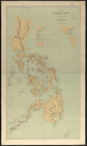
Map of Philippine Islands and adjacent seas : from material of the English and Batavian governments
5270.
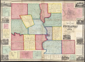
Map of Pickaway County, Ohio
5271.
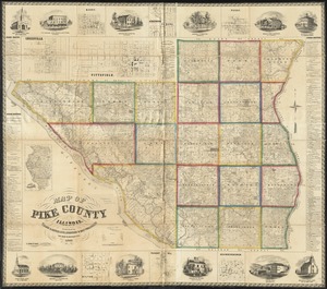
Map of Pike County, Illinois
5272.
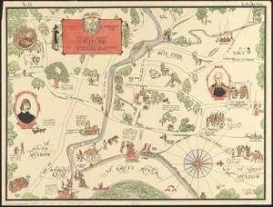
The map of pioneer Hartford : founded 1636, incorporated 1784, showing early landmarks and the locations of historical events
5273.
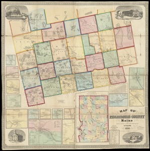
Map of Piscataquis County Maine
5274.
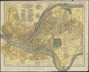
Map of Pittsburg and Allegheny, Pa
5275.
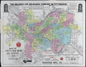
Map of Pittsburgh and environs : from official records, original plats, and actual surveys
5276.
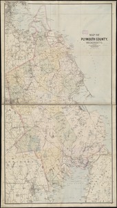
Map of Plymouth County, Mass.
5277.
Map of Plymouth County, Massachusetts
5278.
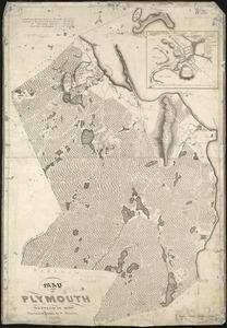
Map of Plymouth settled in 1620
5279.
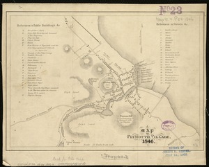
A map of Plymouth Village : 1846
5280.
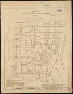
Map of Pond Town Plantation, Maine
‹ Prev
Next ›
1
2
…
260
261
262
263
264
265
266
267
268
…
669
670