Toggle navigation
LMEC Home
Exhibitions
Georeferencing
Tools for Teachers
Collections
My Favorites
Sign Up / Log In
Search
Search the map portal
Map Collection
Map Collection
Map Sets
Search
Search
Search for
Search In
All Fields
Creator
Title
Subject
Place
Search All Digital Collections
Advanced Search
13683 Results
Filter your Search
Place
North and Central America
10,345
United States
8,476
Massachusetts
2,789
Suffolk (county)
1,677
Boston
1,633
Europe
1,417
Canada
950
New York
649
more
Place
»
Topic
Boston (Mass.)--Maps
747
City planning--Massachusetts--Boston--Maps
418
United States--History--Revolution, 1775-1783--Maps
329
United States--Maps
322
Real property--Massachusetts--Boston--Maps
254
Urban renewal--Massachusetts--Boston--Maps
254
Massachusetts--Maps
231
Insurance surveys
197
more
Topic
»
Date
Date range begin
–
Date range end
Current results range from
1482
to
2023
View distribution
Creator
United States. Hydrographic Office
597
Boston Redevelopment Authority
404
Des Barres, Joseph F. W. (Joseph Frederick Wallet), 1722-1824
247
Royal United Services Institute for Defence and Security Studies
160
Jefferys, Thomas, -1771
154
George, III, King of Great Britain, 1738-1820
152
George, IV, King of Great Britain, 1762-1830
151
O.H. Bailey & Co
148
more
Creator
»
Format
Maps/Atlases
13,502
Manuscripts
985
Prints
102
Books
49
Drawings/Illustrations
44
Photographs
15
Objects/Artifacts
13
Documents
7
more
Format
»
Georeferenced
Yes
979
No
12,704
Collection
Norman B. Leventhal Map & Education Center Collection
9,098
American Revolutionary War-Era Maps
3,305
Boston and New England Maps
2,915
Urban Maps
2,473
Maritime Charts and Atlases
1,169
William L. Clements Library Collection
910
Library of Congress Collection
618
Boston Redevelopment Authority Collection
475
more
Collection
»
Available to use
No known restrictions
10,249
Creative Commons license
1,678
Search Constraints
Sort by relevance
relevance
title
date (asc)
date (desc)
Number of results to display per page
20 per page
10
per page
20
per page
50
per page
100
per page
View results as:
grid view
map view
Search Results
13581.
Wilton, N.H
13582.
Wiltonia sive comitatus Wiltoniensis : Anglis Wil Shire
13583.
Winchendon
13584.
Winchester, Middlesex County, Mass : 1886
13585.
Winchester, N.H : Cheshire County, 1887
13586.
Wind and current chart of the North Atlantic [sheet 1]
13587.
Windsor, Vermont : 1886
13588.
The Windward passage from Jamaica, betwene the east end of Cuba, and the west end of Hispaniola
13589.
The Windward Passage, with the several passages from the east end of Cuba : & from the north part of St. Domingo
13590.
Winnebago County, Wis.
13591.
Winslow & McKenzie "Warehouse," New Bedford, Mass. [insurance map]
13592.
Winter sports map of the Berkshire Hills
13593.
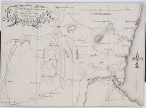
The Winter-Cantonment of the American Army and it's Vicinity for 1783
13594.
Winthrop - anciently Pullin Point : our peninsula in 1624
13595.
Winthrop Mills Company (Cotton & Woolen Cloth), Winthrop, Maine [insurance map]
13596.
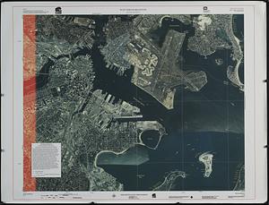
Winthrop/Boston Massachusetts : [coastal high hazard area base map]
13597.
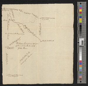
Wm. Croghans 984 acres on Skeggs beaver creek
13598.
Woburn, Mass., 1883
13599.
Wollaston, Massachusetts
13600.
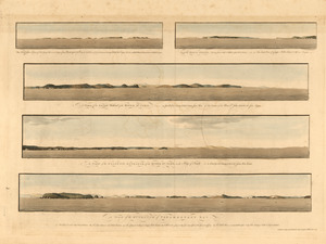
The Wolves, a cluster of isles lying s.e. near 3 leagues from Pasamaquady Bay ... ; Grand Manan Island ... ; A view of the...
‹ Prev
Next ›
1
2
…
676
677
678
679
680
681
682
683
684
685


![Wind and current chart of the North Atlantic [sheet 1]](https://bpldcassets.blob.core.windows.net/derivatives/images/commonwealth:jh344151t/image_thumbnail_300.jpg)


![Winslow & McKenzie "Warehouse," New Bedford, Mass. [insurance map]](https://bpldcassets.blob.core.windows.net/derivatives/images/commonwealth:ww72c0067/image_thumbnail_300.jpg)


![Winthrop Mills Company (Cotton & Woolen Cloth), Winthrop, Maine [insurance map]](https://bpldcassets.blob.core.windows.net/derivatives/images/commonwealth:2r36vc255/image_thumbnail_300.jpg)